


Landsat 8
Landsat 8 ushered in a new era of Earth observation with advanced sensors and improved data quality to extend the Landsat data record.

| Quick Facts | |
|---|---|
| Sensors: OLI, TIRS | Spatial Resolution: 30 m (VNIR and SWIR), 15 m (panchromatic), 100 m (TIR) |
| Spectral Resolution: 11 bands | Temporal Resolution: 16 days |
| Radiometric Resolution: 12-bit | Image Data: >700 scenes/day |
| Scene Size: 185 km (115 mi) x 180 km (112 mi) | Swath Width: 185 km (115 mi) |
| Global Reference Grid System: WRS-2 | Altitude: 705 km (438 mi) |
| Inclination: 98.2 degrees | Orbit: Near-polar, sun-synchronous |
| Equatorial Crossing Time: Nominally 10:12 AM (± 5 min.) local time (descending node) | Period of Revolution: 99 minutes; ~14.5 orbits/day |
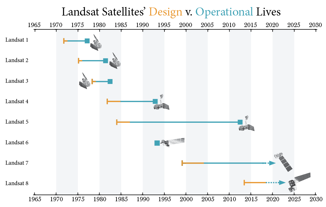
| Design Life: 5 years | Consumables: 10 years |
Overview
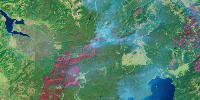
Landsat 8 provides consistent, high-quality imagery that allows scientists to monitor land cover and land use changes, track water resources, and study natural and human-driven changes to Earth’s surface.
Landsat 8 replaced Landsat 5 in orbit after its 2013 decommission. It joined Landsat 7, doubling the frequency of observations from every 16 days to every 8 days.
The Operational Land Imager (OLI) and the Thermal Infrared Sensor (TIRS) aboard Landsat 8 capture enhanced observations of our planet. By seeing the Earth in sharper detail, scientists are able to detect subtler changes over time, all while extending the invaluable Landsat data record.
The mission’s new thermal-infrared capabilities enable researchers to measure how crops use water, track short- and long-term glacial retreat, and monitor how urban areas trap heat.
As the first mission launched since the creation of the Free and Open Data Policy of 2008, Landsat 8 marked a new era of Earth observation. Its science-quality, freely available data make it possible to monitor Earth’s changing landscapes—from a single corn field to the entire globe.
Societal Benefits
-
Urban Expansion
Visualize the expansion of urban centers and monitor the resultant changes in land use and surface temperature.
-
Tropical Deforestation and Global Forest Dynamics
Provide an unbiased record of Earth’s forests, enabling world governments and resource organizations to track forest change.
-
Glacier and Ice-shelf Retreat
Chronicle changes to Earth’s ice, offering global estimates of glacial retreat and coastline shifts.

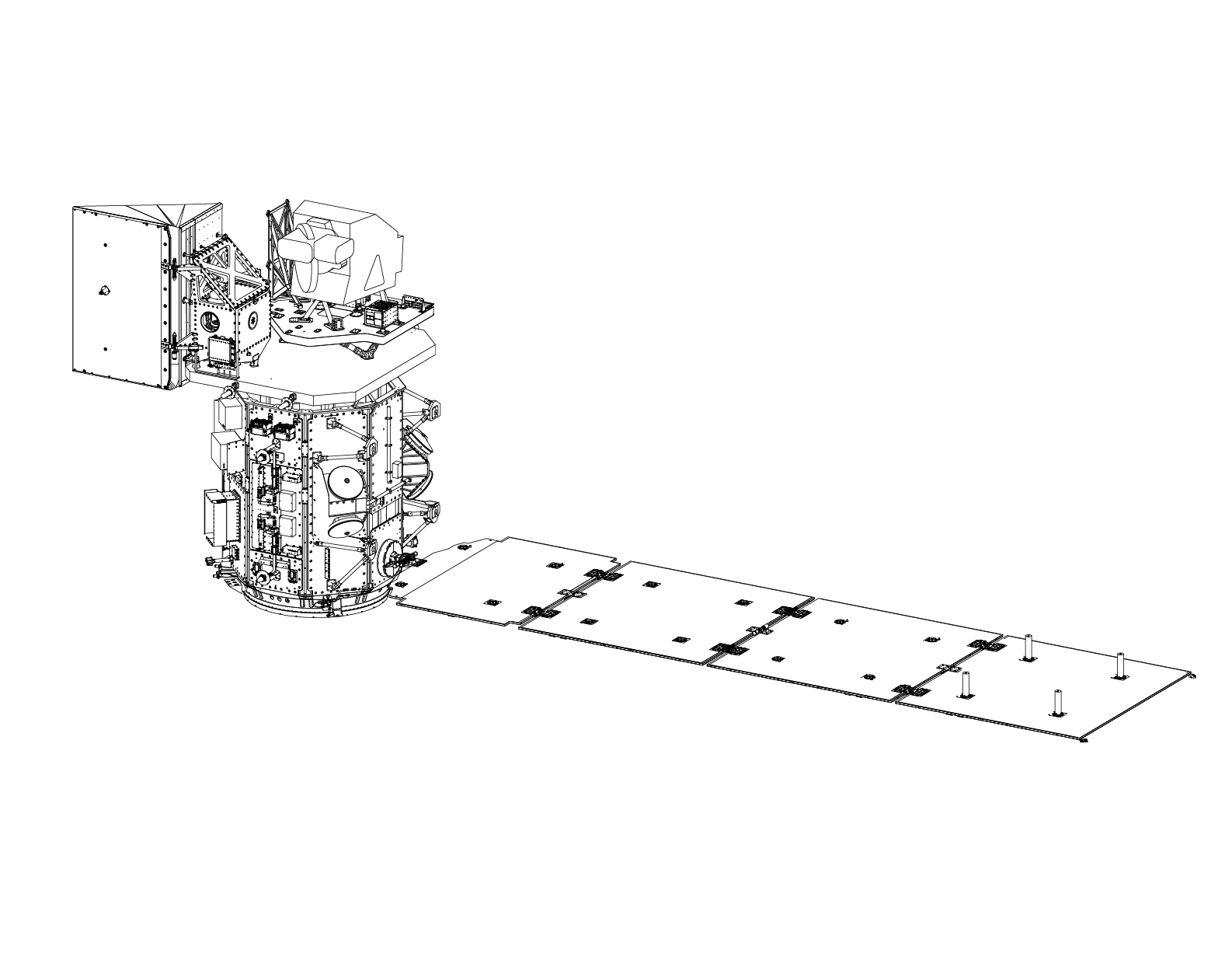
Spacecraft
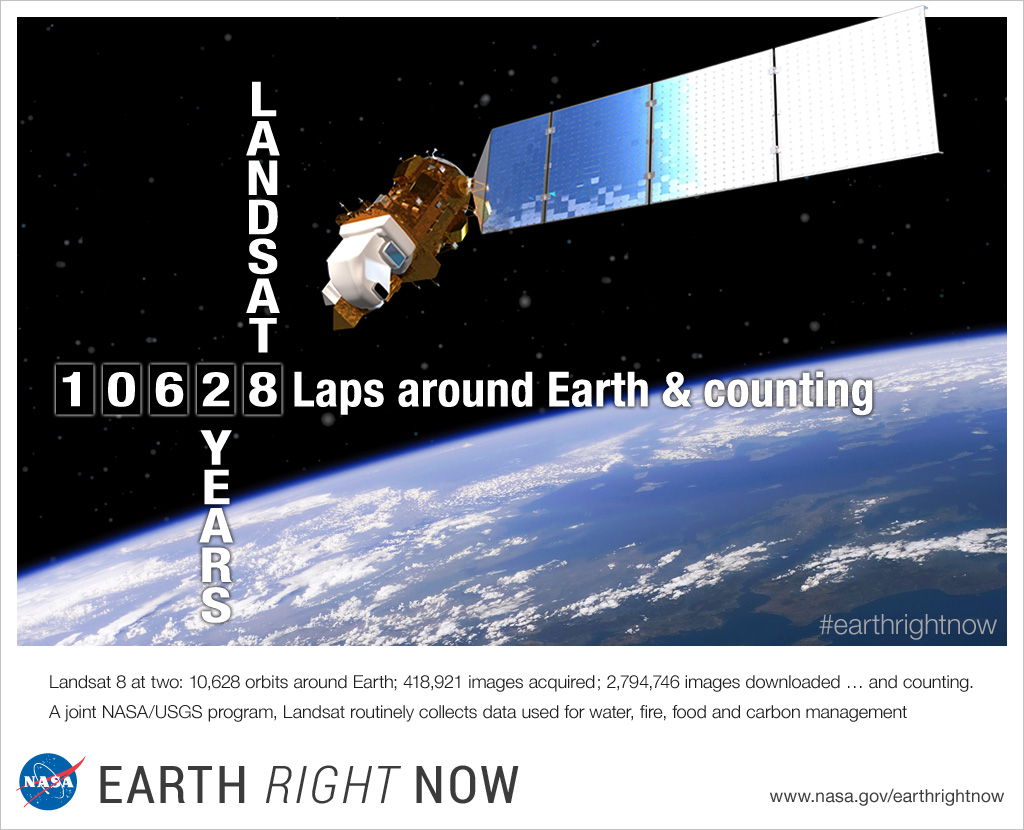
Landsat 8 was launched into orbit February 11, 2013 joining Landsat 7 in operation to provide eight-day temporal coverage of Earth.
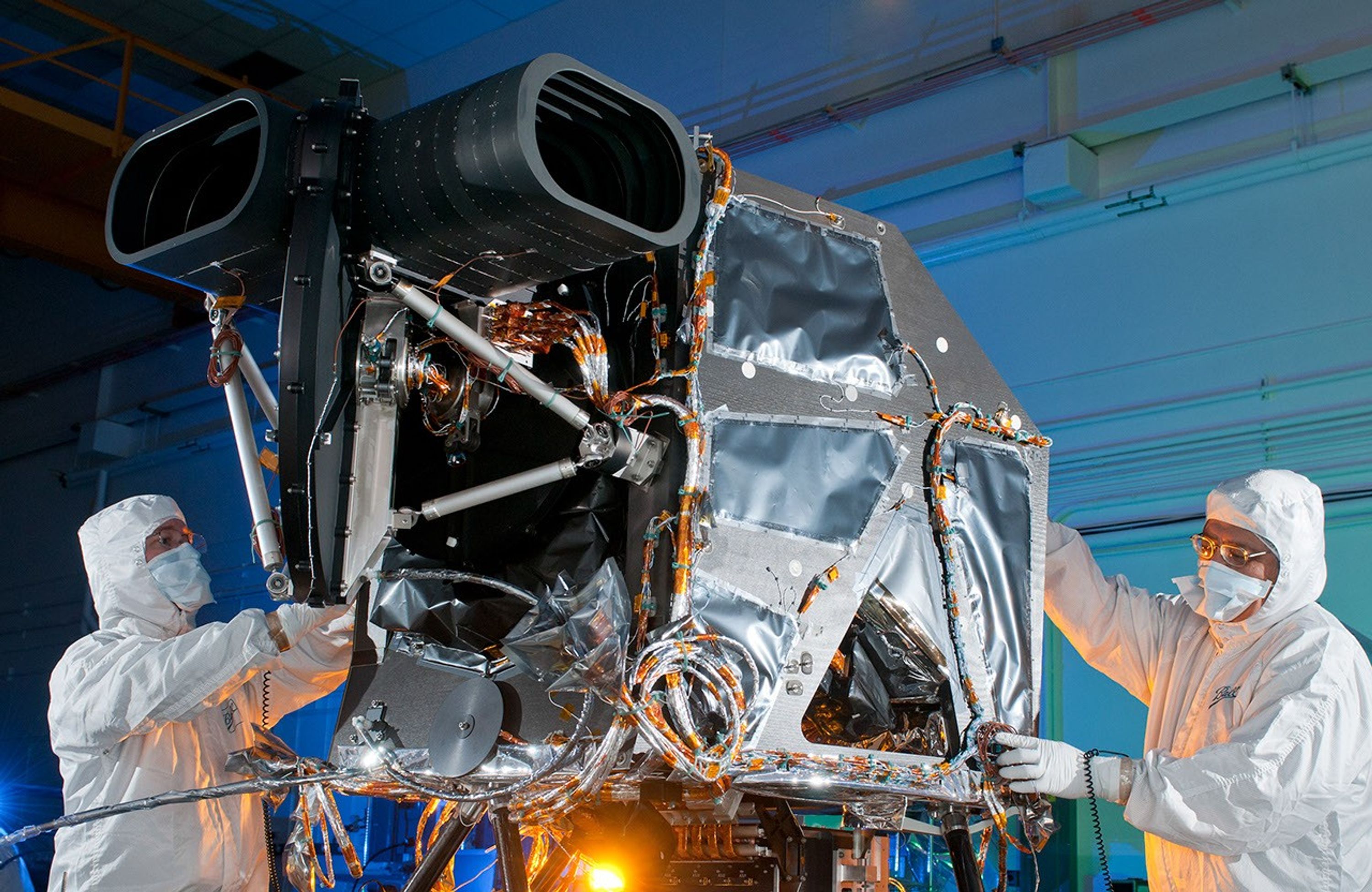
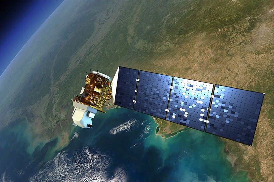
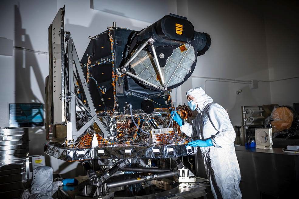
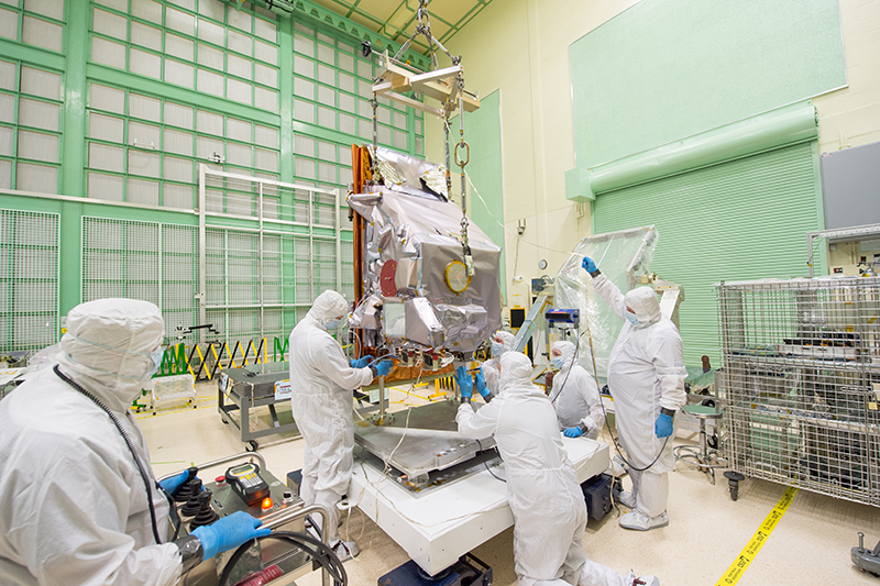
The Landsat 8 observatory includes a spacecraft bus and two Earth-observing instruments: the Operational Land Imager (OLI) and the Thermal Infrared Sensor (TIRS).
The spacecraft, built by Orbital Sciences Corporation, has a design life of 5 years, but carries sufficient fuel for 10 years of operations. In 2013, Landsat 8 surpassed this 10-year milestone as a result of careful engineering, hardware redundancies, and robust mission operations.
Operational Land Imager (OLI)
The Operational Land Imager (OLI) captures observations of Earth’s surface in visible, near-infrared, and shortwave-infrared light. The instrument was built by Ball Aerospace in Boulder, Colorado.
OLI’s design was an advancement in Landsat sensor technology and uses an approach demonstrated by the Advanced Land Imager (ALI) sensor flown on NASA’s experimental Earth Observing-1 (EO-1) satellite. In contrast to previous Landsat “whiskbroom” sensors, OLI is a “pushbroom” sensor. An upgrade to the 8-bit data collected by Landsat 7’s ETM+ sensor, OLI collects 12-bit data to detect more subtle detail in Earth’s surface. To ensure radiometric accuracy and stability, OLI contains internal calibration sources and has the ability to perform both solar and lunar calibration.
OLI provides data in the following spectral bands:
Band 1: Coastal/Aerosol (0.43 – 0.45 µm)
Band 2: Visible Blue (0.45 – 0.51 µm)
Band 3: Visible Green (0.53 – 0.59 µm)
Band 4: Visible Red (0.64 – 0.67 µm)
Band 5: Near-infrared (0.85 – 0.88 µm)
Band 6: Shortwave-infrared 1 (1.57 – 1.65 µm)
Band 7: Shortwave-infrared 2 (2.11 – 2.29 µm)
Band 8: Panchromatic (0.50 – 0.68 µm)
Band 9: Cirrus (1.36 – 1.38 µm)
Spatial resolution: 30 m (VSWIR), 15 m (panchromatic)
Data: 12-bit integers
Thermal Infrared Sensor (TIRS)
Landsat 8’s Thermal Infrared Sensor (TIRS) measures land surface temperature in two thermal infrared bands using principles of quantum physics. The instrument was built at NASA Goddard Space Flight Center in Greenbelt, Maryland.
Due to an expedited build timeline, TIRS was designed with Quantum Well Infrared Photodetector (QWIP) technology and a three-year design life.
The instrument contains a cryocooler radiator, an Earth view, Earth shield, Focal Plane Electronics (FPE), as well as a blackbody and deep space view for internal calibration.
TIRS provides data in the following spectral bands:
Band 10: Thermal-infrared 1 (10.60 – 11.19 µm)
Band 11: Thermal-infrared 2 (11.50 – 12.51 µm)
Spatial resolution: 100 m (resampled to 30 m)
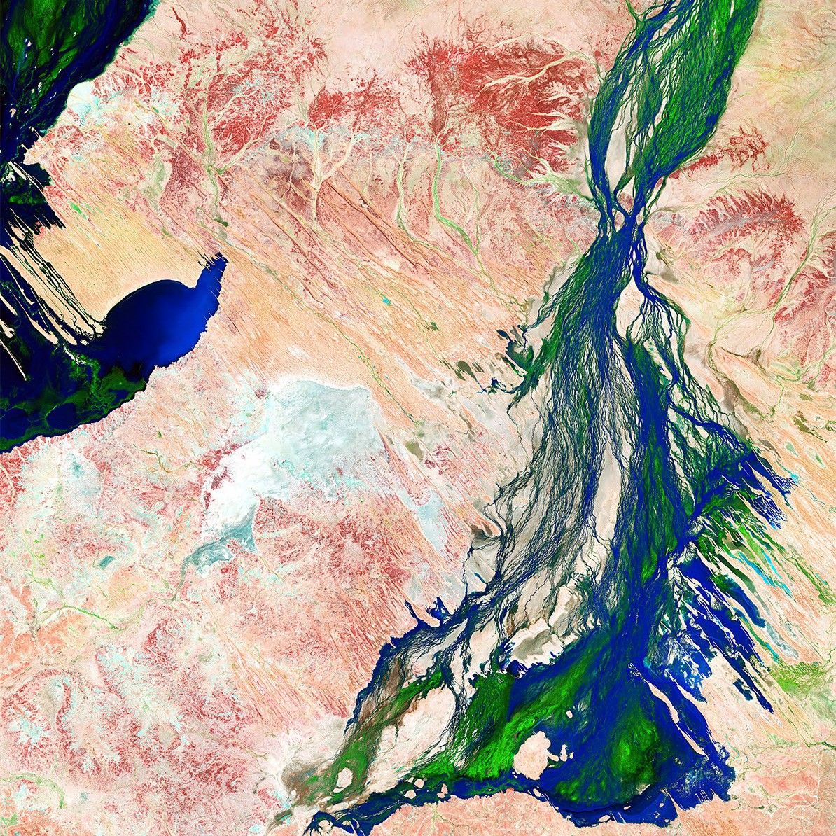
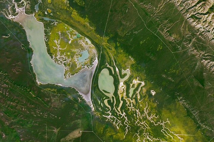
March 18, 2013
First Light
Boulder, Colorado
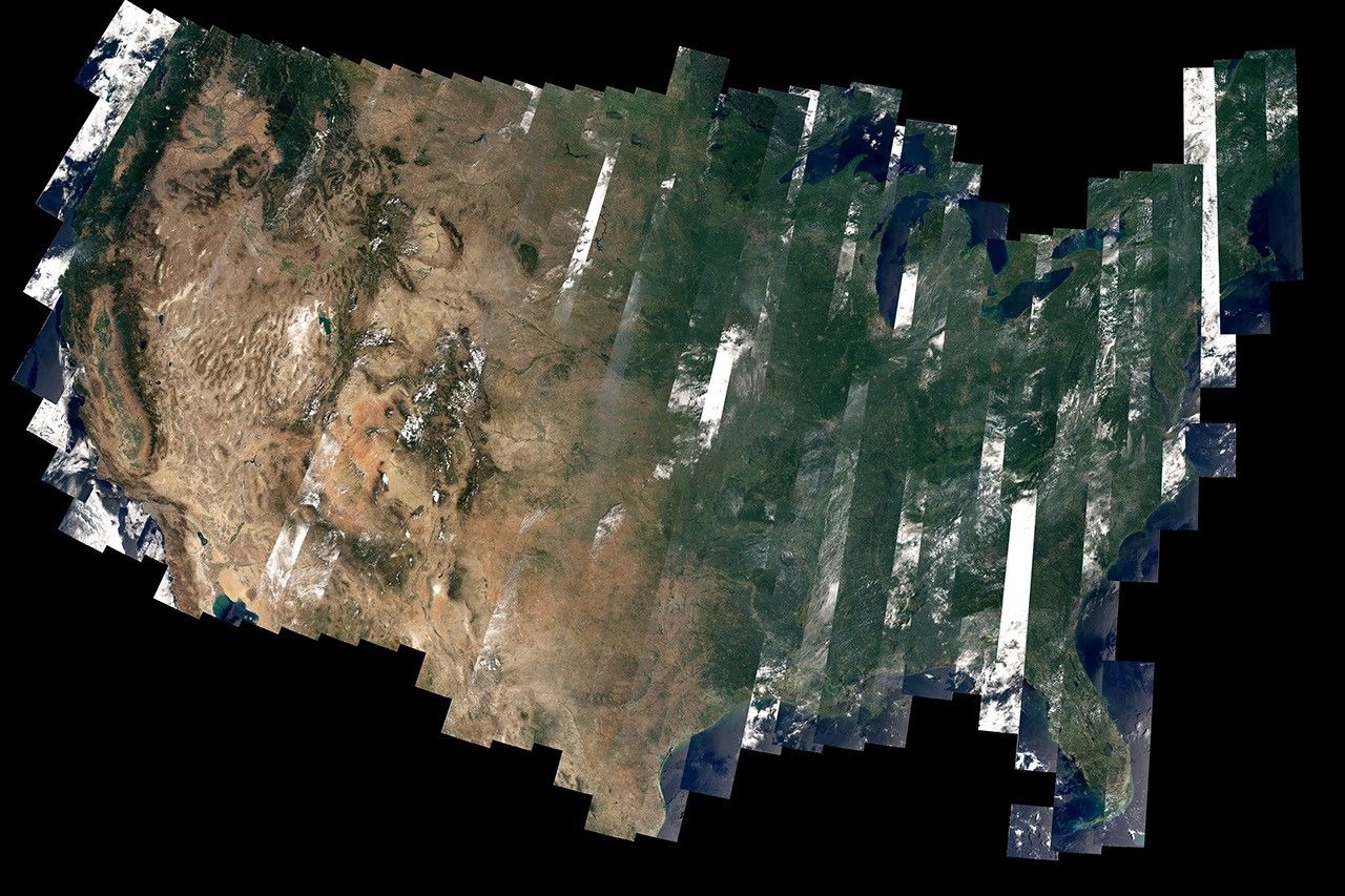
Landsat 8’s first image shows the area where the Great Plains and Rocky Mountains meet in Colorado. The natural-color image shows the coniferous forest of the mountains coming down to the dormant plains. Boulder, Colorado, sits in the middle of the image.
Learn More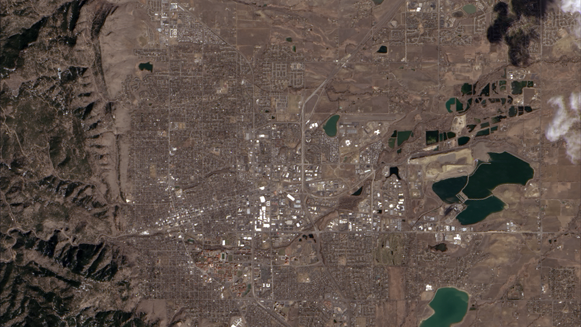
Mission Objectives
-
Multispectral Imaging
Collect and archive moderate-resolution, reflective multispectral image data affording seasonal coverage of the global land mass for a period of no less than five years.
-
Thermal Imaging
Collect and archive moderate-resolution, thermal multispectral image data affording seasonal coverage of the global land mass for a period of no less than three years.
-
Continuity
Ensure that data are sufficiently consistent with the data from the earlier Landsat missions, in terms of acquisition geometry, calibration, coverage characteristics, spectral and spatial characteristics, output product quality, and data availability to permit studies of land cover and land use change over multi-decadal periods.
-
Availability
Distribute standard data products to users on a nondiscriminatory basis and at no cost to the users.
"Landsat is a centerpiece of NASA's Earth Science program... Landsat 8 carries on a long tradition of Landsat satellites that for more than 40 years have helped us learn how Earth works, to understand how humans are affecting it and to make wiser decisions as stewards of this planet."

Charles Bolden
Former NASA Administrator
Landsat Looks at the Moon
Every full moon, Landsat 8 turns its back on Earth. It scans the distant lunar surface multiple times, then flips back around to continue its task of collecting land-cover information of the sunny side of Earth below.
These monthly lunar scans are key to ensuring the land-imaging instrument (the Operational Land Imager) is detecting light consistently. For this, engineers need a consistent source of light to measure. The moon lacks an atmosphere and has an unchanging surface, making it the perfect calibration site.
-
Mission Details
Landsat 8 is composed of three mission segments: the space segment (spacecraft and instruments), the launch segment, and the ground segment.
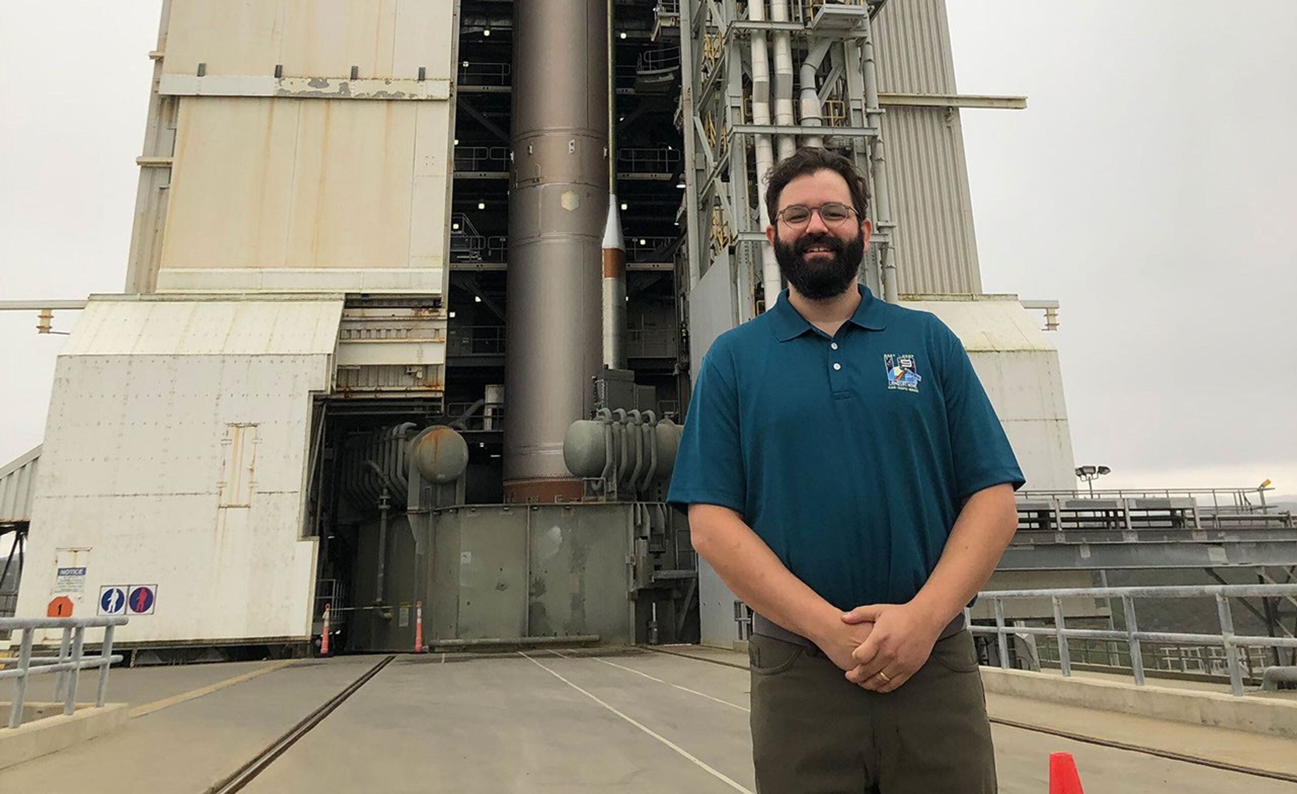
NASA is responsible for developing the space and launch segments, while USGS is responsible for developing the ground segment and operating the mission after launch. The United Launch Alliance (ULA) Atlas-V rocket with the Landsat Data Continuity Mission (LDCM) spacecraft onboard is seen launching on Monday, February 11, 2013 at Vandenberg Air Force Base, California. The Landsat Data Continuity Mission (LDCM) mission is a collaboration between NASA and the U.S. Geological Survey.United Launch Alliance
 -
Spectral Bands & Applications
The OLI and TIRS instruments on Landsat 8 collect data across 11 spectral bands. These instruments were designed to maintain continuity with previous Landsat missions while expanding capacity by adding four new bands.
Band 1 measures coastal water quality and aerosols, band 9 detects high, thin clouds, and two thermal infrared bands better distinguish between surface and atmospheric temperature. The Multispectral Scanner System (MSS) aboard Landsats 1-5 had four bands. The Thematic Mapper (TM) aboard Landsats 4 & 5 had seven bands. Landsat 7's Enhanced Thematic Mapper Plus (ETM+) has 8 bands and Landsats 8 & 9 have 11 bands. The atmospheric transmission values for this graphic were calculated using MODTRAN for a summertime mid-latitude hazy atmosphere (circa 5 km visibility).
Landsat 8: A Decade of Service
February 2023 marked the 10th anniversary of the launch of Landsat 8. Equipped with its Operational Land Imager (OLI) and Thermal Infrared Sensor (TIRS) onboard instruments, Landsat 8 represented a significant advance in remote sensing technology and was the first to allow everyone in the world fully free and open access to its data from first light. Explore some of the remarkable ways Landsat 8 has fundamentally altered the way we see our world.
Learn MoreProject and Program Management

Christopher S.R. Neigh
Landsat 8 Project Scientist

James R. Irons
Former Landsat 8 Project Scientist

Bruce Cook
Former Deputy Landsat 8 Project Scientist

Jeff Masek
Former Landsat 8 Deputy Project Scientist

Kenneth Schwer
NASA Landsat 8 Project Manager
.jpg?w=870&h=671&fit=clip&crop=faces%2Cfocalpoint)
Phil Sabelhaus
Former NASA Landsat 8 Project Manager

William Ochs
Former NASA Landsat 8 Project Manager

Del Jenstrom
Landsat 8 Deputy Project Manager

Cathy Richardson
TIRS instrument manager
David Jarrett
NASA Headquarters Program Executive

Edward Grigsby
Former NASA Headquarters Program Executive
Christopher Crawford
USGS Landsat 8 Project Scientist

Thomas Loveland
Former USGS Landsat 8 Project Scientist
Kristi Kline
USGS Landsat 8 Project Manager

Landsat 8 Graphics Library

Related Resources
Selected Publications
- Irons, J. R., Dwyer, J. L., & Barsi, J. A. (2012). The next Landsat satellite: The Landsat Data Continuity Mission. Remote Sensing of Environment, 122, 11–21. https://doi.org/10.1016/j.rse.2011.08.026
- Irons, J., & Masek, J. (2006). Requirements for a Landsat Data Continuity Mission. Photogrammetric Engineering & Remote Sensing, 1102–1108. https://www.asprs.org/wp-content/uploads/pers/2006journal/october/highlight.pdf
- Loveland, T. R., & Irons, J. R. (2016). Landsat 8: The plans, the reality, and the legacy. Remote Sensing of Environment, 185, 1–6. https://doi.org/10.1016/j.rse.2016.07.033
- Roy, D. P., Wulder, M. A., Loveland, T. R., C.E., W., Allen, R. G., Anderson, M. C., Helder, D., Irons, J. R., Johnson, D. M., Kennedy, R., Scambos, T. A., Schaaf, C. B., Schott, J. R., Sheng, Y., Vermote, E. F., Belward, A. S., Bindschadler, R., Cohen, W. B., Gao, F., & Hipple, J. D. (2014). Landsat-8: Science and product vision for terrestrial global change research. Remote Sensing of Environment, 145, 154–172. https://doi.org/10.1016/j.rse.2014.02.001


