![Request for Information – Potential [Placeholder for Prize]](https://assets.science.nasa.gov/dynamicimage/assets/science/psd/solar/2023/09/s/solarsystem_0.jpg?w=1024)


Chesapeake Bay from Space
About
Type: Exploration
Topics: Water, urban growth, ecosystems
Setting: Small group
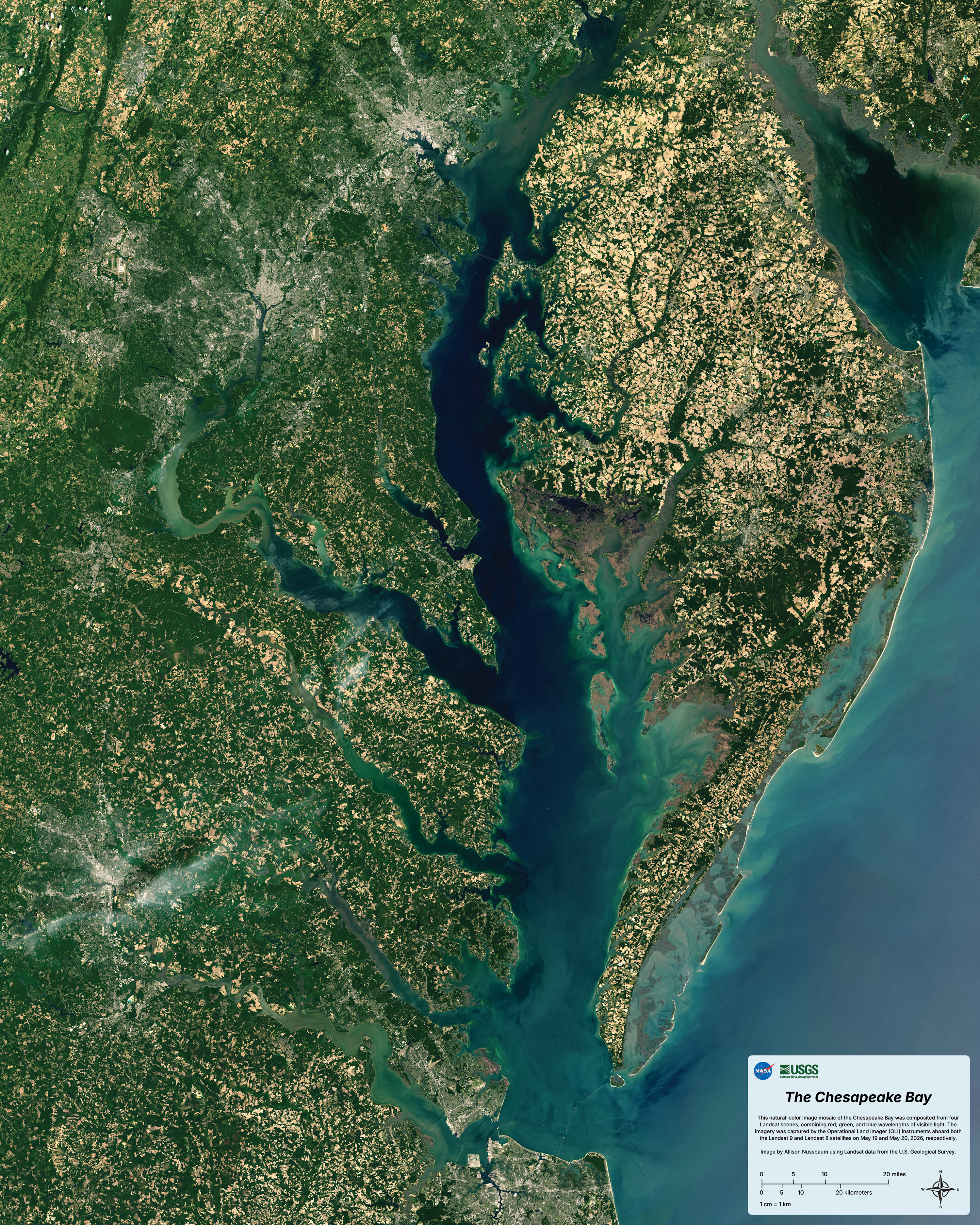
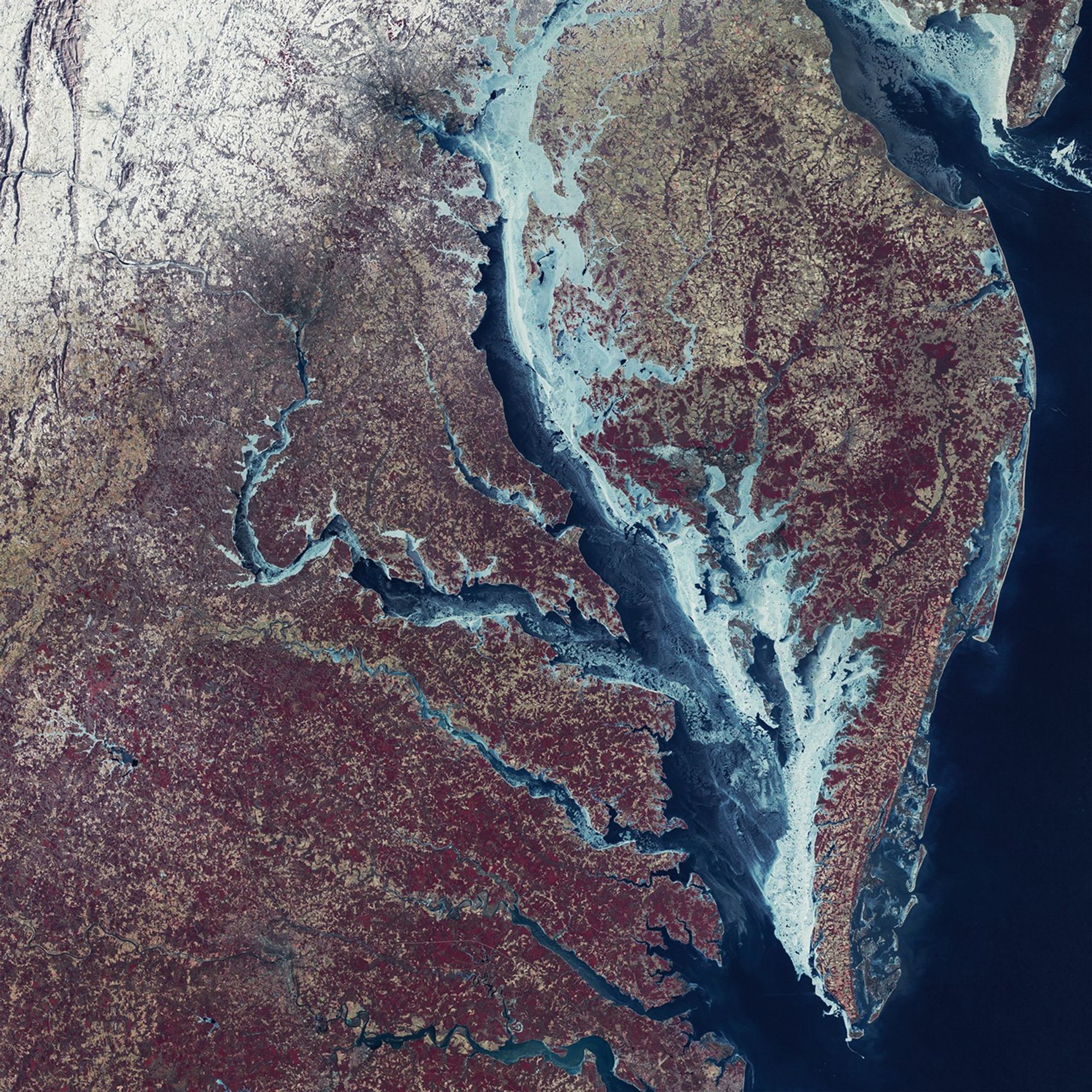
This natural-color image mosaic of the Chesapeake Bay was composited from four Landsat scenes, combining red, green, and blue wavelengths of visible light. The imagery was captured by the Operational Land Imager (OLI) instruments aboard both the Landsat 9 and Landsat 8 satellites on May 19 and May 20, 2026, respectively. The mosaic spans Delaware, Maryland, Washington D.C., and Virginia.
NASA Landsat/Allison Nussbaum
February 1977
February 2026
NASA Earth Observatory

NASA/Allison Nussbaum
NASA Earth Observatory
NASA/Allison Nussbaum
February 1977
February 2026
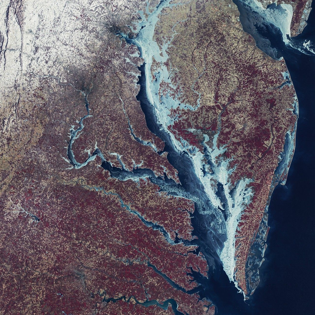
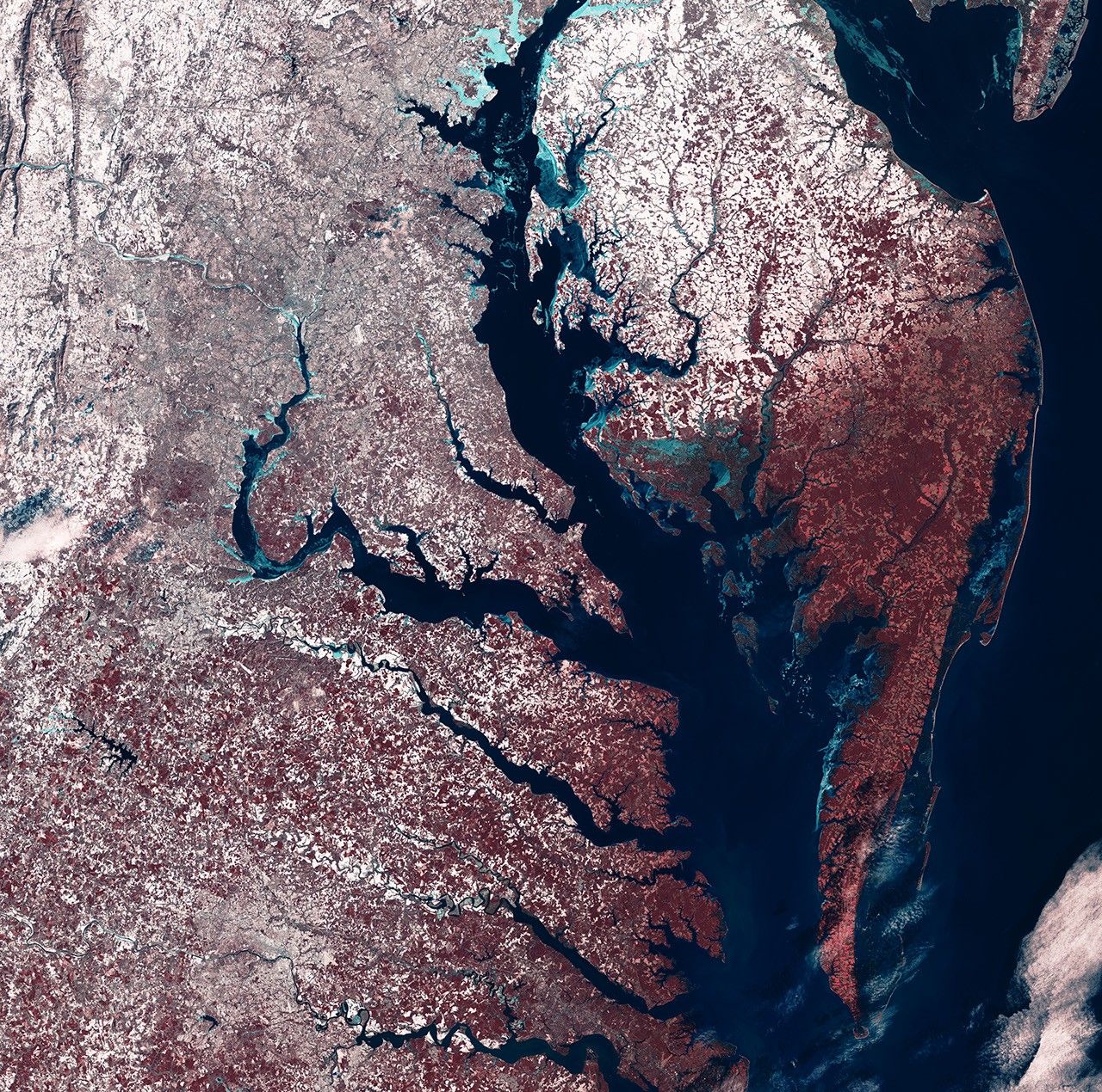
Frozen Chesapeake Bay
The MSS (Multispectral Scanner System) on Landsat 1 captured the image on the left during the exceptionally cold winter of 1976-1977. The mosaic combines two Landsat scenes acquired on February 7 with a third captured on February 8. The landscape is shown in false color (MSS bands 6-5-4). The image on the right was captured by the OLI (Operational Land Imager) instrument on Landsat 8 and 9. It combines four scenes acquired February 4 and February 5, 2026. The landscape is shown in false color (OLI bands 5-4-3). In both images, ice appears in shades of blue, green, and white. On land, snow appears white, vegetation is red, and urban areas take on brown-gray tones.