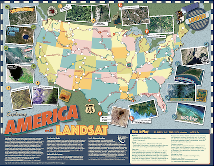
Exploring America with Landsat
Board Game
ABOUT
Age Level: 10+
Setting: Small group (2-4 players)
Type: Board game
Topics: Land cover, natural resources
Estimated Time: 30 minutes
Travel along the National Trails or Waterways and collect postcards from 4 different regions to win.
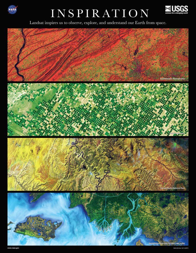
The back of the 2018 Earth Science Week poster.
Ginger Butcher
Materials & Setup
- Collect materials: 1 playing piece (a small unique object) and 4 markers for each player (coins or colored paper) for each player, deck of playing cards.
- Setup: Download and print game board. Place all playing pieces at the Gateway Arch symbol. Deal 4 cards to each player - remaining cards are the draw pile.
Game Play
- Each turn, a player draws one card and plays one card.
- Players move their pieces along rivers or trails landing on the white circles. Red cards allow players to move along a trail (red lines) and black cards to move along a river (aqua lines).
- Claim a location by landing on a lettered space. Claim a location in each of the 4 regions to win.
Inspiration: Landsat inspires us to observe, explore, and understand our Earth from space
The Exploring America with Landsat game was inspired by the 50th Anniversary of the National Trails System. NASA, AmericaView, and USGS created this fun game to celebrate Earth Science Week 2018. The Inspiration poster offers inspiring Landsat views of the American landscape.
The front of the 2018 Earth Science Week poster.
Alternate Game Play
- Pick locations — Create four cards from four different colors of paper. Label the first color cards A, B, C, and D. Label the second color cards E, F, G, H. Label the third color cards I, J, K, L. And label the last color cards M, N, O, P. At the start of the game, each player selects one card of each color. Those become the locations they must visit to win the game.
- Chance cards – Download and cut out these cards. Place on the board and when any player plays a 7 or 2 playing card, they must choose 1 Chance card and follow the instructions.
- Create your own game — Create your own rules or your own cards. Browse and print some of the inspiring Landsat images from Earth Observatory or Earth as Art gallery to make your own Chance cards.
Landsat Image Puzzles
- “Try your skill at these web-based puzzles of all the images from this poster and others. Created by AmericaView as part of their Earth Observation Day activities, there are dozens of puzzles with a variety of skill levels.”
Related Resources
- AmericaView — AmericaView is a nationwide, university-based, and state- implemented consortium that advances the widespread use of remote-sensing data and technology through education, outreach, and workforce development for the public and private sectors.
- USGS EROS Earth at Art
- USGS Landsat
- NASA Earth Observatory