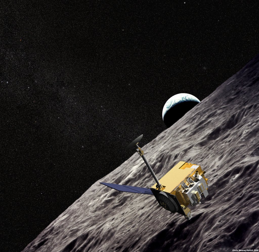
LRO Science
LRO has already collected as much data as all other planetary missions combined. This volume of data is possible because the Moon is so close to Earth and because LRO has its own dedicated ground station, which means it doesn't have to share time on the Deep Space Network. LRO has surpassed its original science goals and is now paving the way for Artemis.
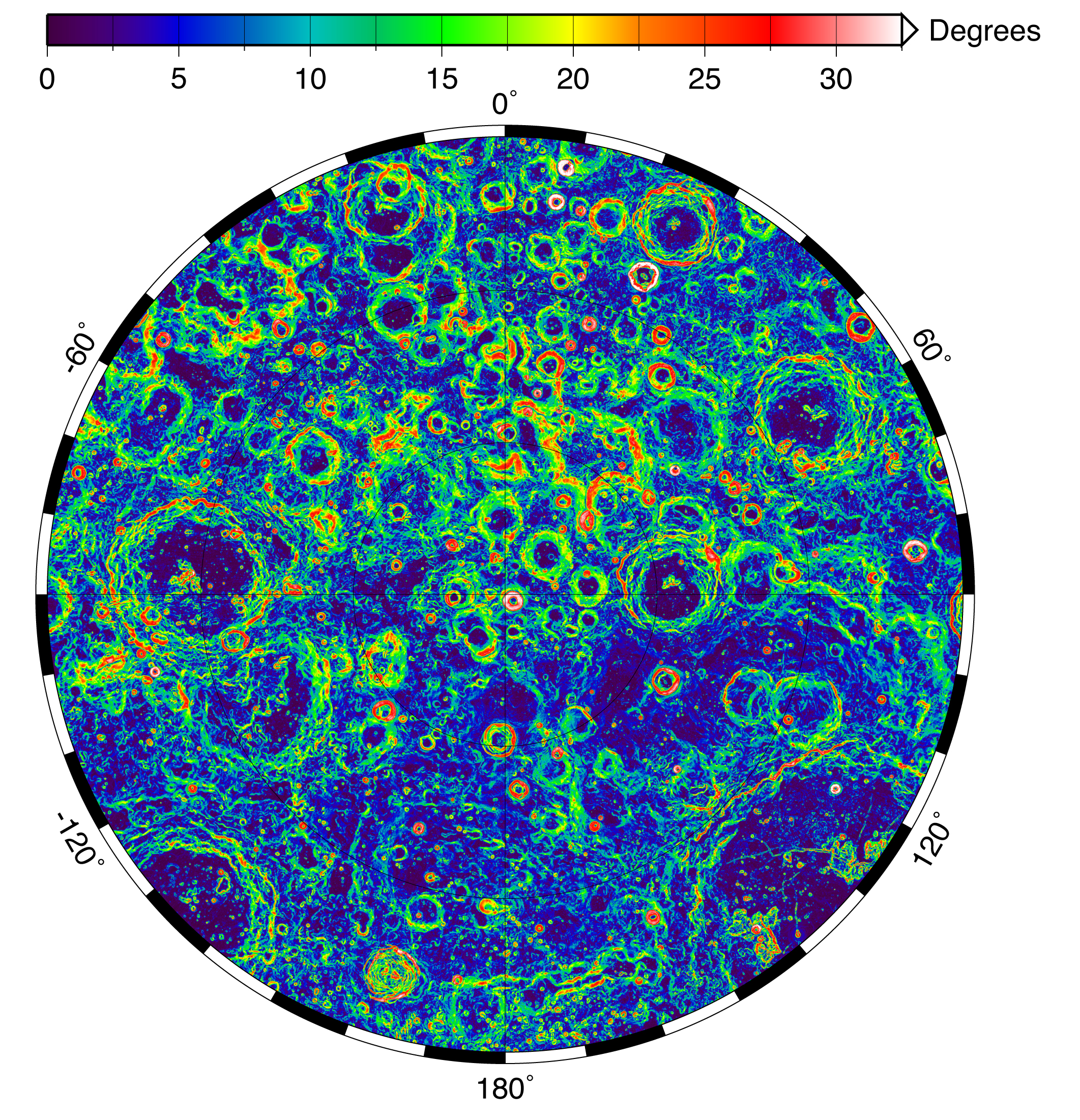
Topographic Maps
Topographic maps of the Moon based on data from LRO's Lunar Orbiter Laser Altimeter (LOLA) instrument are the most accurate to date. The final set of data from the exploration phase of the LRO mission was released to the NASA Planetary Data System.
The Lunar Radiation Environment
LRO's Cosmic Ray Telescope for the Effects of Radiation (CRaTER ) instrument characterizes the global lunar radiation environment and its biological impacts by measuring galactic and solar cosmic ray radiation behind a "human tissue-equivalent" plastic. CRaTER discovered a previously unmeasured source of hazardous radiation coming from the Moon itself. The radiation reportedly comes from the partial reflection of galactic cosmic rays off the Moon surface.
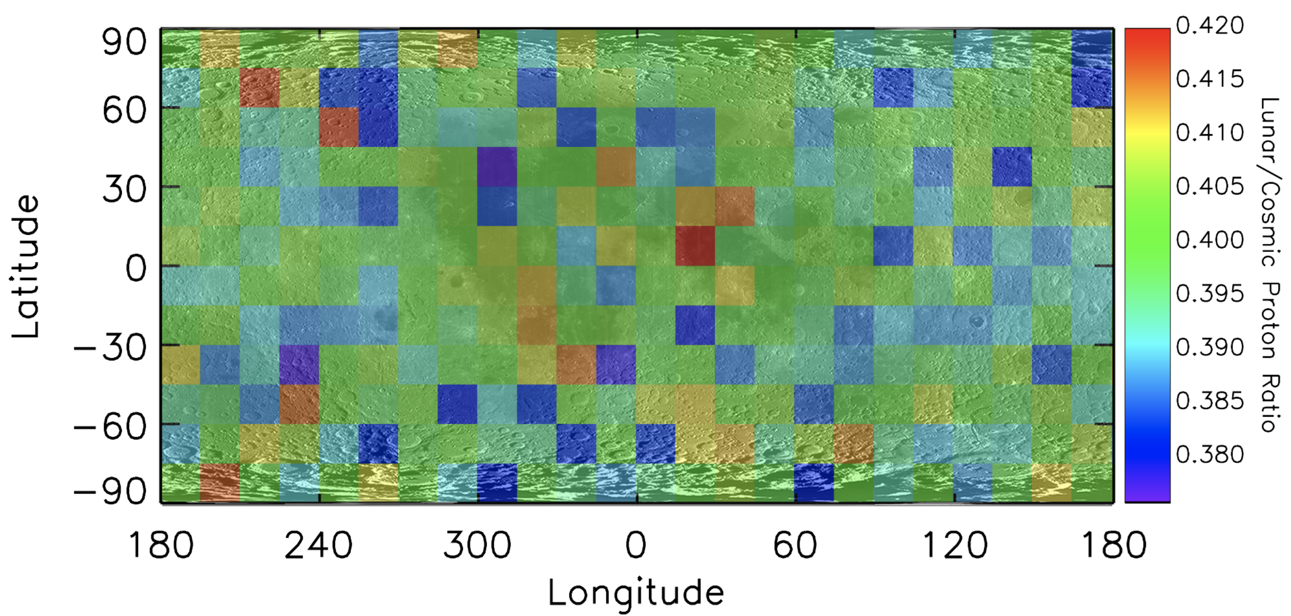
Evaluating Biological Impacts
CRaTER is able to observe how radiation interacts with a tissue-equivalent plastic known as TEP. The TEP detector is able to mimic radiation doses within humans that would be delivered if a person was on the Moon. CRaTER's long-term measurements of radiation in deep space are some of the best ever made.
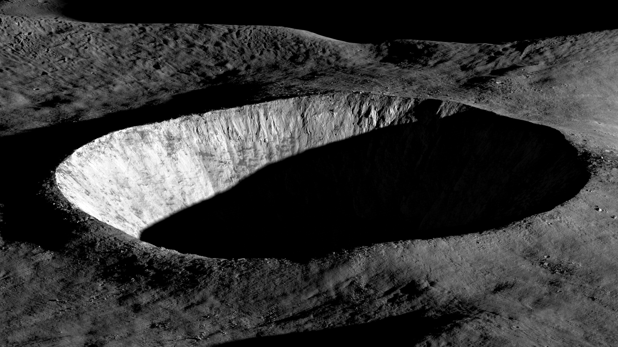
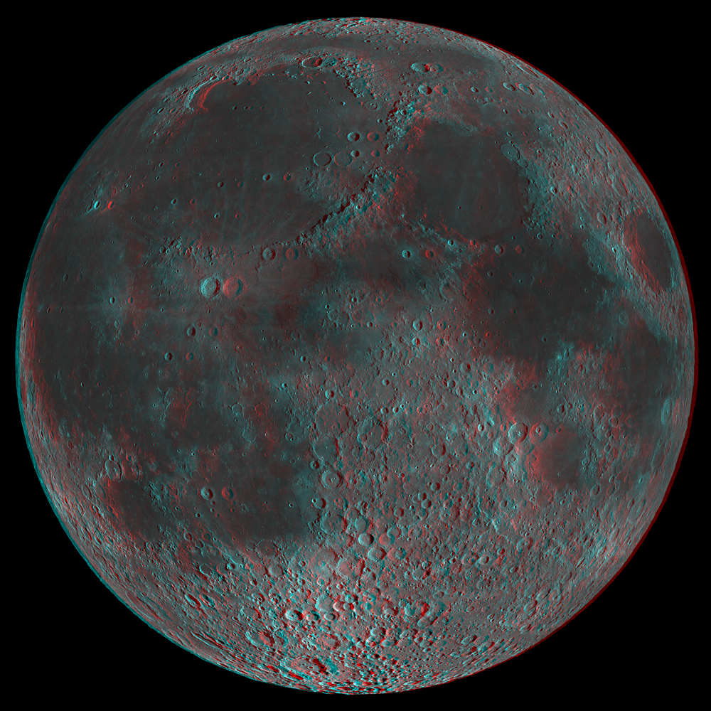
Providing the first highly accurate 3D Lunar Maps
Anaglyphs are now being used to better understand the 3D structure of the lunar surface. An "anaglyph" is the stereoscopic 3D effect achieved by means of encoding slightly offset images using filters of different (usually chromatically opposite) colors. These images can be viewed in three-dimensions using red-blue/green glasses.
LRO acquires stereo images by targeting a location on the ground and taking an image from one angle on one orbit, and from a different angle on a subsequent orbit. The LRO Narrow Angle Camera (NAC) team generates anaglyphs from pairs of stereo images. Stereo image pairs of the moon in high resolution (0.5 to 2 meters/pixel) provide 3D views of the surface, which scientists use to make high-resolution topographic maps.
The LROC NAC anaglyphs make lunar features such as craters, volcanic flows, lava tubes and tectonic features jump out in 3D.
Mapping Mineralogy Across the Moon
The crust of the Moon is made up of two main types of rock, anorthosite and basalt. Anorthosite is light in color because it is made up of a light-colored mineral called plagioclase feldspar. Basalt is dark in color because it contains the iron-bearing minerals pyroxene, olivine and ilmenite, along with volcanic glass. The iron present in these minerals tend to absorb light, making them appear dark.
The Diviner Lunar Radiometer Experiment revealed the presence of lunar soils with compositions more sodium-rich than that of the typical anorthosite crust. Diviner identified quartz, silica-rich glass, and alkali feldspar at four of these unique, nearside sites.
The widespread nature of these soils reveals that there may have been variations in the chemistry and cooling rate of the magma ocean which formed the early lunar crust, or they could be the result of secondary processing of the early lunar crust.
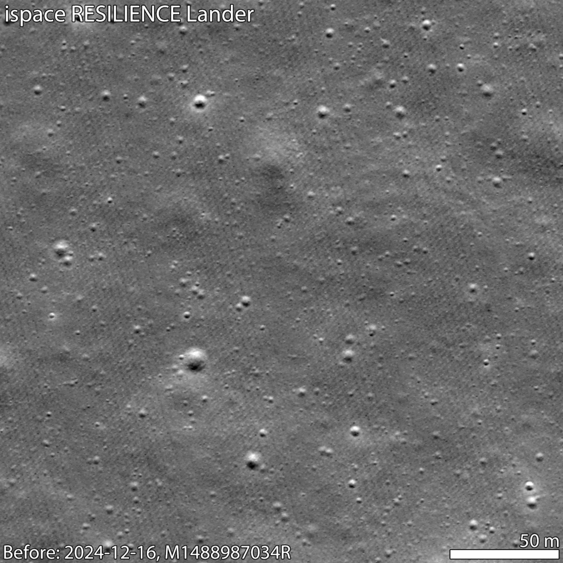
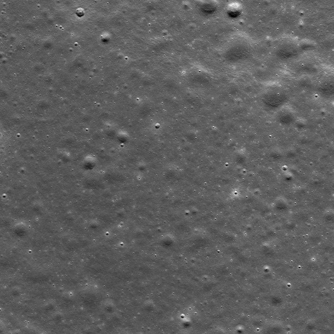
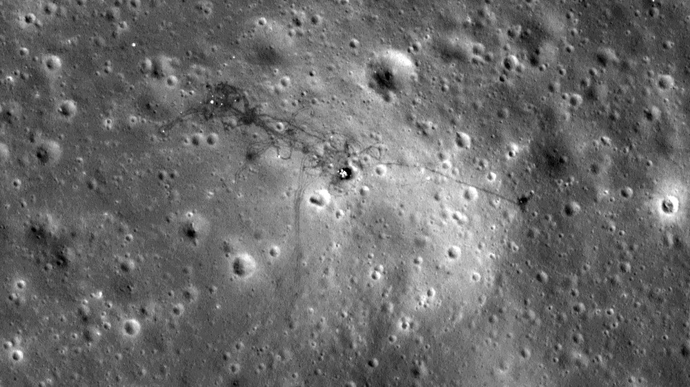
Provide an Assessment of Features for Landing Sites
The continuing observations of historic hardware and impact craters are not just interesting from a historical standpoint - each image adds to our knowledge of lunar science and engineering, particularly cartography, geology, and photometry. Making sure that the lunar cartographic network is accurate is a critical component for planning future lunar missions for both human and robotic exploration of the Moon. The historic spacecraft serve as benchmarks.
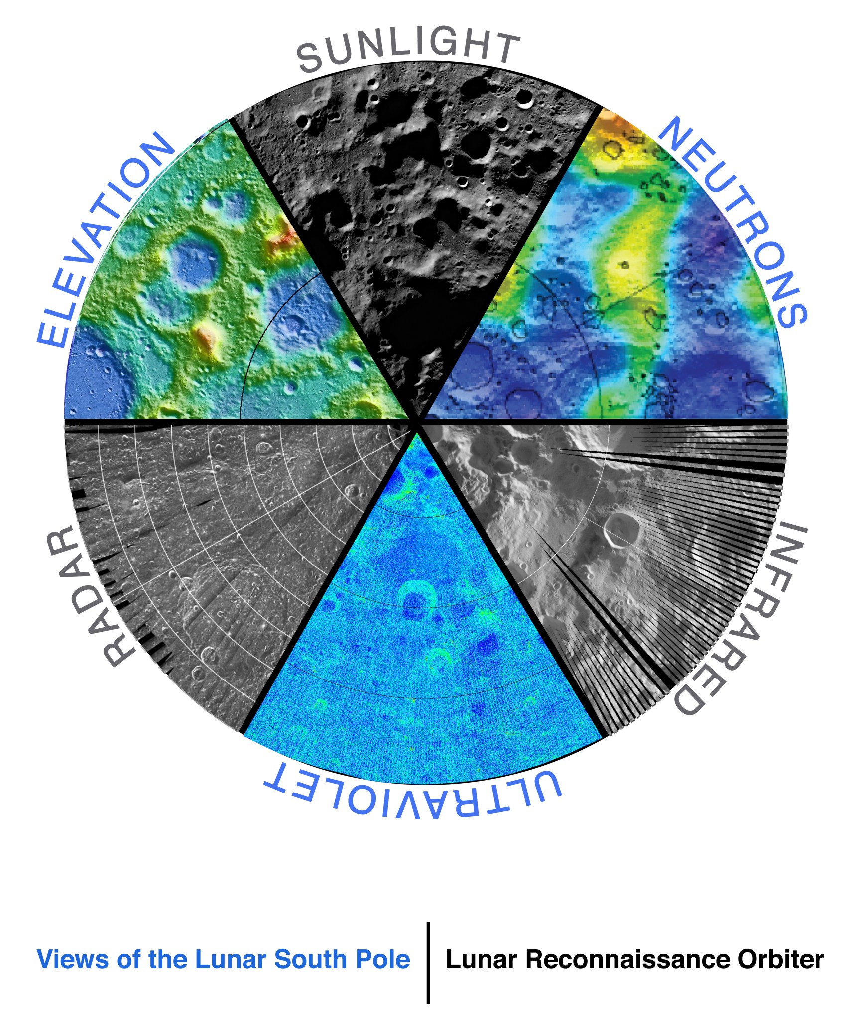
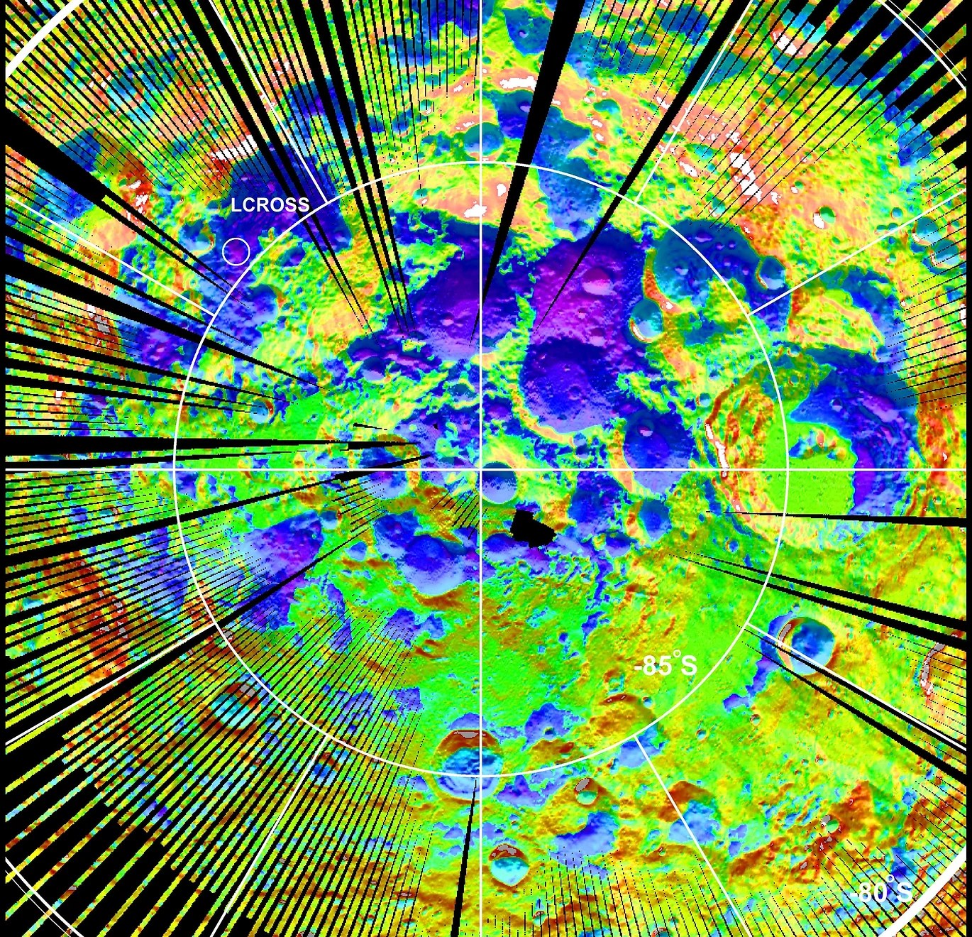
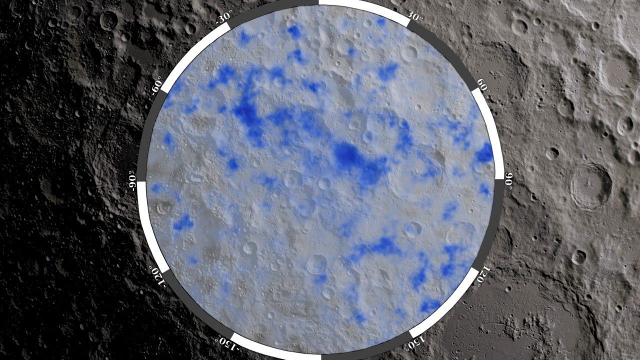
Searching for Polar Volatiles (Especially Water Ice)
LRO looks for water using its Lunar Explorer Neutron Detector (LEND) instrument, which detects the presence of hydrogen atoms by counting neutrons released from the Moon’s soils. Using data from LRO and other missions, scientists have discovered evidence for water or hydrogen, a component of water, in special places on the Moon. Since the Moon is not tilted much from its rotation axis, the depths of certain craters in the lunar poles may not have seen the sun for billions of years.
Data Products
Find the LRO maps and data that you are looking for with this collection of resources.
Learn More