![Request for Information – Potential [Placeholder for Prize]](https://assets.science.nasa.gov/dynamicimage/assets/science/psd/solar/2023/09/s/solarsystem_0.jpg?w=1024)


Mars Global Surveyor
Science
Overview
Mars Global Surveyor conducted global mapping of the entire planet – from the ionosphere (an envelope of charged particles surrounding Mars) down through the atmosphere to the surface, and deep into Mars' interior. As part of the larger Mars Exploration Program, Mars Global Surveyor performed atmospheric monitoring for sister orbiters during aerobraking, relayed surface telemetry, and identified potential future landing sites.
The spacecraft contributed to meeting the four main science goals of the Mars Exploration Program by achieving the following science objectives during its primary mission:
- Characterize the surface features and geological processes on Mars.
- Determine the composition, distribution and physical properties of surface minerals, rocks and ice.
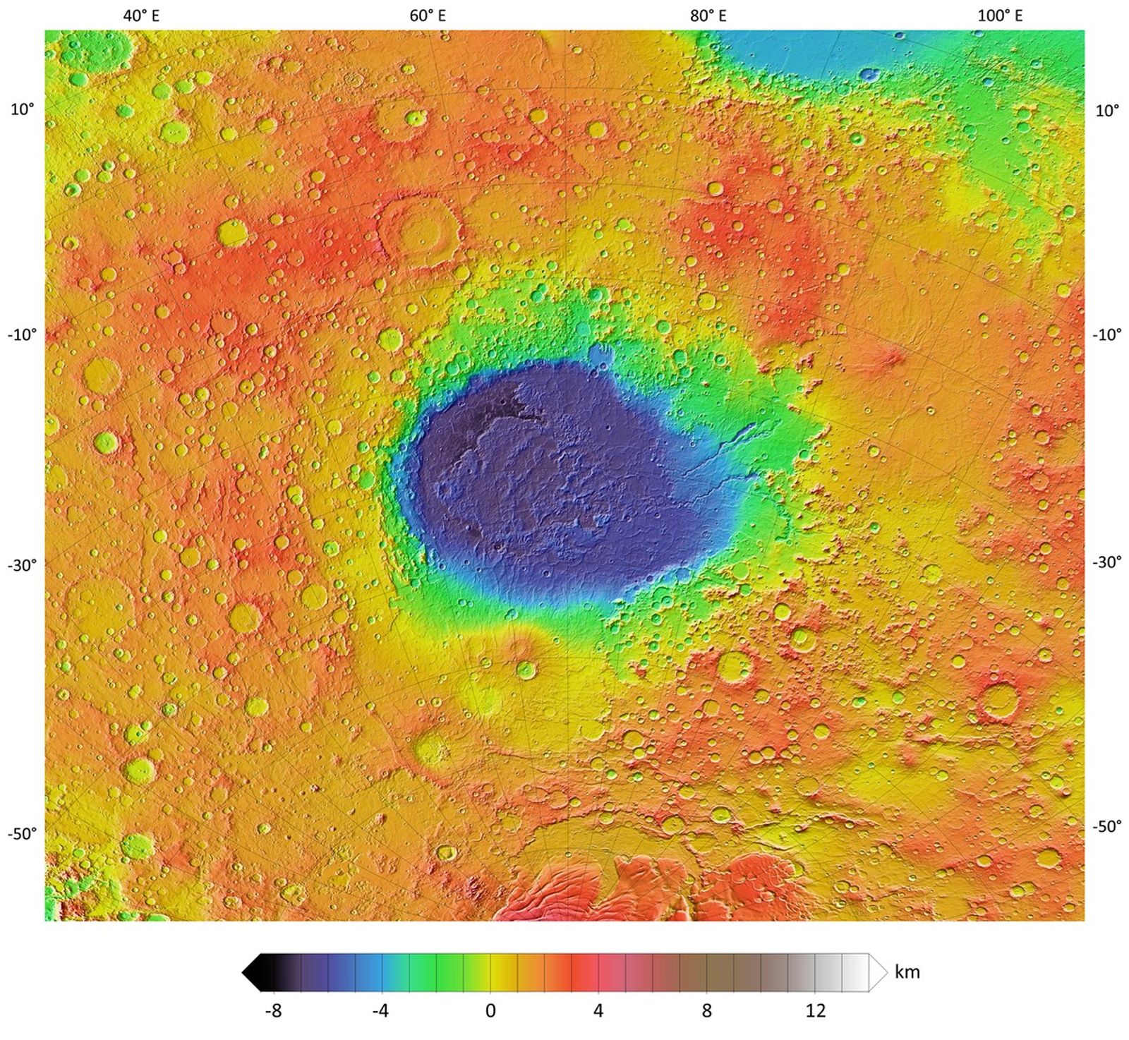
- Determine the global topography, planet shape, and gravitational field.
- Establish the nature of the magnetic field and map the crustal remnant field. (A crustal remnant field is evidence of magnetism within the planet's crust or rocks, produced by the planet's own magnetic field at the time of formation.)
- Monitor global weather and the thermal structure of the atmosphere.
- Study interactions between Mars' surface and the atmosphere by monitoring surface features, polar caps that expand and recede, the polar energy balance, and dust and clouds as they migrate over a seasonal cycle.
Extended Mission Principal Goals
- Continued weather monitoring to form a continuous set of observations with NASA's Mars Reconnaissance Orbiter, which reached the Red Planet in March 2006.
- Imaging of possible landing sites for the subsequent Phoenix lander, and the Mars Science Laboratory rover.
- Observation and analysis of key sites of scientific interest, such as sedimentary-rock outcrop sites.
- Continued monitoring of changes on the surface due to wind and ice.

Science Instruments
Mars Global Surveyor carried a complement of six scientific investigations to perform atmospheric monitoring for sister orbiters during aerobraking, and it helped rovers and lander missions by identifying potential landing sites and relaying surface telemetry.
Learn More About MGS Science Instruments about Science Instruments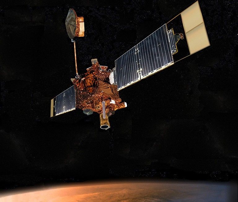
Science Highlights
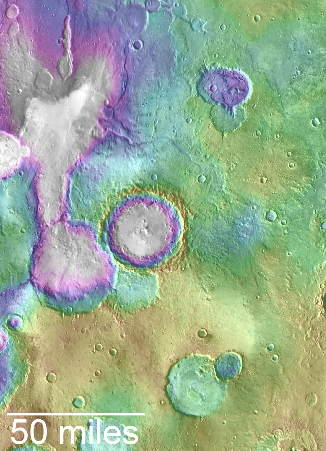
Mars Global Surveyor contributed a multitude of findings, including signs of past, persistent water such as an ancient delta and currently active water features in the gullies of canyon walls.
Learn More About MGS Science Highlights about Science Highlights