


Description
CLARS
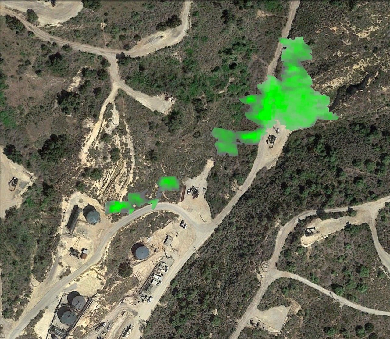 | 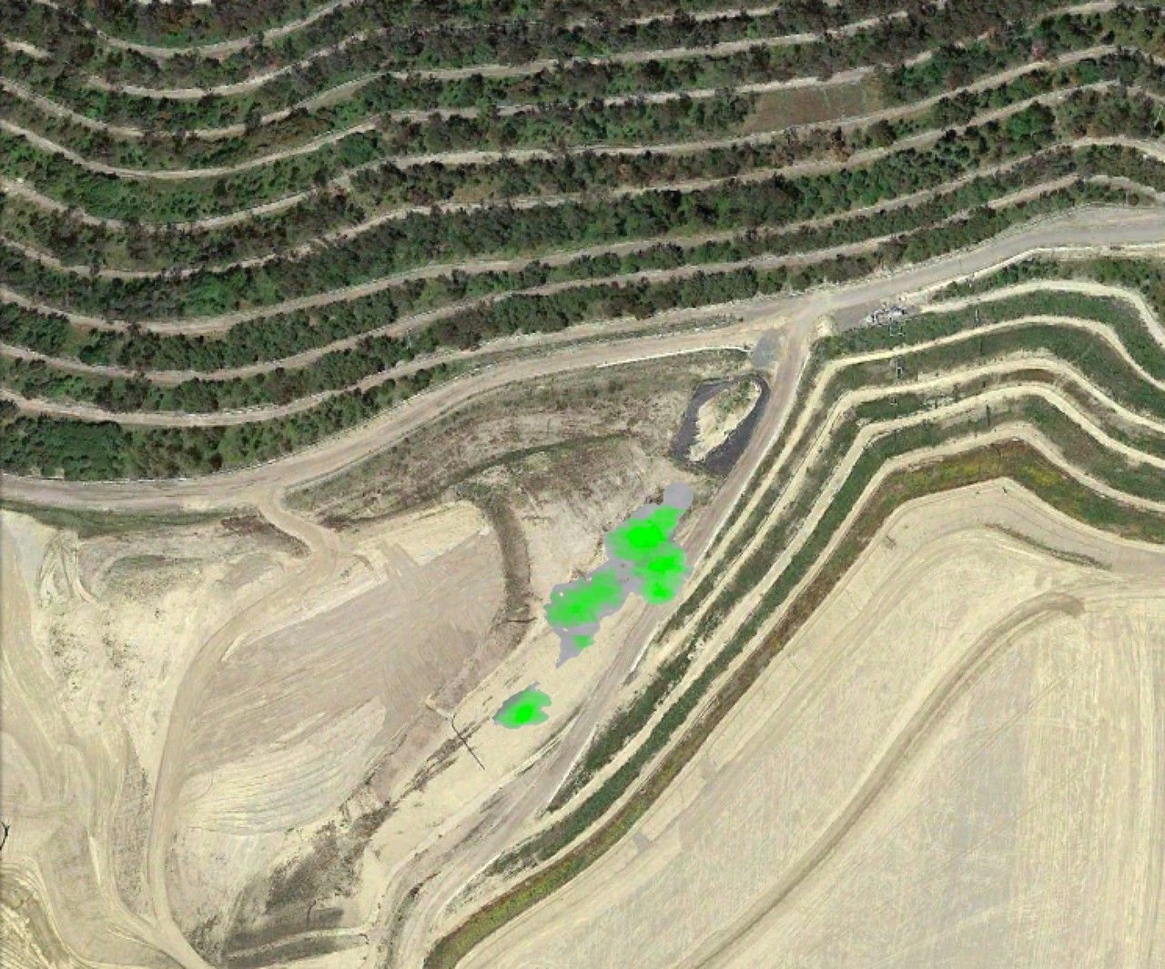 | |
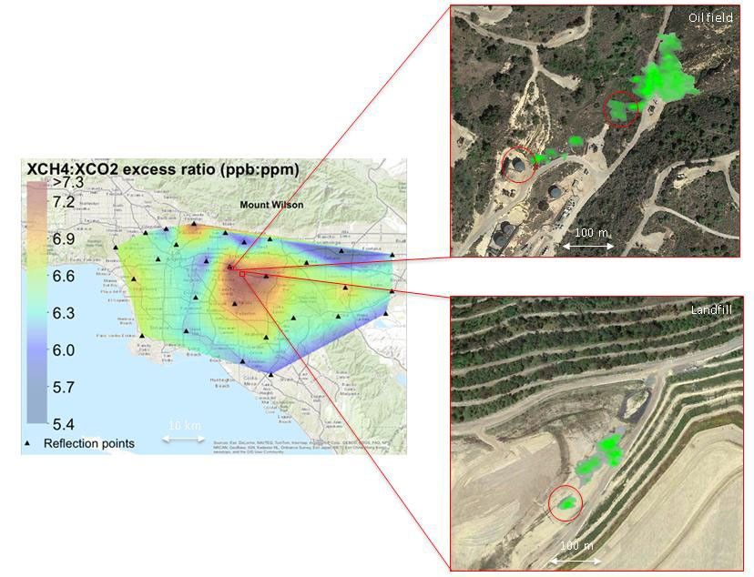
| HyTES Oilfield | HyTES Landfill |
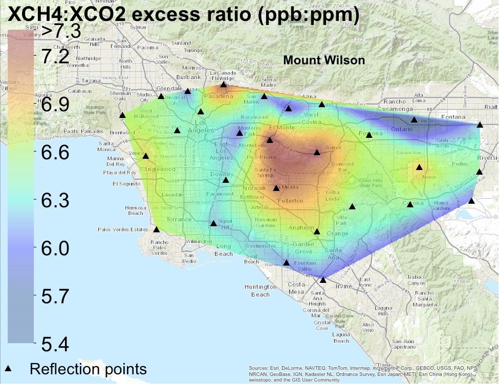
Main image left: Persistent methane hotspot (central red area) over Los Angeles basin from September 2011 through October 2013 detected by a prototype NASA satellite instrument at NASA's California Laboratory for Atmospheric Remote Sensing (CLARS) on Mt. Wilson (Wong et al., ACP 2015). CLARS observations of the Los Angeles basin are ongoing.
Main image right: Examples individual methane leaks (green plumes) from an oil field (upper) and landfill (lower) identified by NASA's airborne Hyperspectral Thermal Emission Spectrometer (HyTES), July 2-3, 2014.


