Tracking Curiosity’s Entry, Descent and Landing on Mars
| Credit | NASA/JPL-Caltech/ASU |
|---|---|
| Language |
|
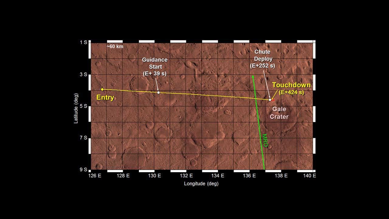
This image shows engineers' refinements of where NASA's Curiosity rover will enter the atmosphere of Mars on Aug. 5 PDT (Aug. 6 EDT). The background image is a false-color image from the Thermal Emission Imaging System (THEMIS) camera on NASA's Mars Odyssey spacecraft.
The yellow line tracks the expected path on the ground directly under Curiosity as it descends through Mars' atmosphere and touches down at Gale Crater. When it enters the atmosphere, it is about 77.7 miles (125 kilometers) above the surface. The red oval is the predicted landing area, known as the "landing ellipse." The graphic also marks critical events during descent, as well as the time they occur after atmospheric entry. The green line shows the ground track of NASA’s Mars Reconnaissance Orbiter, which will be flying almost overhead Curiosity as it lands, and will provide communication support. Not shown in the picture are the ground tracks of NASA’s Mars Odyssey and ESA’s Mars Express, which will also provide support during Curiosity's entry, descent and landing.


