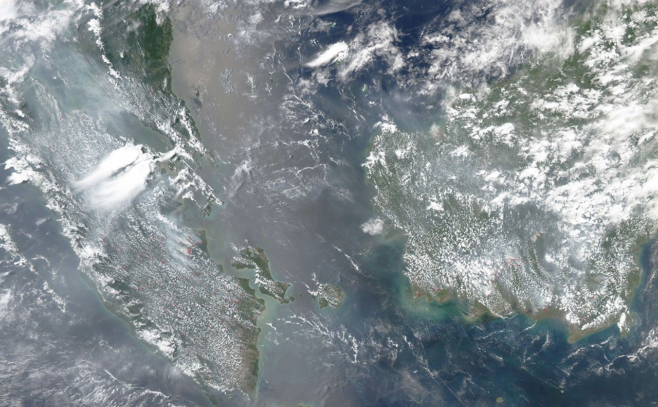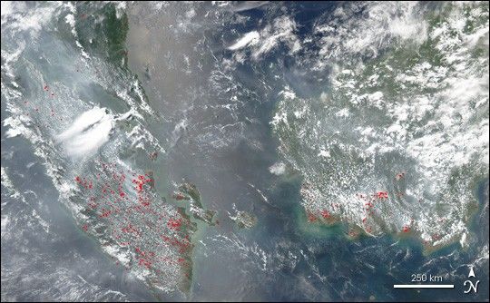
Slash-and-burn forest clearing and open cropland burning on the Indonesian island of Sumatra and in the Kalimantan portion of the island of Borneo are blanketing the region with a pall of haze that has delayed air travel and prompted government officials to distribute gas masks to island residents, according to various news reports. This Moderate Resolution Imaging Spectroradiometer (MODIS) image shows the polluted air across Sumatra (left) and Borneo (right) on September 7, 2004. Actively burning fires have been marked with red dots, and a pall of grayish smoke hangs over the region.
A Sumatran environmental officer was quoted in the news as reporting that the level of ash, dust and other particles in the air on September 5 and 6 reached 395 and 350 micrograms (a microgram is a millionth of a gram) per cubic meterâmore than three times the safe level of no more than 100 micrograms per cubic meter. In some places visibility is only a few hundred meters.
From July through October, people have traditionally used fire to clear forest land for planting and to clear away the previous year's crop stubble to make ready for the new planting season. However, after a devastating burning season associated with a severe El Niño in 1998 destroyed millions of square kilometers of forest, the government has been trying to crack down on the illegal burning with the help of regional governments. The policies have been difficult to enforce, and the problem returns each year.
References & Resources
NASA image by Jesse Allen, based on data from the MODIS Rapid Response Team, NASA-GSFC