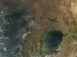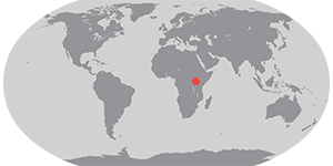

In the Great Rift Valley in eastern Africa, scores of fires were burning on February 22, 2005, when this image was captured by the Moderate Resolution Imaging Spectroradiometer (MODIS) on NASA’s Aqua satellite. Northwest of the largest lake, Lake Victoria, active fires (locations marked in red) were burning in southwestern Uganda. The border between Uganda and its western neighbor, Democratic Republic of Congo, falls through the middle of Lake Albert, the northernmost of three lakes that mark the western side of Africa’s Great Rift Valley. The three lakes appear splashed with gold due to sun glint. The other two lakes are Lake Edward (middle) and Lake Kivu. The fires in Democratic Republic of Congo give the impression of a corral surrounding the country’s tropical forests.
References & Resources
NASA image created by Jesse Allen, Earth Observatory, using data obtained from the MODIS Rapid Response team.