

















- January 21, 2007 (1.7 MB)
- January 10, 2007 (1.4 MB)
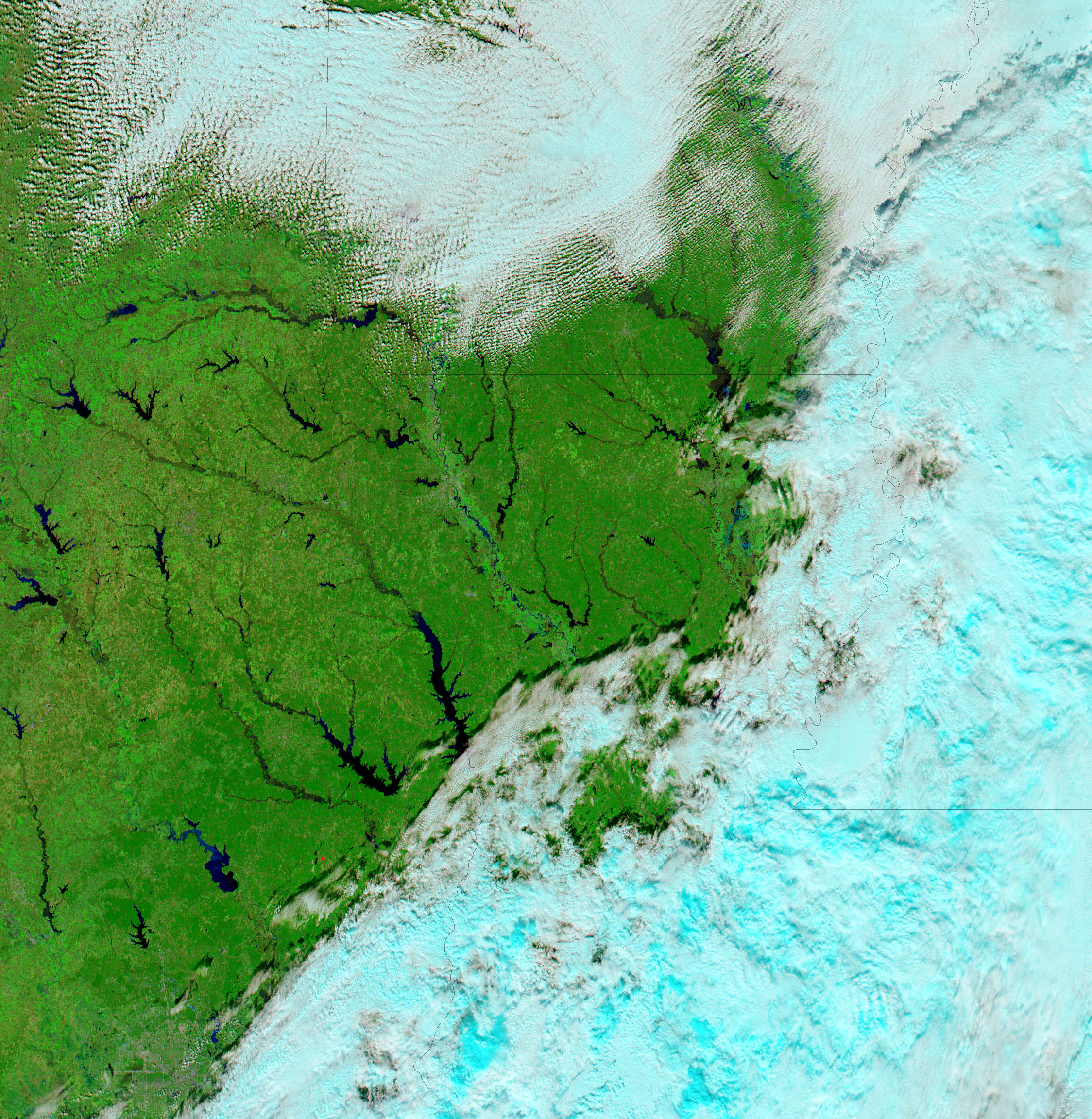
River systems throughout northern Texas, Arkansas, and Louisiana were swollen with winter rain when the Moderate Resolution Imaging Spectroradiometer (MODIS) on NASA’s Aqua satellite captured the top image on January 21, 2007. The National Weather Service had issued warnings of mild flooding on many of the rivers shown in this image, but by January 22, the high water had begun to subside. The floods followed a powerful winter storm that dumped heavy rain on the South, and ice and snow on the Midwest.
The lower image shows Texas, Arkansas, and Louisiana on January 10, before the storm struck. Like the top image, the lower image was made with both infrared and visible light to increase the contrast between water and land. In this type of image, water is black or dark blue, while plant-covered land is bright green and bare or lightly vegetated ground is tan. The city of Shreveport, Louisiana, is the grey area on the banks of the Red River. Clouds are pale blue and white. True-color, photo-like images are also available from the MODIS Rapid Response Team.
References & Resources
NASA images courtesy the MODIS Rapid Response Team at NASA GSFC.