


- January 24, 2007 (2.8 MB)
- January 10, 2007 (4.5 MB)
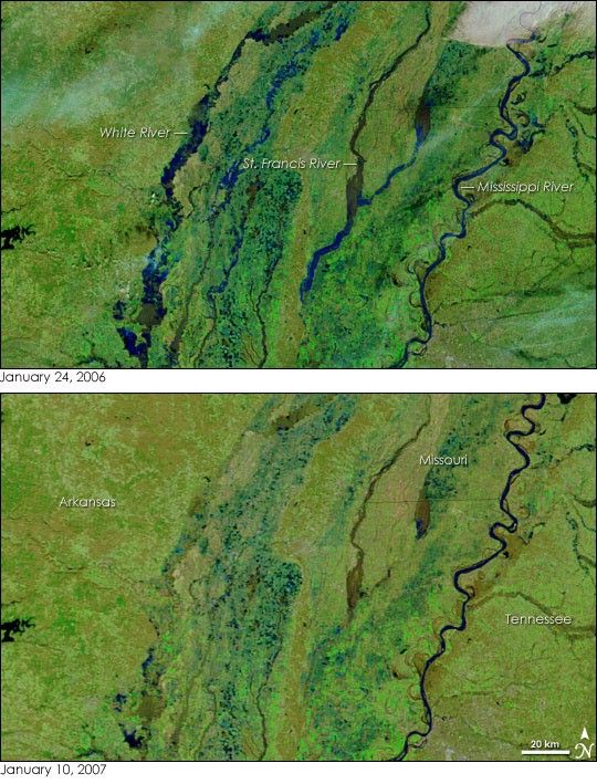
The rivers of northeast Arkansas were running high on January 24, 2007, when the Moderate Resolution Imaging Spectroradiometer (MODIS) on NASA’s Terra satellite captured the top image. The National Weather Service warned residents of minor flooding along the White River on January 24, and the river was expected to remain high for several days. The floods followed a strong winter storm, which coated the Midwest United States with rain, ice, and snow on January 15 and January 16. The lower image shows normal conditions on the river as seen by Terra MODIS on January 10.
Both images were made with a combination of visible and infrared light. Water is dark blue or black, vegetation is green, and clouds are pale blue and white. Daily images of the United States are available from the MODIS Rapid Response System.
References & Resources
NASA image courtesy the MODIS Rapid Response Team at NASA GSFC.


