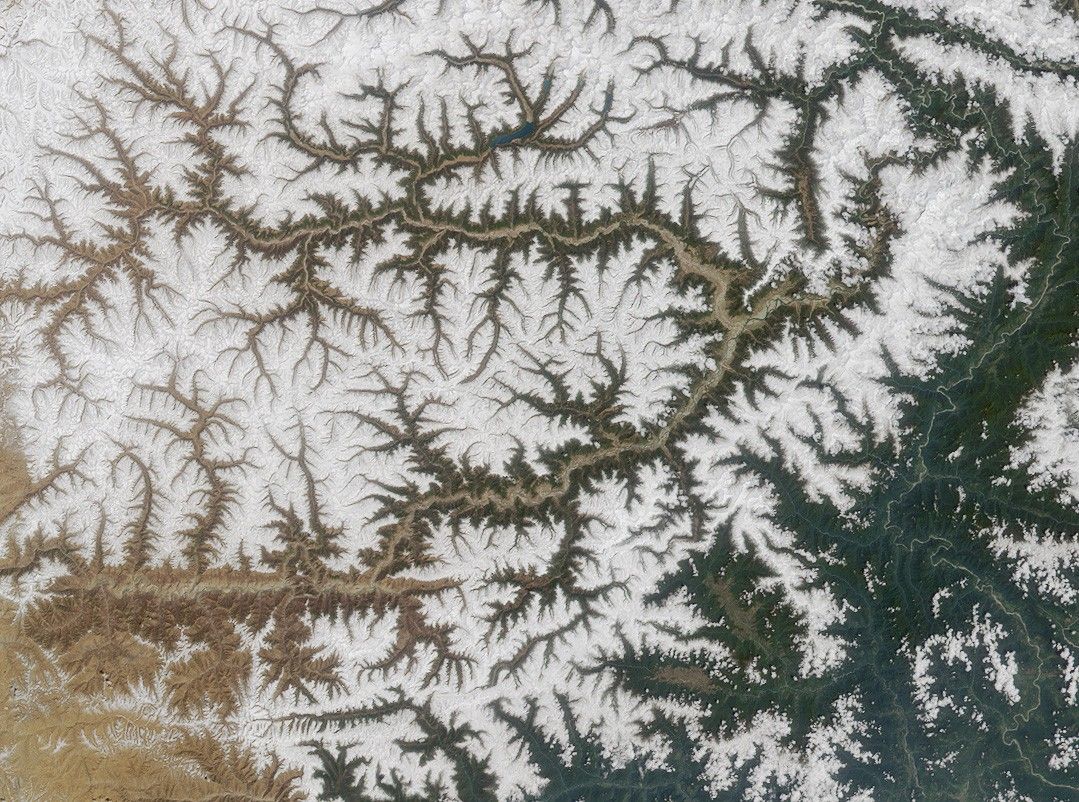
Here’s another chance to play geographical detective! This Multi-angleImaging SpectroRadiometer (MISR) image covers an area measuring approximately297 kilometers x 221 kilometers, and was captured by the instrument’svertical-viewing (nadir) camera on April 12, 2001.
A large river flows from the left side of the image, below center, andtraverses the image, angling northeast toward the upper right. It then makes ahairpin turn and continues to flow in a generally southward direction near theright-hand side of the image.
Below are eight statements about this river, only some of which are true. Useany reference materials you like, and mark each statement true or false:
- Within the image area, the river flows across an international boundary intoan area where over 100 species of orchids grow.
- The river’s name in a particular language means “pacifier” in English.
- Sedimentary rocks containing mineral grains that record changes in theorientation of Earth’s magnetic field have been found north of the river.
- At least one expert kayaker has perished attempting to navigate a deep gorgeof the river.
- The two highest named peaks within the image area are situated on oppositesides of the river; each has a maximum elevation of nearly 4000 meters.
- The description of a mythical place in a 1930’s British novel is thought bysome explorers to have been inspired by a location on this river.
- Scientists believe that 100 million years ago the region through which theriver flows was farther from the equator than it is today.
- In the 1920’s, an expedition along the river searched for and successfullyencountered a legendary 30-meter-high waterfall.
Quiz Rules
E-mail your answers, name (initials are acceptable if you prefer), and yourhometown by Tuesday, May 21, 2002 to suggestions@mail-misr.jpl.nasa.gov.
Answers will be published on the MISR web site (http://www-misr.jpl.nasa.gov/)in conjunction with the next weekly image release. The names and home towns ofrespondents who answer all questions correctly by the deadline will also bepublished in the order responses were received. The first 3 people on this listwho are not affiliated with NASA, JPL, or MISR and who did not win a prize inthe last quiz will be sent a print of the image.
A new “Where on Earth...?” mystery appears as the MISR “image of the week”approximately once per month. A new image of the week is released everyWednesday at noon Pacific time on the MISR home page. The image also appears on the Atmospheric Sciences Data Centerhome page, though usually with a several-hourdelay.
References & Resources
Image courtesy NASA/GSFC/LaRC/JPL, MISR Team.