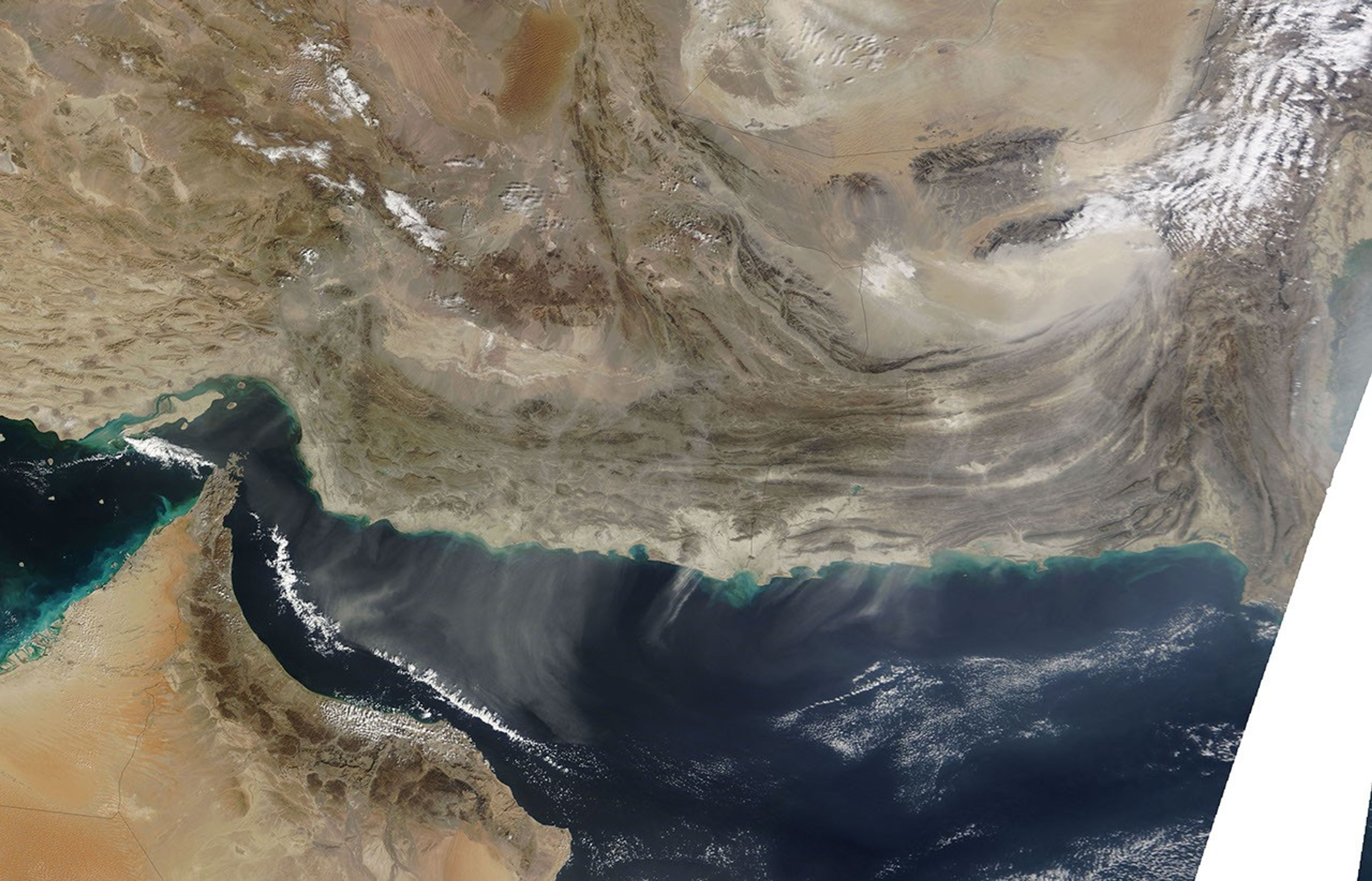






















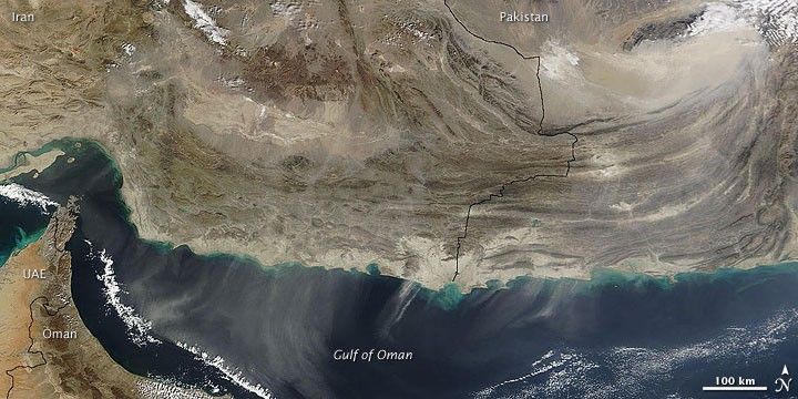
Multiple dust plumes blew southward over the Gulf of Oman in early February 2009. The Moderate Resolution Imaging Spectroradiometer (MODIS) on NASA’s Terra satellite acquired this image on February 5, 2009. The dust plumes in this image blow southward over an area that stretches hundreds of kilometers from east to west. Some of the largest plumes appear just east of the United Arab Emirates (UAE) and Oman.
Many of the plumes appear to originate from sediments near the coastlines of Iran and Pakistan, but faint plumes also appear farther inland. Near the image’s upper right corner, a pale beige blur signifies a large area of airborne dust in Pakistan. This area consists of a sizeable sand sea that encloses a dry salt lake, Hammun-i-Mashkel, near the Iran-Pakistan border.
References & Resources
NASA image courtesy MODIS Rapid Response, NASA Goddard Space Flight Center. Caption by Michon Scott.