


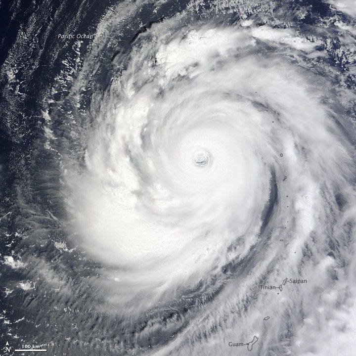
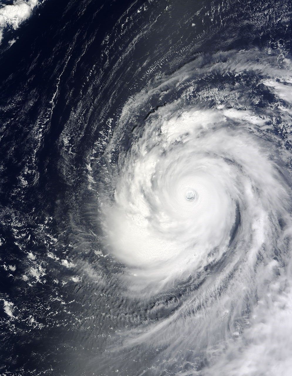
The Moderate Resolution Imaging Spectroradiometer (MODIS) on NASA’s Terra satellite captured this photo-like image of Super Typhoon Choi-wan on September 16, 2009. The powerful storm had passed the Northern Mariana Islands when the image was taken at 11:25 a.m. local time (1:25 UTC). No significant damage was reported on the populated southern islands, said the Saipan Tribune.
The storm is notable because of its symmetry in this image. A symmetrical shape is a good indication that winds high in the atmosphere are not acting to tear the storm apart. Symmetrical storms are usually well-formed, strong cyclones. At the time the image was taken, Choi-wan was a Category 5 storm with winds of 260 kilometers per hour (160 miles per hour or 140 knots) and gusts to 315 km/hr (195 mph or 170 knots), said the Joint Typhoon Warning Center. The Joint Typhoon Warning Center expected the super typhoon to weaken as it moved north and then northeast over cooler waters. The storm was not forecast to hit any major landmass.
The large image provided above has a resolution of 250 meters per pixel. The image is available in additional resolutions.
NASA image by Jeff Schmaltz, MODIS Rapid Response Team, Goddard Space Flight Center.


