


15 meter resolution Visible and Near Infrared image (1.2 MB)
30 meter resolution Shortwave Infrared image (1 MB)
90 meter Thermal Infrared image (628 KB)
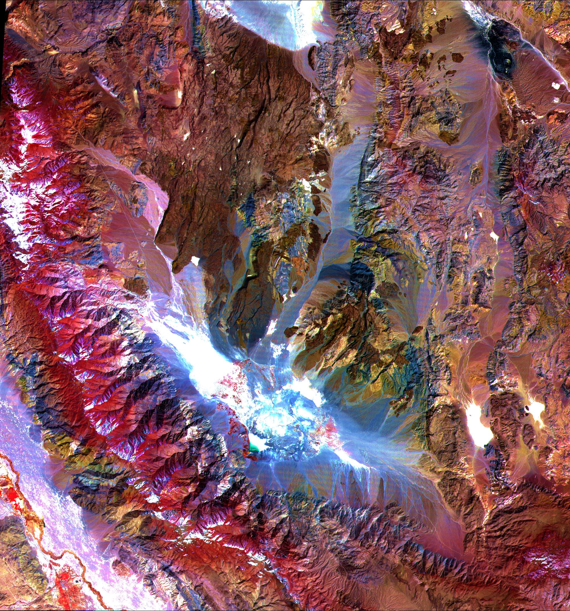
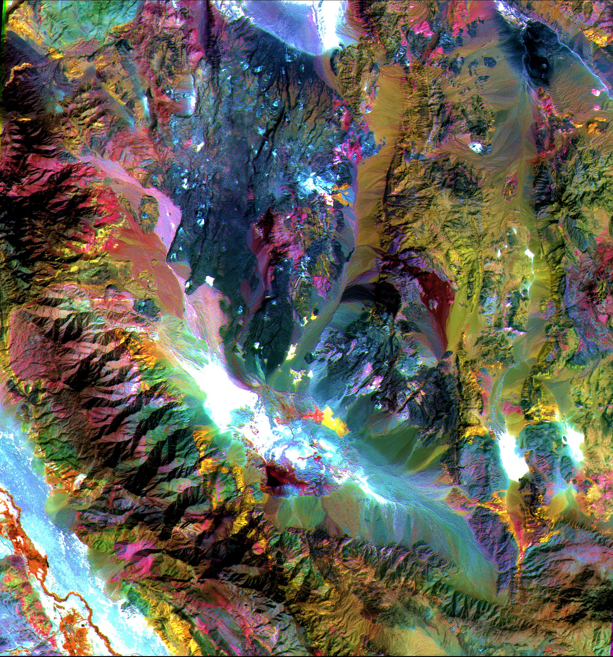
These images of the Saline Valley area, California, were acquired March30, 2000, by the Advanced Spaceborne Thermal Emission and Reflection Radiometer(ASTER). ASTER is the highest resolution instrument aboard NASA's Terrasatellite. The images cover a full ASTER scene (60 by 60 km). Each image displaysdata from a different spectral region, and illustrates the information gained bylooking at the Earth’s surface in different wavelengths of light. The top image displays visible and near infraredbands 3 (.81µm), 2 (.56µm), and 1 (.66µm) in red, green, and blue (RGB). Vegetation appears red,snow and dry salt lakes are white, and exposed rocks are brown, gray,yellow, and blue. Rock colors mainly reflect the presence of ironminerals, and variations in albedo. The middle image displays shortwavelength infrared bands 4 (1.65µm), 6 (2.205µm), and 8 (2.33µm) as RGB. In this wavelength region,clay, carbonate, and sulfate minerals have unique absorptionfeatures, resulting in distinct colors in the image. For example,limestones are yellow-green, and purple areas are kaolinite-rich (kaolinite is a clay mineral). Thebottom image displays thermal infrared bands 13 (10.6µm), 12 (9.1µm) and 10 (8.3µm) as RGB.In these wavelengths, variations in quartz content are moreor less red; carbonate rocks are green, and mafic volcanic rocks arepurple (mafic rocks have high proportions of elements like magnesium and iron). ASTER’s ability toidentify different types of rock and soil from space using thermal infrared wavelengths of lightis one of its unique capabilities.
References & Resources
Image courtesy NASA, GSFC, MITI, ERSDAC, JAROS, and the U.S./Japan ASTER Science Team.
None


