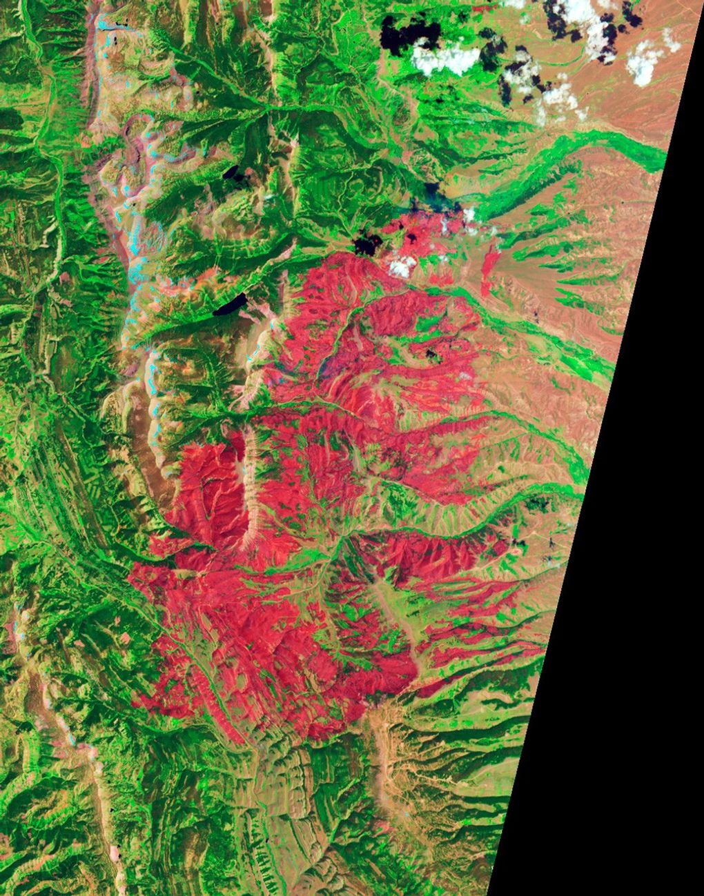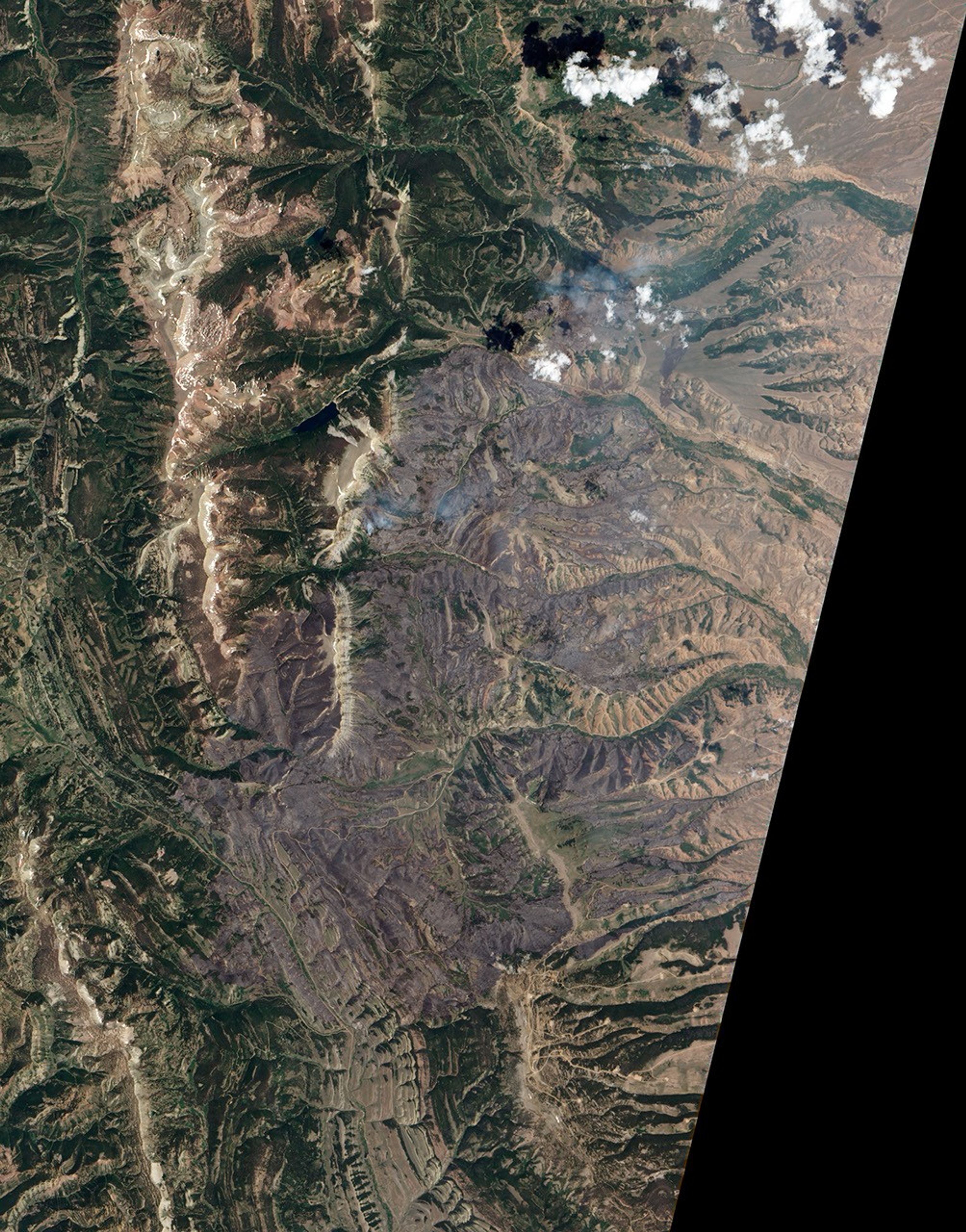
















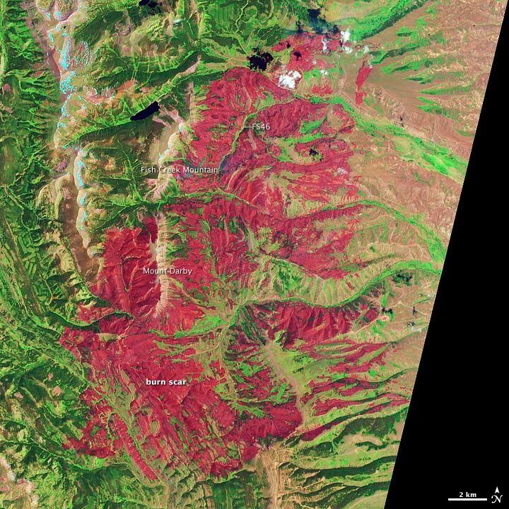
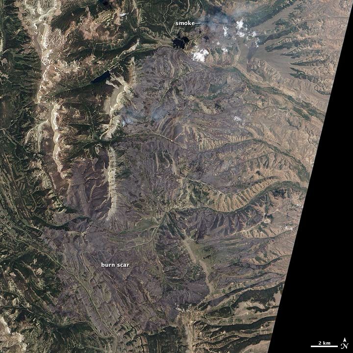
The Fontenelle Fire was first reported on June 24, 2012, burning in Bridger-Teton National Forest, about 18 miles (29 kilometers) west of Big Piney, Wyoming. By July 5, it had burned 57,324 acres (232 square kilometers), though it had not damaged any structures. The fire began south of Mount Darby and spread north on both sides of the mountain’s ridge toward Fish Creek Mountain. On July 5, the northern edge of the fire was burning the most vigorously and moving northeast.
The Advanced Land Imager (ALI) on the Earth Observing-1 (EO-1) satellite acquired these images of the affected area on July 4, 2012, when the fire was 16 percent contained. Burned forests appear red in the false-color image (top); unburned forests are green. The blue patches along the brown ridges on Fish Creek mountain and the highlands to the west are snow. In the natural color image (bottom), smoke is visible over the eastern slope of Mount Darby and on the northern edge of the fire.
Further Reading
- MSNBC. (2012, July 4). Firefighters from Alaska Join Effort to Control Fontenelle Blaze in Wyoming. Accessed July 5, 2012.
References & Resources
- Inciweb. (2012, July 5). Fontenelle Fire. Accessed July 5, 2012.
NASA Earth Observatory image created by Jesse Allen and Robert Simmon, using EO-1 ALI data provided courtesy of the NASA EO-1 team. Caption by Adam Voiland.