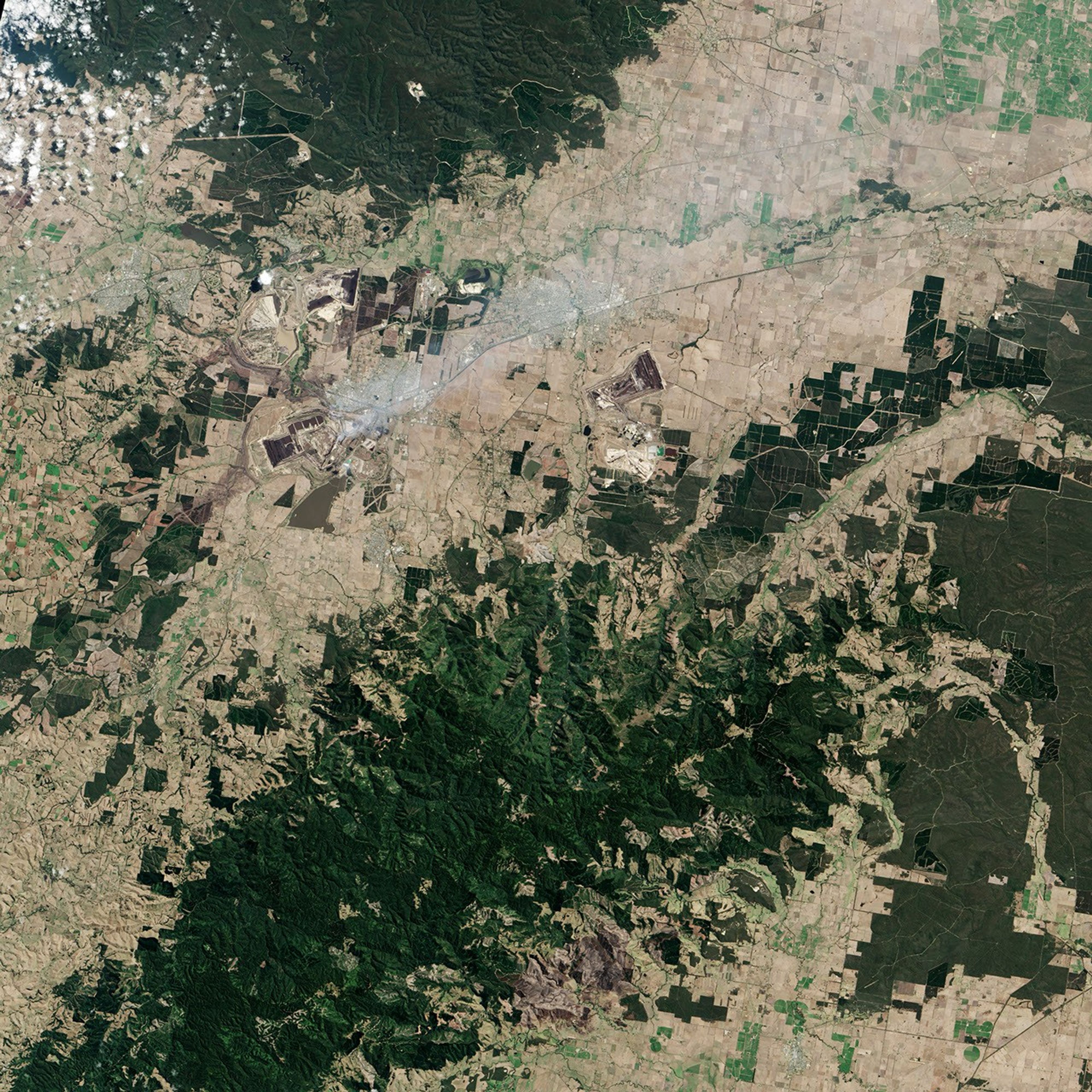


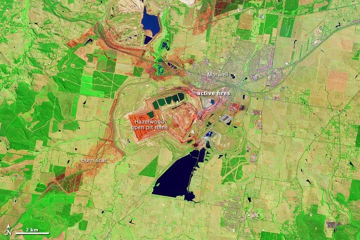


An act of arson ignited a fire near the town of Morwell, Australia on February 9, 2014. In hot, windy conditions, the fire spread into the Hazelwood Mine, an open-pit coalmine south of the town, where it continues to burn. The top two images, both from the Operational Land Imager on the Landsat 8 satellite, combine infrared and visible light to show the extent of the burned area and the glowing fire in the mine. In this view, both the newly burned land and the exposed coal are red. A comparison of the top image from February 23 with the middle image taken on February 7, a few days before the fire started, makes it possible to differentiate between burn scar and coal. Actively burning fires along the northeastern rim of the mine are orange.
Though the flames no longer threaten the town directly, the fire has blanketed the community with choking smoke for weeks. The lower image, a natural color version of the February 23 scene, shows plumes of smoke rising from the mine and drifting over Morwell. For nearly 20 days, the town has experienced extremely poor air quality from the ash, carbon monoxide, and other particles in the smoke. Concerned about ongoing exposure, on February 28 health officials advised vulnerable people to leave, including young children, pregnant women, elderly, and people with lung diseases. The fire is expected to burn for at least another two weeks.
References & Resources
- ABC News (2014, February 28) Morwell mine fire: Premier Denis Napthine backs Victorian health officer’s decision on warning. Accessed February 28, 2014.
- ABC News (2014, February 26) Police hunt arsonist as the battle to contain the Hazelwood mine fire continues. Accessed February 28, 2014.
- The Australian (2014, February 28) Anger erupts as authorities advise relocation from smoke-hit Morwell. Accessed February 28, 2014.
- The Guardian (2014, February 28) Morwell mine fire: vulnerable residents advised to relocate. Accessed February 28, 2014.
- The Guardian (2014, February 27) Morwell mine fire ‘beyond comparison’, Victoria’s health officer says. Accessed February 28, 2014.
NASA Earth Observatory images by Jesse Allen and Robert Simmon, using Landsat data from the U.S. Geological Survey. Caption by Holli Riebeek.