
Today's story is part of our recent series Landsat Goes Over the Top: A Long View of the Arctic.
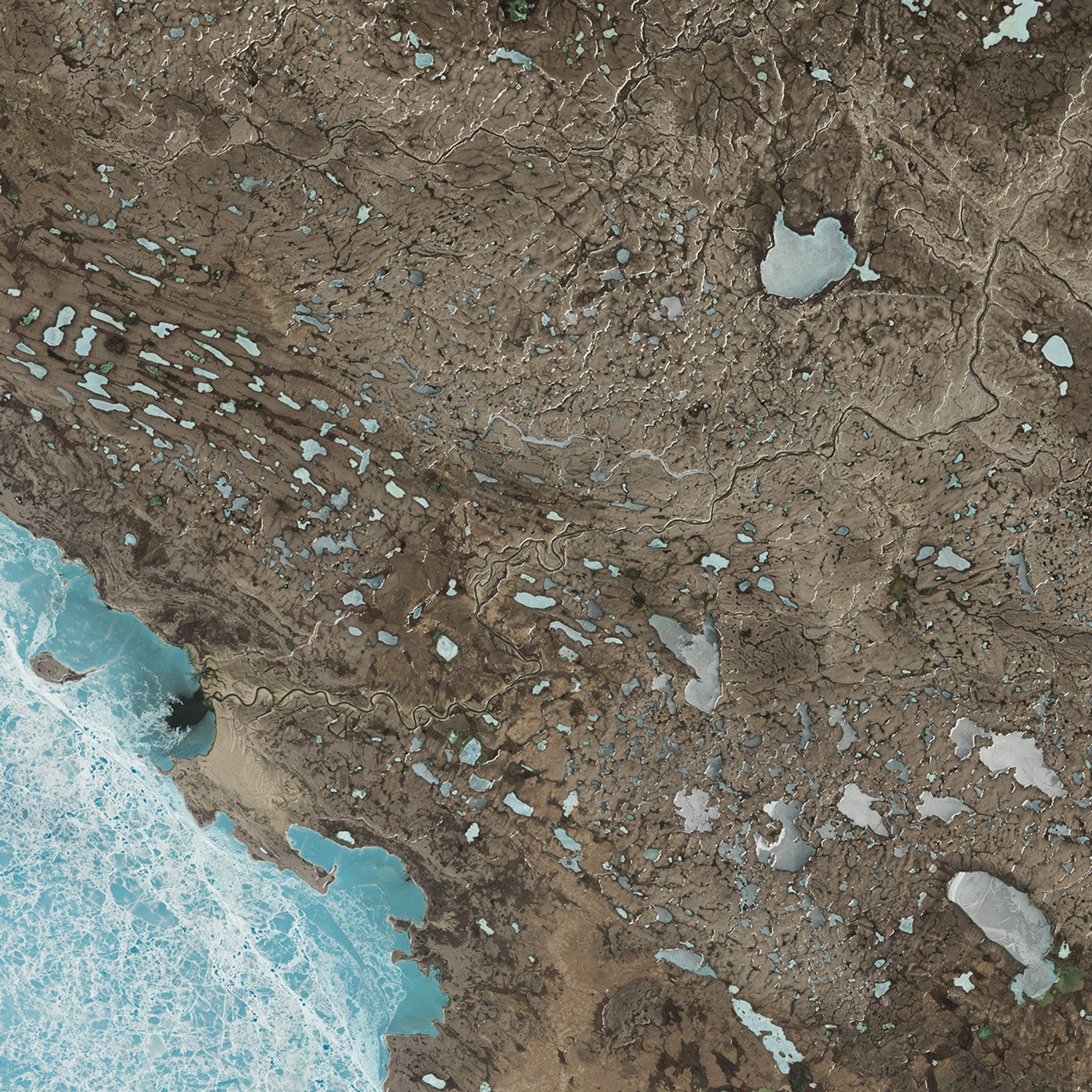
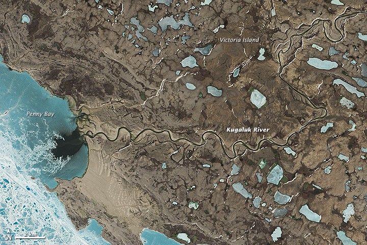
The landscape of Canada’s Victoria Island reveals a long history of glaciation, most recently by the Laurentide Ice Sheet during the last Ice Age. On June 21, 2014, the Operational Land Imager (OLI) on Landsat 8 acquired this image of the Wollaston Peninsula on the island’s southwest side.
Hills on the north-central part of the island (not pictured) rise as high as 500 meters (1,600 feet). However, most of the features that were sculpted by the ice are located in the surrounding, relatively low-lying areas. These scoured landforms, moraines, and glacial deposits often dictate the locations of lakes and the paths of rivers.
The Kugaluk River, centered in this image, meanders across the Wollaston Peninsula to Penny Bay. South of the river’s mouth, light brown areas are tidal deposits that contain silt, sand, gravel, and clay.
Penny Bay remains ice covered into the summer, before beginning an annual ice retreat. When ice on the bay and the adjoining Dolphin and Union Strait is thick, caribou take the opportunity to migrate across the strait between Victoria Island and the Canadian mainland.
References & Resources
- Government of Canada (1989, August 1) Surficial geology, Wollaston Peninsula, (Victoria Island), District of Franklin, Northwest Territories. Accessed April 14, 2015.
- NASA Earth Observatory (2015, February 12) Landsat Goes Over the Top: A Long View of the Arctic. Accessed April 14, 2015.
- Poole, K. G. et al. (2010, December) Sea Ice and Migration of the Dolphin and Union Caribou Herd in the Canadian Arctic: An Uncertain Future. Arctic, 63 (4), 414-428.
- Storrar, R. and Stokes, C.R. (2007) A glacial geomorphological map of Victoria Island, Canadian Arctic. Journal of Maps, 3 (1), 191-210.
NASA Earth Observatory image (top) by Jesse Allen and Robert Simmon, using Landsat data from the U.S. Geological Survey and acquired by special request with the support of Theresa Arvidson (NASA/GSFC) and Eugene Fosnight (USGS/EDC). Caption by Kathryn Hansen.