










![Request for Information – Potential [Placeholder for Prize]](https://assets.science.nasa.gov/dynamicimage/assets/science/psd/solar/2023/09/s/solarsystem_0.jpg?w=1024)









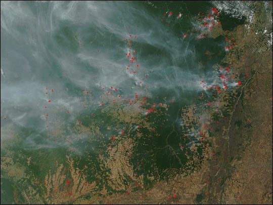
On August 11, 2002, the Moderate Resolution Imaging Spectroradiometer (MODIS) on the Terra satellite detected scores of fires (marked with red dots) burning in northern Mato Grosso in west-central Brazil. Smoke blankets the tropical Amazon forests at the left of the image as fires and deforestation continue to encroach along the margins of the disappearing forests. Slash and burn agriculture is an ongoing problem in the region; even protected areas, such as the Xingu Indigenous Peoples Preserve (right of center, hanging like a pendulum from the intact forests to its north), continue to be threatened by illegal and/or accidental fires. To the east of the Xingu Preserve, the purplish-brown area is a large wetland called the Ilha do Bananal, which runs alongside the Araguaia River.
References & Resources
Image courtesy Jacques Descloitres, MODIS Land Rapid Response Team at NASA GSFC