























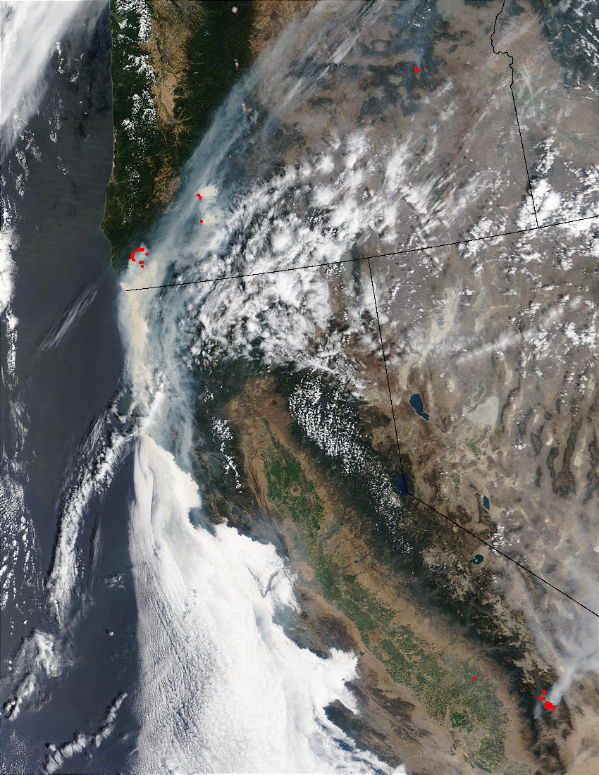
Almost 440,000 acres are burning in Oregon as of August 4, 2002. Almost half of those acres are comprised of two large fires (red dots near coastline) in the southwest portion of the state in the Klamath Mountains. The Florence Fire is more than 198,000 acres and only 5 percent contained. In places the terrain is so rugged and inaccessible that fire crews are detonating explosives in the ground to create fire breaks in places that are too difficult to manually construct. Just to the south is the Sour Biscuit Fire, begun in Oregon, but now burning down into California as well. This fire is about 40,000 acres and 15 percent contained. This image of the fires was captured on August 3, 2002 by the Moderate Resolution Imaging Spectroradiometer (MODIS).
References & Resources
Image courtesy Jacques Descloitres, MODIS Land Rapid Response Team at NASA GSFC