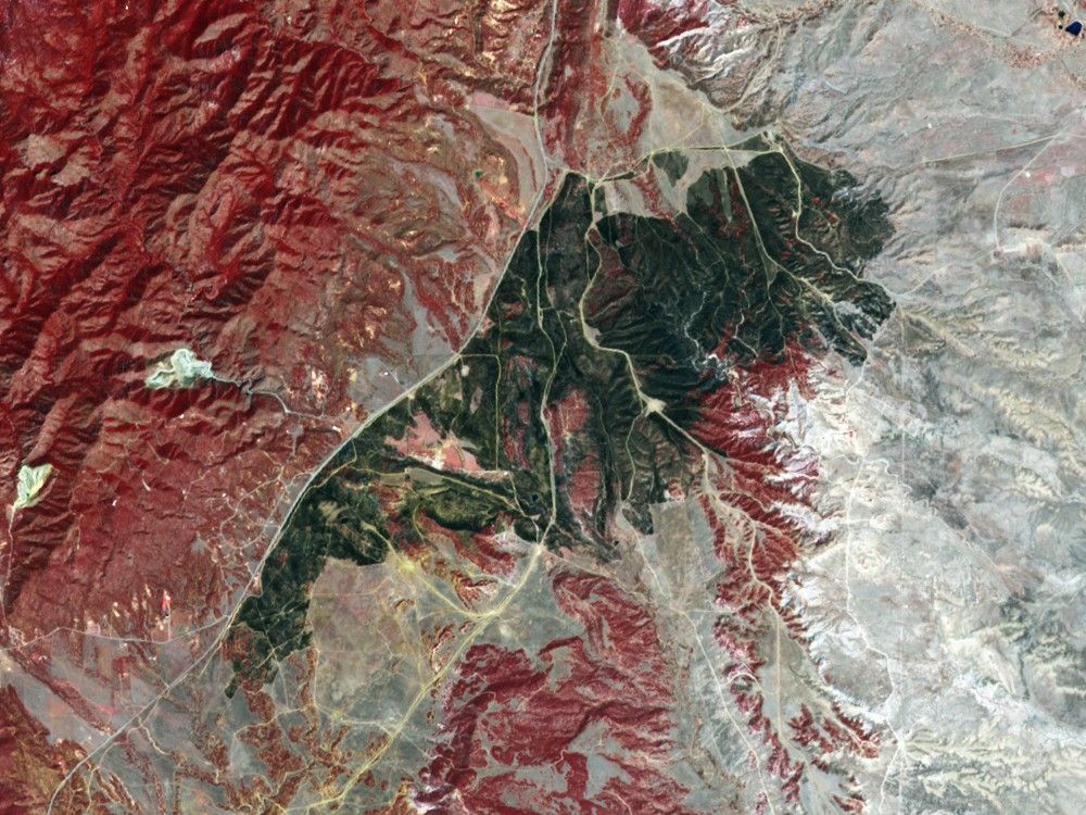






















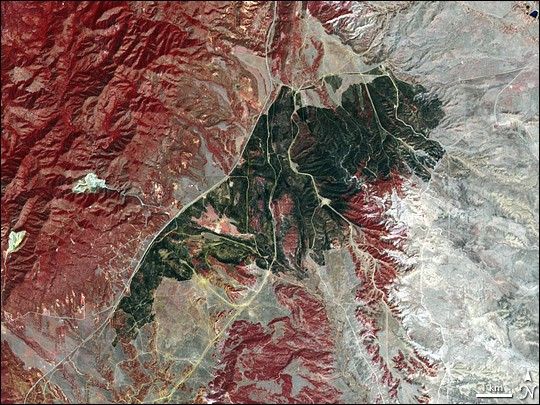
A fast-moving brushfire raced across the Colorado landscape near Fort Carson in mid-April. The blaze forced evacuations in the area and took more than a week—which included a beneficial snow storm—to contain. The fire scorched more than 9,000 acres according to news reports, and a pilot lost his life while helping to fight the fire.
This image of the area burned by the fire was captured by the Advanced Spaceborne Thermal Emission and Reflection Radiometer (ASTER) on NASA’s Terra satellite on April 20, 2008. The area is about 18 kilometers southwest of Fort Carson, in southern El Paso County, Colorado. The image uses visible and infrared light to enhance the differences between vegetation (red), bare ground (gray and beige), and the burned area (charcoal). Highway 115 (gray line running northeast-southwest along western edge of burned area) served as a firebreak, helping firefighters to keep the blaze from spreading into the more rugged terrain to the west.
References & Resources
NASA image created by Jesse Allen, using data provided courtesy of NASA/GSFC/METI/ERSDAC/JAROS, and U.S./Japan ASTER Science Team. Caption by Rebecca Lindsey.