


In January 2016, lightning ignited dozens of fires in northwestern Tasmania.
Sensors on the Aqua, Terra, and Suomi NPP satellites began to detect an increase in fire activity in the region on January 14, 2016. During the following weeks, fires charred tens of thousands of hectares, including parts of a World Heritage site.
On January 30, 2016, the Operational Land Imager (OLI) on Landsat 8 captured a natural-color image (above) showing a fresh burn scar east of Granville Harbor. Charred vegetation appears gray. Winds blew a plume of smoke to the south.
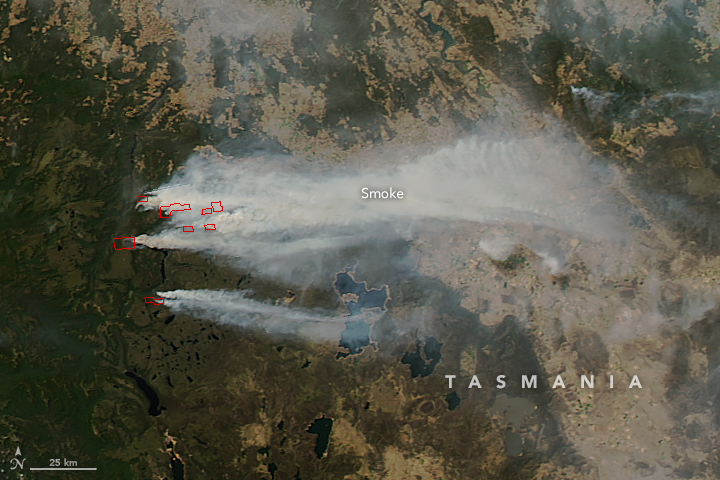
Several days earlier, the Moderate Resolution Imaging Spectroradiometer (MODIS) on NASA’s Aqua satellite captured an image (below) showing several fires burning through forested areas southeast of Cradle Mountain. Red outlines indicate hot spots where MODIS detected the unusually warm surface temperatures associated with the fires.
References & Resources
- ABC News (2016, February 2) Tasmanian bushfires: Damage to Wilderness World Heritage Area to be assessed by specialists. Accessed February 2, 2016.
- Climate Central (2016, January 27) Wildfires Are Burning Some of the World’s Oldest Trees. Accessed February 2, 2016.
- Tasmania Fire Service Alert Maps. Accessed February 2, 2016.
- UNESCO Tasmanian Wilderness. Accessed February 2, 2016.
NASA Earth Observatory image by Jesse Allen, using Landsat data from the U.S. Geological Survey.


