






















April 24, 2004
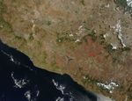
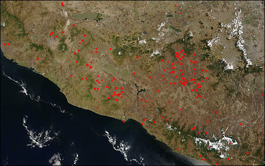
On April 24, 2004, the Moderate Resolution Imaging Spectroradiometer (MODIS) on the Terra satellite captured this image of southern Mexico and numerous fires (red dots) burning the region around Lake Chapala (top, left of center).
The widespread nature of the fires, the time of year, and their location (generally located away from natural vegetation, which appears deeper green) suggests that these fires are being set intentionally for agricultural purposes. Though not necessarily immediately hazardous, such large-scale burning can have a strong impact on weather, climate, human health, and natural resources.
The high-resolution image provided above is 500 meters per pixel. The MODIS Rapid Response System provides this image at additional resolutions.References & Resources
Image courtesy Jeff Schmaltz, MODIS Rapid Response Team, NASA-GSFC