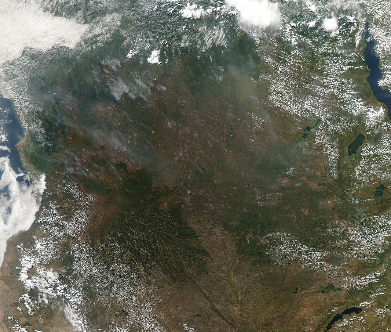
Fires burned throughout central Africa on June 16, 2009, from Lake Tanganyika to the Atlantic Ocean. The Moderate Resolution Imaging Spectroradiometer (MODIS) on NASA’s Aqua satellite captured this natural-color image the same day. Red dots indicate where MODIS has detected actively burning fires. Fires are most prevalent in Angola, Zambia, and the Democratic Republic of the Congo.
Agricultural fires are common in Africa, but the occurrence of such fires depends on the timing of dry and rainy seasons and the kind of landscape. The fires in this image burn across a varied landscape. Angola’s climate is semi-arid savanna in the south and along the coast, but inland, near the northern border, there are tropical forests. The Democratic Republic of the Congo is nearly evenly split between tropical rainforest and savanna ecosystems. Savannah is the dominant ecosystem in Zambia.
References & Resources
- United Nations Environment Programme. (2008). Africa: Atlas of Our Changing Environment. Division of Early Warning and Assessment, United Nations Environment Programme, Nairobi, Kenya.
NASA images by Jeff Schmaltz, MODIS Rapid Response Team. Caption by Michon Scott.