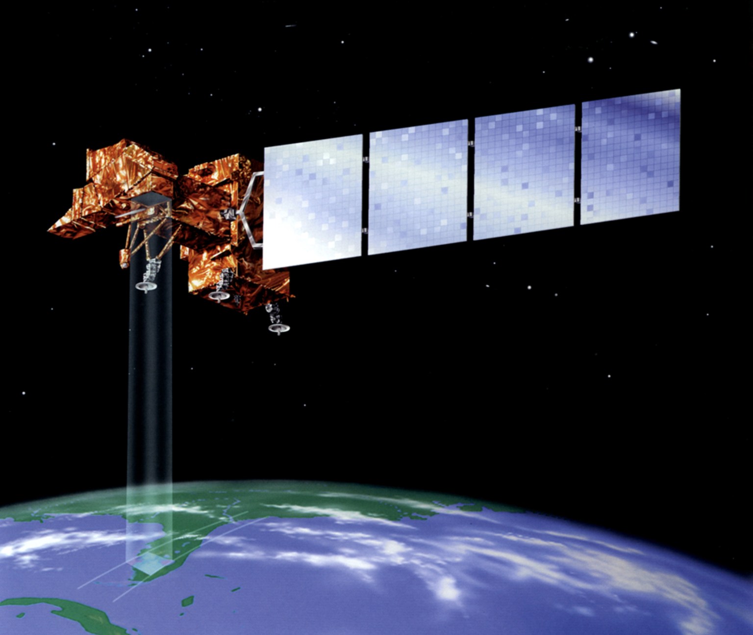


Landsat 10
Landsat 10, expected to launch in 2031, is an innovative Landsat mission that represents a quantum leap in measurement capabilities with improved spatial and spectral resolutions.

| Quick Facts | |
|---|---|
| Temporal revisit: 18 days | Spatial resolution: 10-20 meters (VSWIR), 60 meters (atmospheric VSWIR/TIR) |
| Spectral bands: 26 (21 VSWIR, 5 TIR) | Orbit: Sun-synchronous at 653 km (406 miles) |
| Orbital inclination: ~98 degrees | Global reference grid system: WRS-3 |
| Equatorial crossing time: 10:10 am ± 5 minutes | Field of view: ±7.2 degrees from nadir |
| Scene size: 164 km (102 miles) x 168 km (104 miles) | Mission design life: 5 years |
| Expected launch date: 2031 | Mission Class: C |
| Mission Category: 2 |
Enhanced Spatial Resolutions
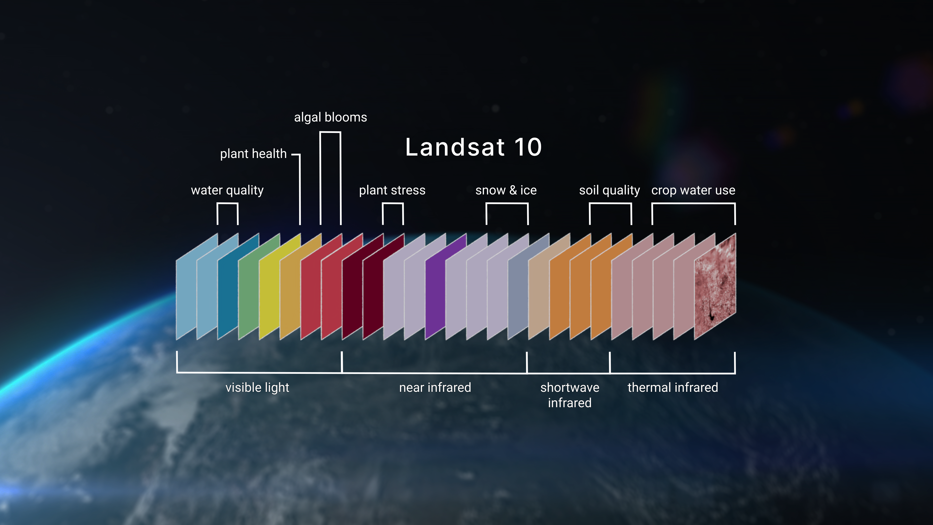
The Landsat 10 Instrument Suite (LandIS) will collect 21 visible to shortwave-infrared (VSWIR) and 5 thermal-infrared bands. All bands will have higher spatial resolutions than prior Landsat missions, with ground sample distances of 10 to 20 meters for visible, near-infrared, and shortwave-infrared bands and 60 meters for atmospheric VSWIR and thermal-infrared bands.
Data Quality and Integrity
The historical record of highly-calibrated Landsat data has served as a gold standard of global land imaging. Landsat 10 will preserve the robust radiometric and geometric accuracy requirements associated with the Landsat program to ensure long-term data consistency and facilitate critical time-series analyses. The radiometric accuracy will be comparable to the signal-to-noise ratios and noise equivalent differential temperatures of Landsat 8 and Landsat 9.
The geometric accuracy of previous Landsat missions will match the finer ground sample distances of Landsat 10. Rigorous radiometric and geometric calibration and validation methods will be employed to provide band-to-band and image-to-image registration. Top of atmosphere and surface reflectance data products will be comparable with those from previous Landsat missions.
Superspectral Observations
Landsat 10 will collect 26 bands, 15 more than the currently operational Landsat 8 and Landsat 9 missions. LandIS will acquire refined versions of the 11 Landsat “heritage” bands to maintain data continuity, five new bands with similar spatial and spectral characteristics to the European Space Agency’s Copernicus Sentinel-2 mission to allow for improved data synergy and fusion, and 10 new spectral bands to support data user needs and emerging applications. Landsat 10 will also have a water vapor band that will provide for atmospheric correction without ancillary data from other satellites.
LandIS will acquire all bands nearly simultaneously. This will minimize illumination change between bands, allowing researchers to detect clouds and create products derived from multispectral surface reflectance and thermal emission data (e.g., evapotranspiration).
Advancing Landsat for the Next Generation
Landsat 10 will build upon the Landsat legacy of observing, managing, and adapting to Earth’s changing surface, and will provide expanded capabilities to support evolving and emerging user applications. The enhanced spatial resolution of the new 26-band superspectral Landsat 10 instrument suite will enhance existing Landsat applications and unlock new applications that support:
- Water quality and aquatic health assessments (e.g., harmful algal blooms)
- Crop production and soil conservation (e.g., crop residues and non-photosynthetic vegetation)
- Forest management and monitoring (e.g., photosynthetic bioindicators)
- Climate and snow dynamics research (e.g., snow grain size and albedo)
- Mineral mapping based on thermal emissivity
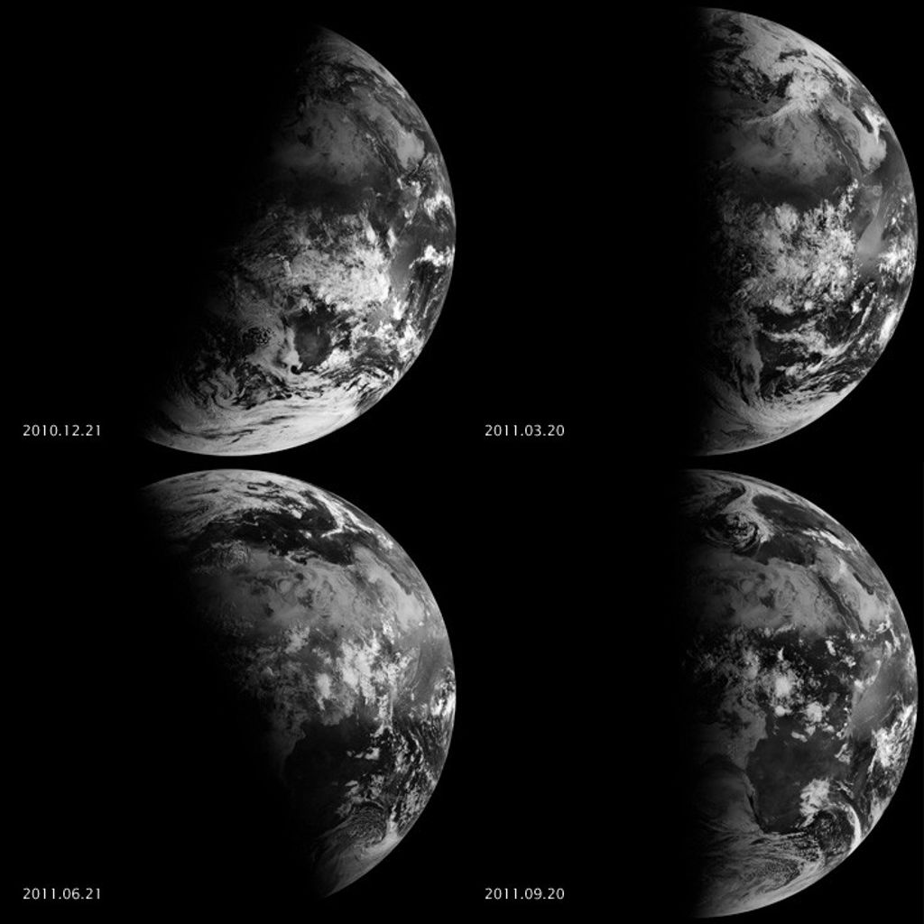
Landsat 10 will continue the Landsat program’s decades-long data record of spaceborne multispectral imagery, which affords global, synoptic, and repetitive coverage of Earth’s land surfaces at a scale where natural and human-induced changes can be detected, differentiated, characterized, and monitored over time.
Why Landsat 10?
-
Landsat 10 will help us live sustainably on Earth
Landsat 10 will propel us into the next half century of scientific discovery with advanced technology to inform decision making. Long-term Earth observations are an essential tool for stewardship of the planet as global population growth increases pressure on resources such as food, water, housing, and energy. Tracking global environmental change and natural resources is important for sustaining human needs in the future.
A natural-color time series of Las Vegas, spanning from 1985 to 2025, highlighting the dramatic urban expansion over time.NASA/Ross Walter -
Landsat 10 will provide continuity, improve understanding, and support decision making
Landsat 10 will continue to provide scientifically-calibrated quantitative data that is unbiased, freely-available, and extends a continuous record of changes on Earth. The longevity of Landsat’s data record enables long-term characterization of environmental changes. Harmonization of Landsat 10 data with similar observatories (e.g., Sentinel-2), improved data access through commercial cloud storage and computing, and newly-developed AI algorithms will facilitate more rapid analyses and decision making.
A natural-color HLS time series of the Imperial Valley near the Salton Sea, spanning from October 2024 to October 2025, highlighting the dramatic agricultural growth cycle over time.NASA/Ross Walter -
Landsat 10 will result in breakthrough science
New measurements will allow Landsat data users to identify features and patterns that could not be demarcated in previous Landsat images due to insufficient spatial or spectral resolutions. This may include features too small to detect (e.g., crop fields, small-scale deforestation, urban structures) or objects with indistinguishable spectral attributes (e.g., land plants and algal pigments). These scientific discoveries are led by developments in engineering and technology that were not previously available and reflect the overall evolution and improvement in visible through shortwave-infrared and thermal-infrared imaging capabilities.
The value of the Landsat program will be magnified with the expanded capabilities of Landsat 10. The new mission will continue the indispensable global land surface data record. It will provide land and ecosystem change data and trend information that would otherwise not be available. With the revolutionary spectral and spatial enhancements, Landsat 10 will bestow scientists with new capabilities to support evolving and emerging applications, and it will assist land managers and policymakers in making more informed decisions about our environment and global, regional, and local natural resources that are used in our economy. A false-color image of Jefferson Davis Parish, Louisiana, acquired by Landsat 9 on February 3, 2023, highlighting the geometric patchwork of flooded, pre-season rice fields.NASA Earth Observatory/Lauren Dauphin