


Sea surface salinity could provide new insight into severe storms
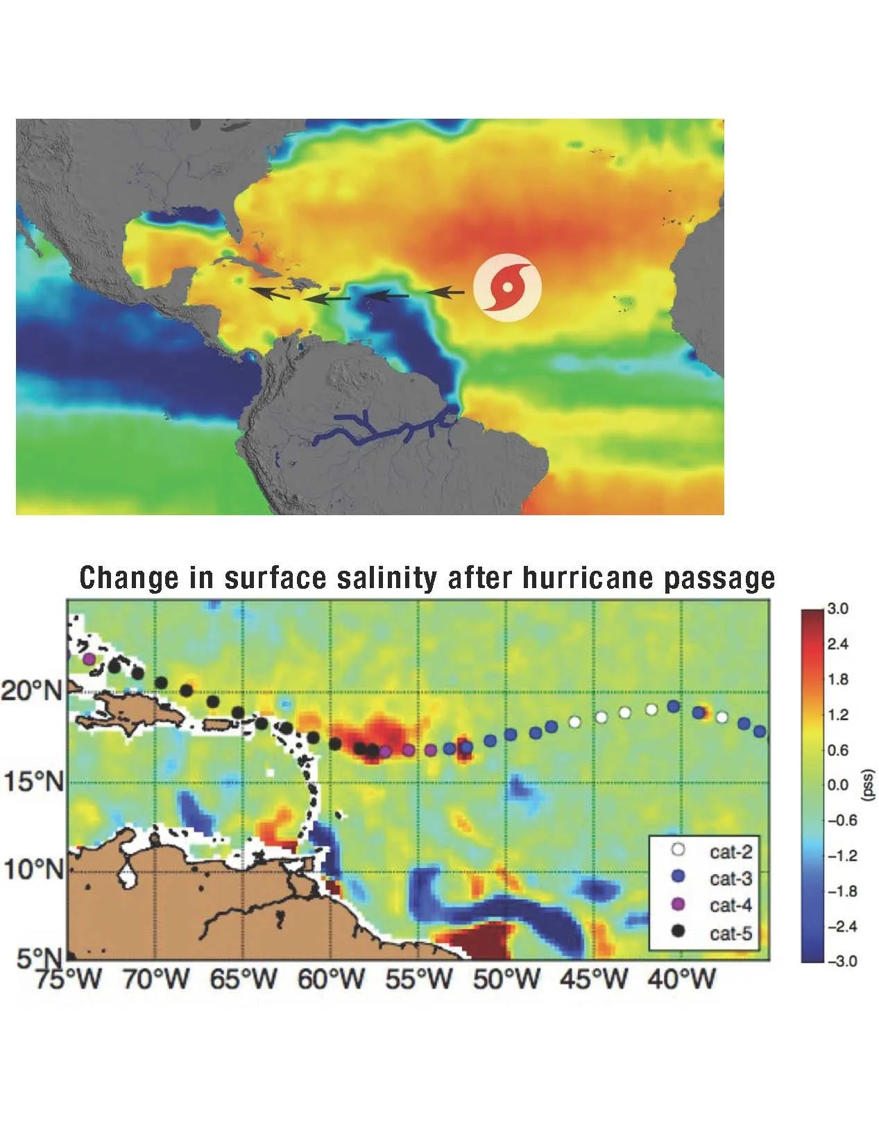
NASA scientists are looking into the possibility of using remotely sensed sea surface salinity (SSS) data to help improve their understanding of how hurricanes form in the Northwestern Tropical Atlantic – a hotbed of hurricane activity. New studies illustrate how changes in SSS can be used to track Atlantic storms, emphasizing the role of salinity stratification in driving upper-ocean dynamics and hurricane evolution.
Data Sources: L-band radiometer data from the NASA SMAP and ESA-SMOS satellites
Publications
Fournier, S., D. Vandemark, L. Gaultier, T. Lee, B. Jonsson, and M. M. Gierach (2017). Interannual Variation in Offshore Advection of Amazon‐Orinoco Plume Waters: Observations, Forcing Mechanisms, and Impacts. J. Geophys. Res. Oceans, 113(C2), doi:1029/2007JC004178
< Previous Discovery | Next Discovery >
< Back to: A Year in Review


