

April 8-13, 2019
Another Blizzard Wallops the Upper Midwest
For the second time in a month, an intense spring “bomb cyclone” plastered the Upper Midwest of the United States with snow and wind. While the April storm was not quite as strong as the blizzard in March, several states were hit with more than 12 inches (30 centimeters) of snow and by wind gusts exceeding 50 miles (80 kilometers) per hour.
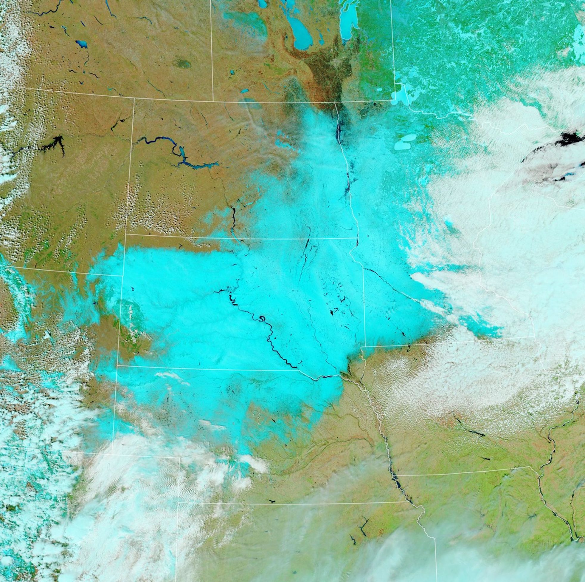
On April 10-12, 2019, whiteout conditions clogged roadways, caused tens of thousands of homes to lose power, and grounded hundreds of flights, according to news reports. South Dakota was one of the hardest hit states, with more than 24 inches (60 centimeters) of snow falling across much of the state.
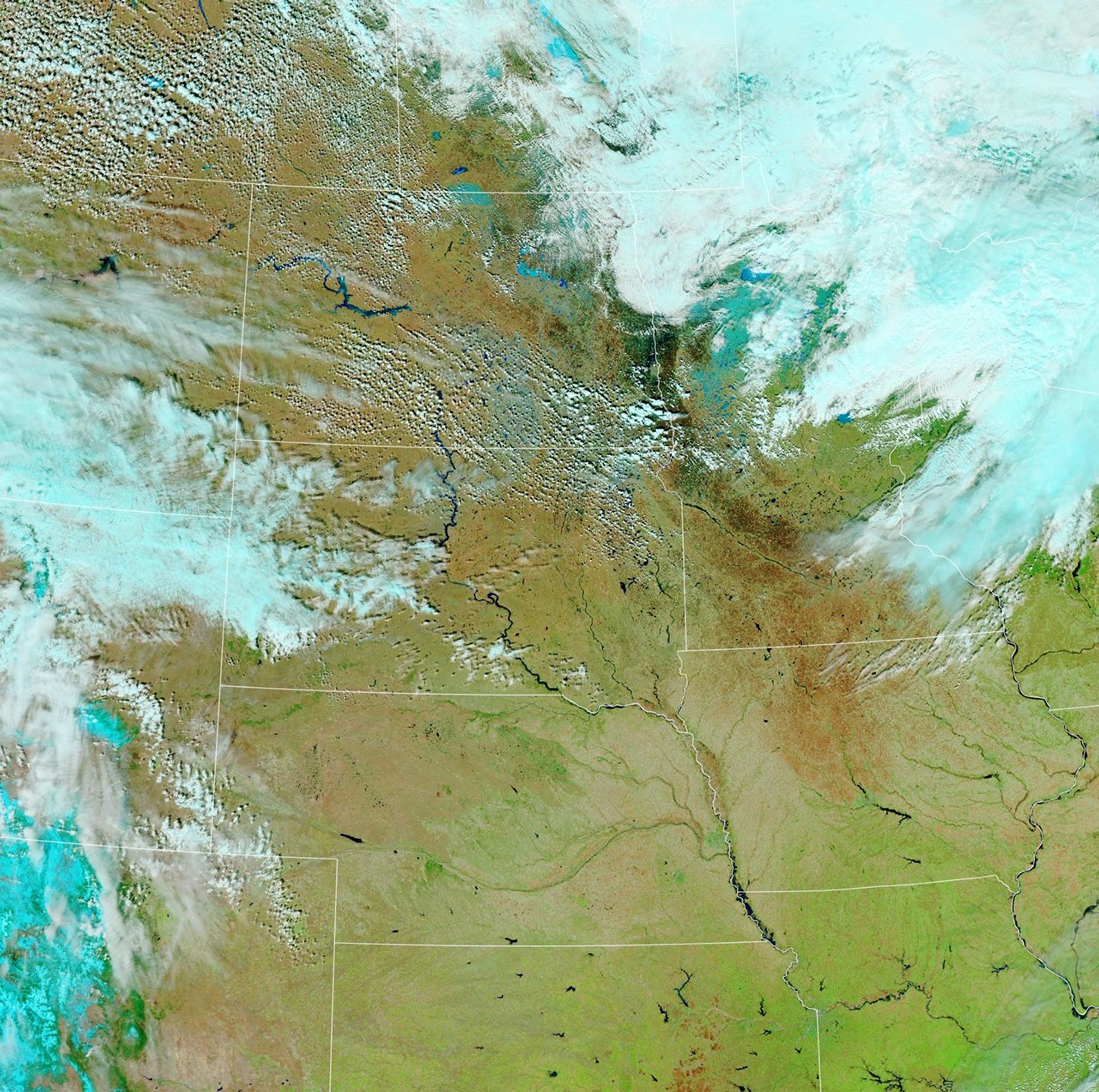
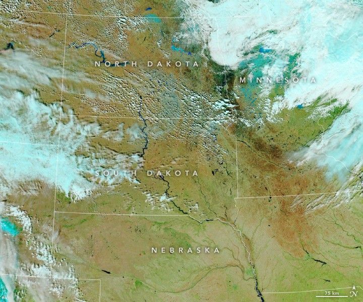
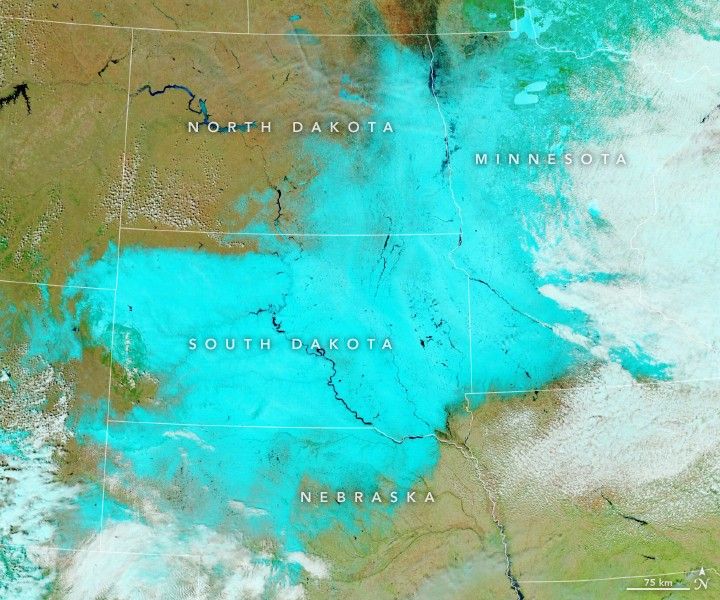
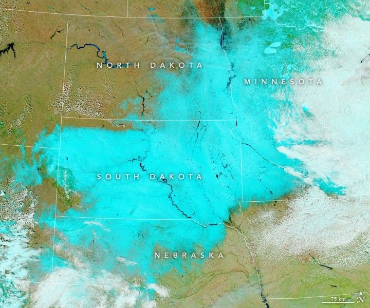
On April 8 and 13, 2019, the Visible Infrared Imaging Radiometer Suite (VIIRS) on the Suomi NPP satellite captured these false-color images. With this combination of visible and infrared light (bands M11-I2-I1), snow appears light blue and clouds white. Bare land is brown. You can see a natural-color version of the image here.
Many rivers in the region were already swollen with water (dark blue) before the storm arrived. Forecasters are wary that the influx of new snow could trigger new floods in the coming weeks; at a minimum, rivers will be high in the coming days. A few rivers in South Dakota—most notably the James and Big Sioux—were well above flood stage on April 15.
The storm’s reach extended well beyond the Upper Midwest. As it pushed across the middle of the continent, it pulled in warm, dry air from the Southwest. Several meteorologists noted that it carried enough dust from Texas to color the snow in South Dakota and Minnesota in shades of yellow, brown, and orange.
References & Resources
- National Weather Service (2019, April 12) Storm Summary Message. Accessed April 15, 2019.
- National Weather Service (2019, April 12) April 10-12th, 2019 Blizzard and Ice Storm. Accessed April 15, 2019.
- National Weather Service (2019, April 15) Information Regarding the Ongoing Flooding. Accessed April 15, 2019.
- The Weather Channel (2019, April 11) Winter Storm Wesley Impacts: Power Outages and Icy Roads Remain Across Minnesota, Iowa and South Dakota. Accessed April 15, 2019.
- Weather Underground (2019, April 10) Intense Spring Storm to Plaster Plains with Record April Snow. Accessed April 15, 2019.
NASA Earth Observatory image by Lauren Dauphin, using VIIRS data from the Suomi National Polar-orbiting Partnership. Story by Adam Voiland.