animations (on the Visible Earth)
Web (14 MB QuickTime)
NTSC (40 MB QuickTime)
Broadcast Quality (351 MB QuickTime)
High Definition (49 MB MPEG-2)
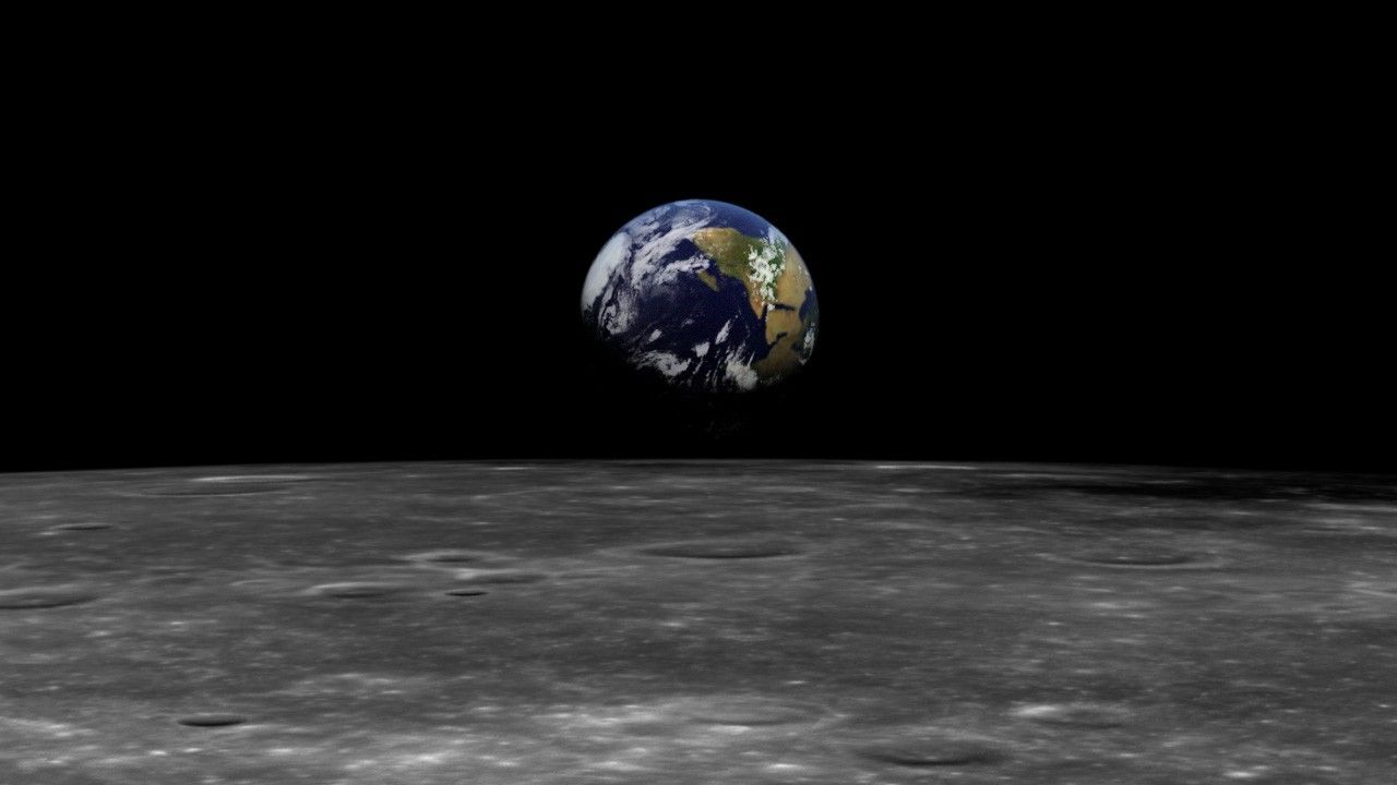
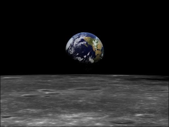
To mark the 30th anniversary of the Apollo 17 mission and the famous“Blue Marble” full Earth image, Goddard Space Flight Center’sVisualization and Analysis Lab has rendered a new visualization inspiredby the mission.
The 21 second visualization begins with the current Kennedy Space Centerlaunch pads in the Cape Canveral area where the Apollo missions startedand the Space Shuttle Missions start today. The launch pads and Floridarecede from view and the full Earth fills the frame. This view isintended to recall the famous “Blue Marble” Earth image of South Africaand Antarctica taken by Apollo 17 on December 7, 1972. The animationcontinues with the horizon of the Moon coming into view. This view ismeant to recall the famous “Earth Rise” images of earlier Apollomissions. Finally the camera tilts down towards surface of the moonwhich is passing below.
Please note that while the animation path and camera angles represent anartist’s conception, the visualization is constructed entirely fromobservations made from NASA, USGS and Space Imaging Inc. missions. TheMoon data comes from NASA Clementine. The long-shot and full Earth viewsare from global 250 meter resolution MODIS data from the NASA TerraAqua Satellites. The regional views of Florida come from 15 meterresolution NASA/USGS Landsat 7 Satellite data, and the local KennedySpace Center data comes from the 1 meter resolution Space Imaging, Inc., IKONOS Satellite.
References & Resources
Animation courtesy Marit Jentoft-Nilsen, NASA/GSFC Visualization and Analysis Lab