
























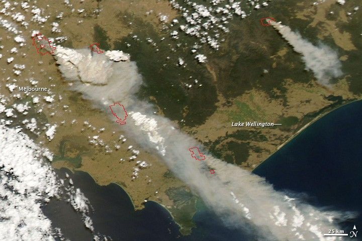
More than 30 people had been killed by out-of-control bushfires in southeast Australia as of February 7, 2009, according to BBC News. This image from the Moderate Resolution Imaging Spectroradiometer (MODIS) on NASA’s Aqua satellite shows multiple large fires (outlined in red) burning in Victoria on February 7. Huge plumes of smoke spread southeast, driven by fierce winds. The large version of the image shows a large dust storm blowing over interior deserts to the northwest. These fires sprang up and exploded in size in just a few short hours. The image captured by the Terra MODIS sensor just a few hours prior to this image showed no sign of these fires. Twice-daily images of southeastern Australia are available from the MODIS Rapid Response Team.
References & Resources
NASA image courtesy the MODIS Rapid Response Team, NASA Goddard Space Flight Center. Caption by Rebecca Lindsey.







