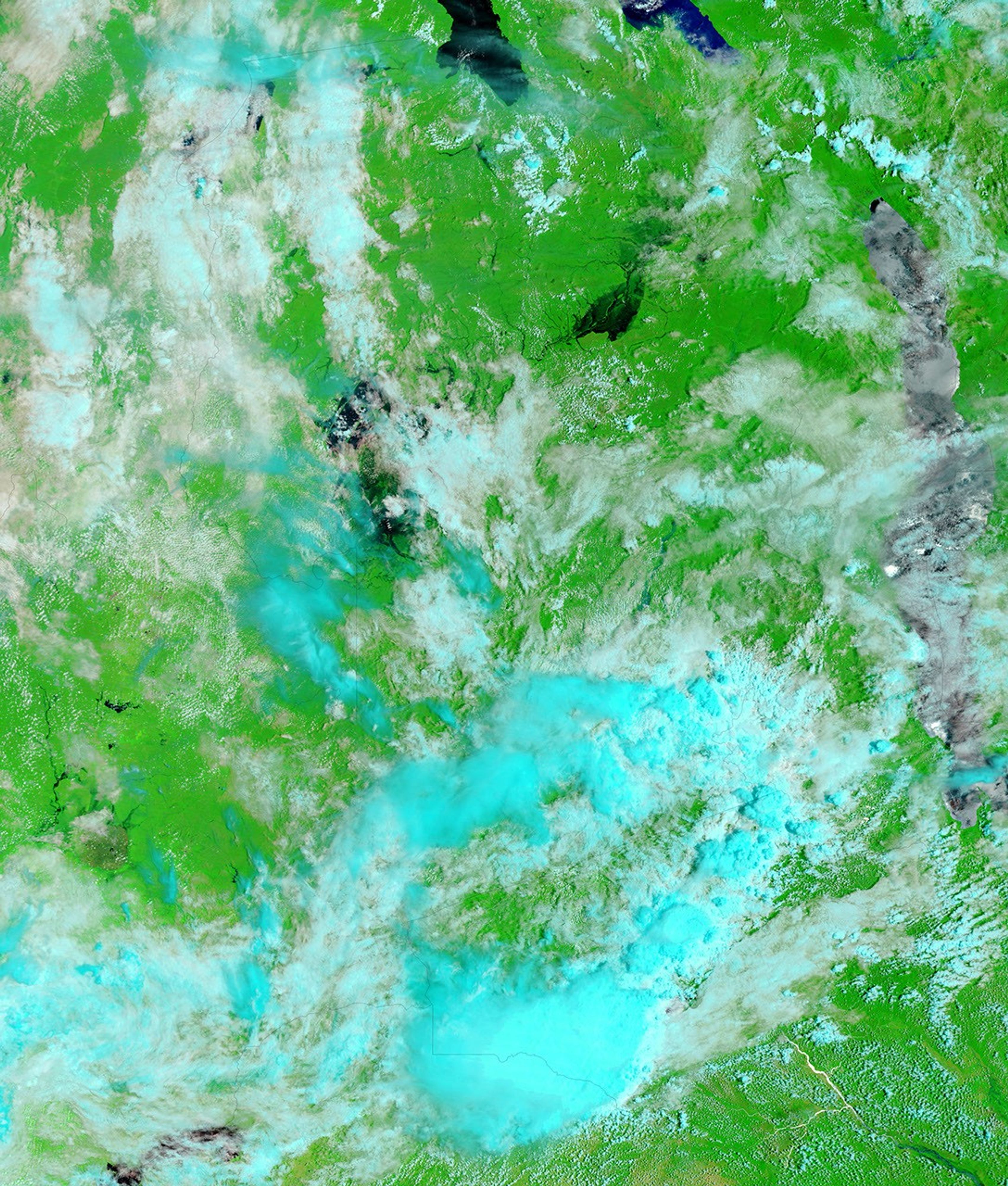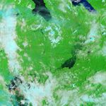

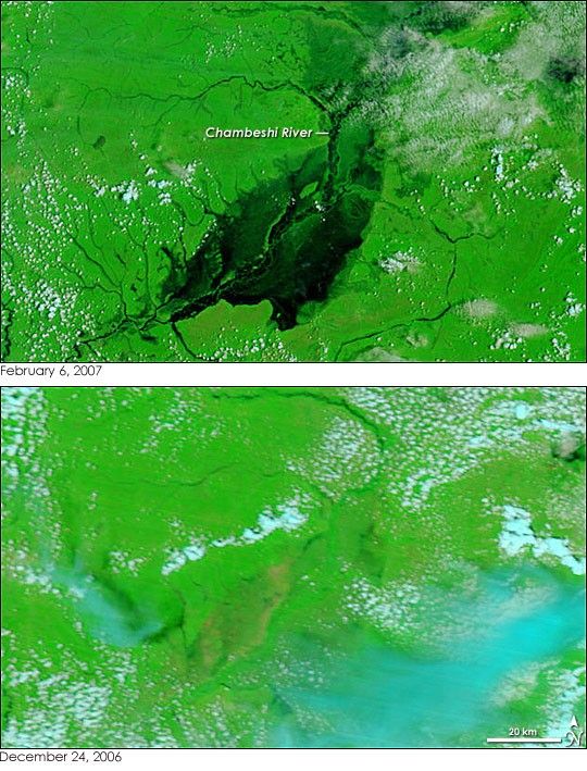
Zambia’s Chambeshi River had been transformed from a barely visible line to a broad lake more than 20 kilometers wide when the Moderate Resolution Imaging Spectroradiometer (MODIS) on NASA’s Terra satellite captured the top image on February 6, 2007. Many rivers in southern Africa, including the Zambezi, pushed over their banks in early 2007 under the onslaught of an exceptionally early and heavy rainy season. In East Zambia alone, 23,751 households had been affected by flooding along the Chambeshi and other rivers as of February 7, reported the Dartmouth Flood Observatory.
Taken a little more than a month apart, this pair of images illustrates the severity of the flooding in East Zambia. The images were made with a combination of visible and infrared light to increase the contrast between water and land. In this type of false-color image, water is black, plant-covered land is green, and bare ground is a rosy tan. Clouds are pale blue and white. The tan land around the Chambeshi River in the lower image may illustrate the typical extent of the river during the rainy season. Clearly, the river has expanded beyond the patch of plant-free ground.
The large images provided above are at MODIS’ full resolution of 250 meters per pixel. Both false-color and photo-like, true-color images of Zambia are available from the MODIS Rapid Response System in a variety of resolutions on a daily basis.
References & Resources
NASA images courtesy the MODIS Rapid Response Team at NASA GSFC