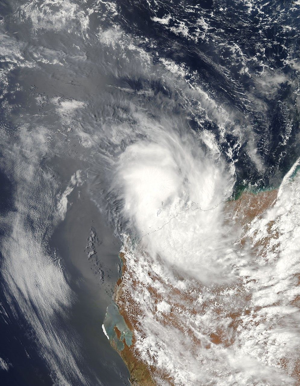
Category 2 Cyclone Dominic washed ashore in Western Australia on January 27, 2009. The storm brought heavy rain that caused flash flooding. Ports along the coast were closed in anticipation of the storm.
This image of Cyclone Dominic was captured by the Moderate Resolution Imaging Spectroradiometer (MODIS) on NASA’s Aqua satellite on January 26, one day prior to landfall. At that time, the storm had little of the classic appearance of a cyclone. Its center was a broad ball of solid clouds, without a well-defined eye. A few bands of clouds arced in toward the center in the clockwise direction exhibited by Southern Hemisphere cyclones.
The high-resolution image provided above is at MODIS’ full spatial resolution (level of detail) of 250 meters per pixel. The MODIS Rapid Response System provides this image at additional resolutions.
References & Resources
- ABC News. (2009, January 27.) Rainfall, flooding as Cyclone Dominic moves further inland. Australian Broadcasting Corporation (ABC) News Website. Accessed January 27, 2009.
NASA image by Jeff Schmaltz, MODIS Rapid Response Team, Goddard Space Flight Center. Caption by Rebecca Lindsey.