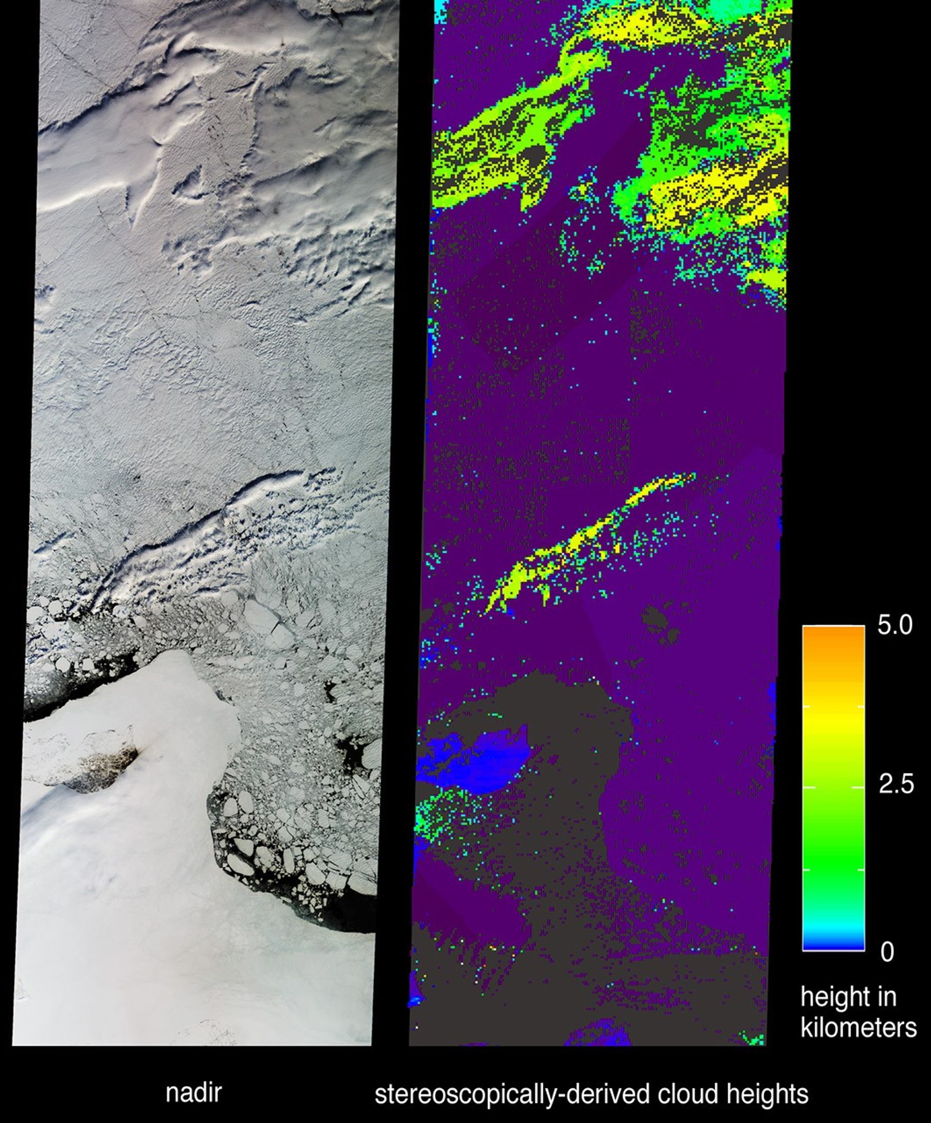
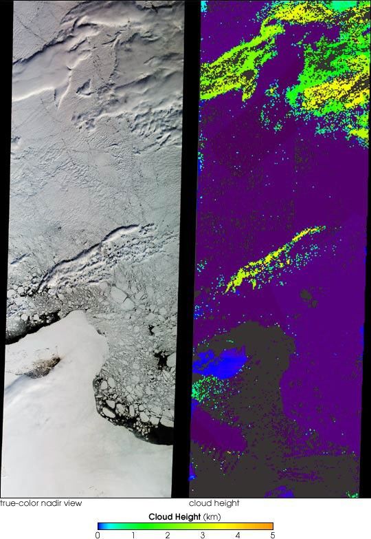
As a consequence of its capability to retrieve cloud-top elevations,stereoscopic observations from the Multi-angle Imaging SpectroRadiometer (MISR)can discriminate clouds from snow and ice. The central portion of Russia’s EastSiberian Sea, including one of the New Siberian Islands, Novaya Sibir, areportrayed in these views from data acquired on May 28, 2002.
The left-hand image is a natural color view from MISR’s nadir camera. On theright is a height field retrieved using automated computer processing of datafrom multiple MISR cameras. Although both clouds and ice appear white in thenatural color view, the stereoscopic retrievals are able to identify elevatedclouds based on the geometric parallax which results when they are observed fromdifferent angles. Owing to their elevation above sea level, clouds are mapped asgreen and yellow areas, whereas land, sea ice, and very low clouds appear blueand purple. Purple, in particular, denotes elevations very close to sea level.The island of Novaya Sibir is located in the lower left of the images. It can beidentified in the natural color view as the dark area surrounded by an expanseof fast ice. In the stereo map the island appears as a blue region indicatingits elevation of less than 100 meters above sea level. Areas where the automatedstereo processing failed due to lack of sufficient spatial contrast are shown indark gray. The northern edge of the Siberian mainland can be found at the verybottom of the panels, and is located a little over 250 kilometers south ofNovaya Sibir. Pack ice containing numerous fragmented ice floes surrounds thefast ice, and narrow areas of open ocean are visible.
The East Siberian Sea is part of the Arctic Ocean and is ice-covered most of theyear. The New Siberian Islands are almost always covered by snow and ice, andtundra vegetation is very scant. Despite continuous sunlight from the end ofApril until the middle of August, the ice between the island and the mainlandtypically remains until August or September.
The Multi-angle Imaging SpectroRadiometer views almost the entire Earth every 9days. These images cover an area of about 380 kilometers x 1117 kilometers.
References & Resources
Image courtesy NASA/GSFC/LaRC/JPL, MISR Team