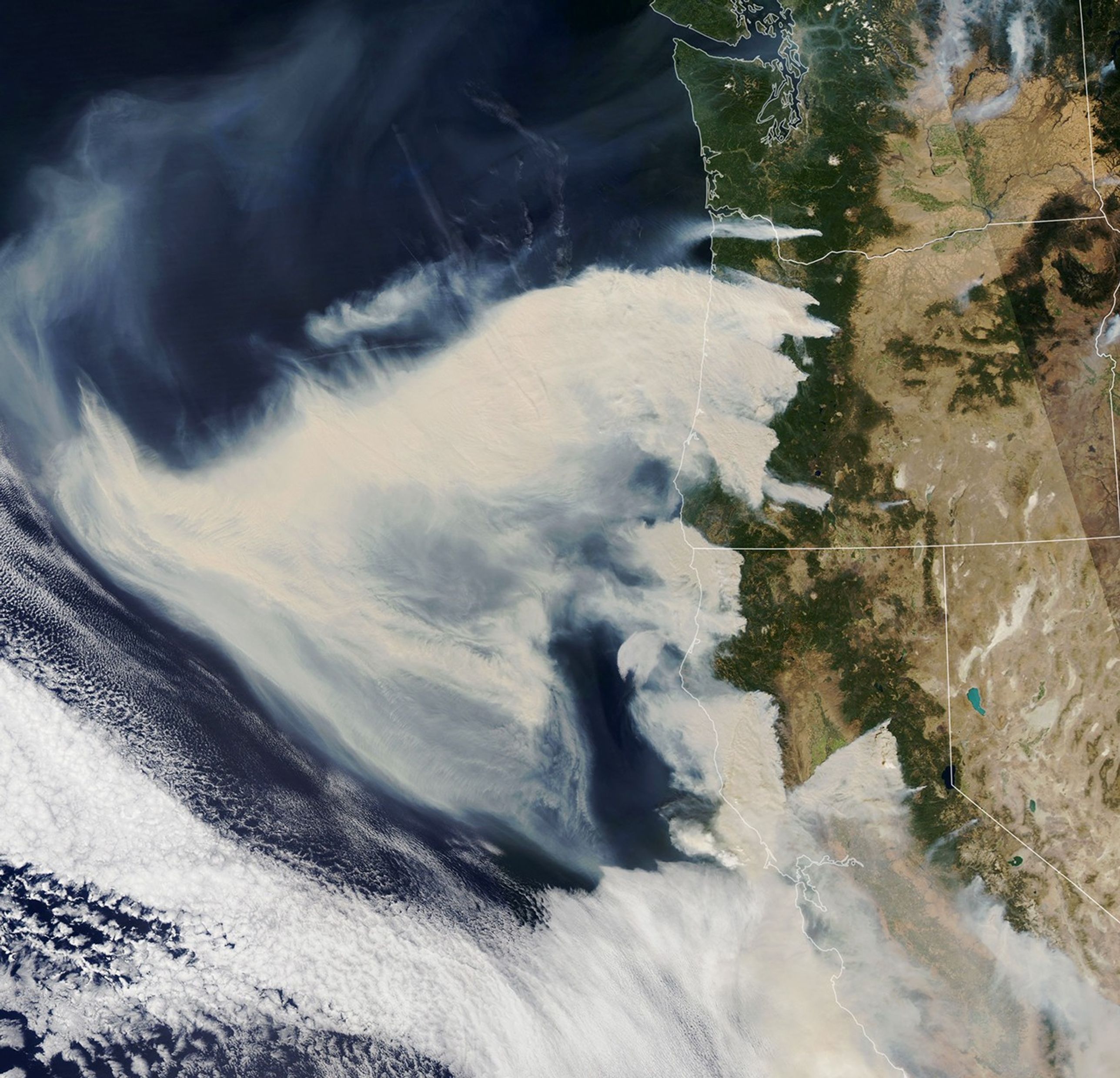
A weather front that drew unseasonably cold air into the Rocky Mountains also set up an atmospheric pressure gradient that sent dry, gusty winds barreling down the lee (downwind or sheltered) slopes of mountain ranges in several western states. The powerful downslope winds, sometimes called foehn winds, have fanned dozens of wildfires in Washington, Oregon, and California. (Other regional names for foehn winds include Santa Ana, Chinkook, and Mono winds.)
On September 8, 2020, the Moderate Resolution Imaging Spectroradiometer (MODIS) on NASA’s Aqua satellite captured this natural color image of thick smoke plumes streaming west from a long line of intense fires.
References & Resources
- AccuWeather (2020, September 6) âExtremely unusualâ wind event reignites relentless fire threat in western U.S. Accessed September 9, 2020.
- InciWeb (2020) Incident Information System. Accessed September 9, 2020.
- NASA Earth Observatory (2020, September 8) A Smoky Inferno.
- NOAA Storm Prediction Center (2020, September 9) Fire Weather Outlook. Accessed September 9, 2020.
- National Weather Service (2020, September 9) Short Range Public Discussion. Accessed September 9, 2020.
- OregonLive (2020, September 9) Oregon Wildfires. Accessed September 9, 2020.
- Swain, D. (2020, September 7) You could write an entire meteorology textbook... Accessed September 9, 2020.
- Yale Climate Connections (2020, September 8) Autumn could deliver the worst of Californiaâs 2020 fire season. Accessed September 9, 2020.
NASA Earth Observatory image by Lauren Dauphin, using MODIS data from NASA EOSDIS/LANCE and GIBS/Worldview . Caption by Adam Voiland .