


- natural color (1.4 MB)
- false color (1.7 MB)
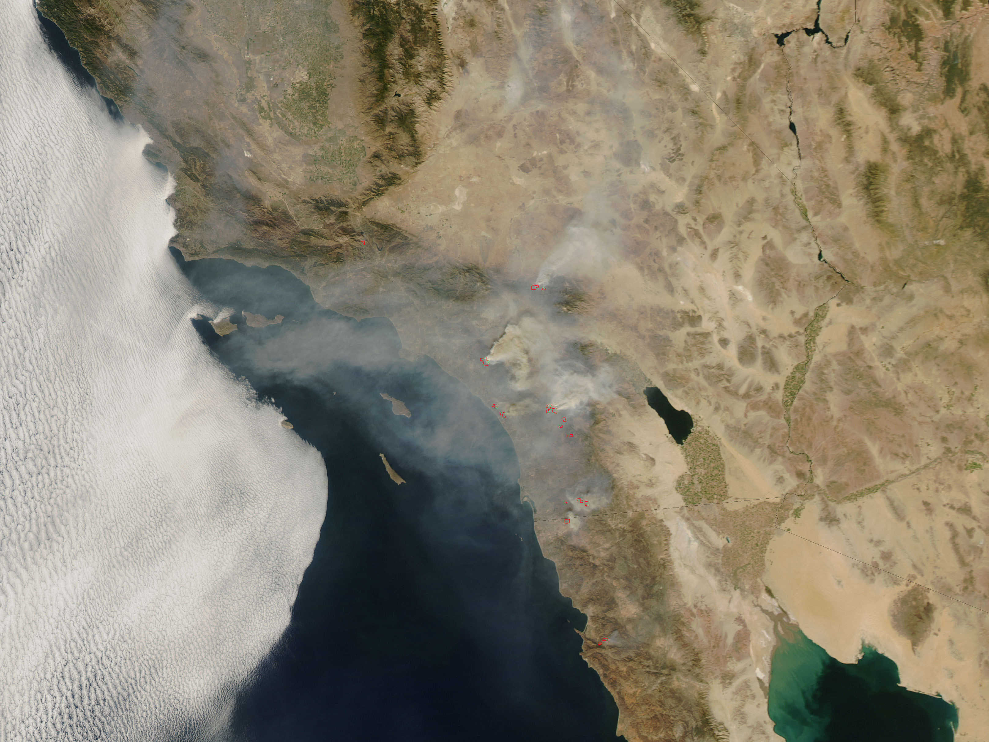
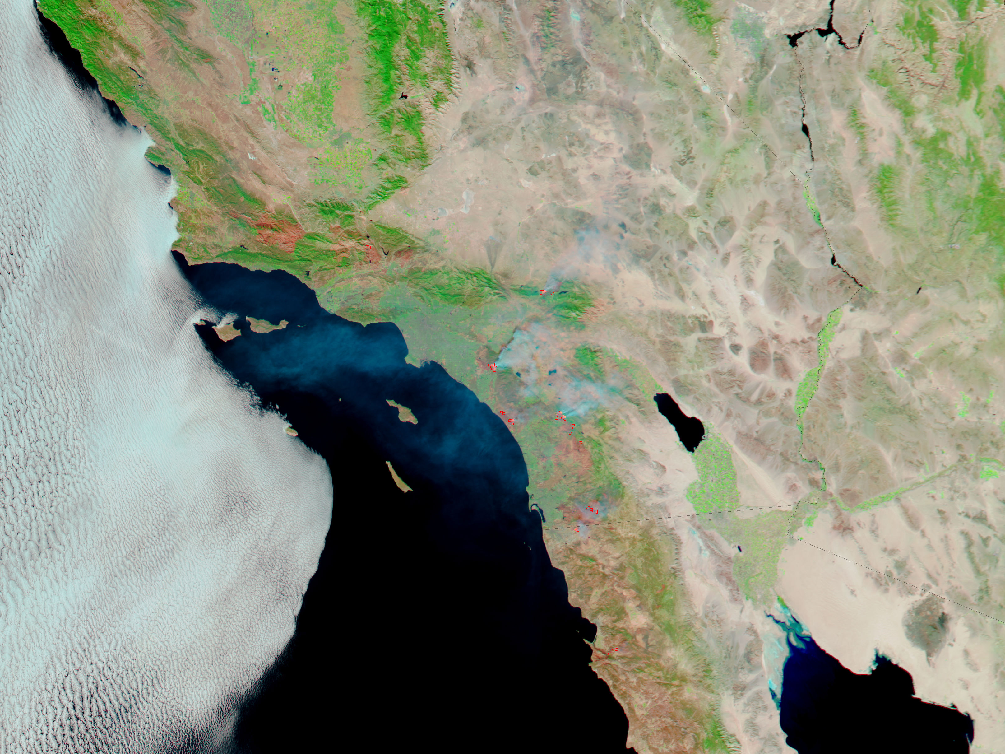
After days of seemingly relentless Santa Ana winds, California firefighters got a break. Winds died down and allowed water-bombing helicopters and ground teams to make significant progress is controlling the week-old fires that had scorched hundreds of thousands of acres and forced half a million people to evacuate their homes.
This pair of images from the Moderate Resolution Imaging Spectroradiometer (MODIS) on NASA’s Aqua satellite on October 25, 2007, shows the fires in natural color (top) and infrared-enhanced false color (bottom). The natural-color image is similar to a digital photograph, while the false-color image emphasizes burned areas (reddish-brown) and open flame (pink glow). At the time of the image, winds appeared to be onshore; smoke clouds from the Santiago and Poomacha Fires were blowing east.
The large images provided above have a spatial resolution (level of detail) of 250 meters per pixel, the maximum resolution of the sensor. The MODIS Rapid Response Team provides twice-daily images of the region in additional resolutions. For more information and maps of the California fires, please visit the National Interagency Fire Center.
References & Resources
NASA image courtesy the MODIS Rapid Response Team, Goddard Space Flight Center


