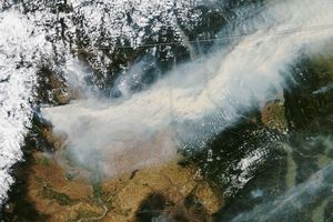
On September 27, 2009, a large wildfire burned northwest of Yellowstone Lake while smaller fires burned to the south. The Moderate Resolution Imaging Spectroradiometer (MODIS) on NASA’s Aqua satellite captured this true-color image the same day. Red outlines indicate hotspots associated with wildfires. Thick smoke from the Arnica Fire largely obscures the satellite’s view of Yellowstone Lake. The smaller fires in the south produce thinner plumes of smoke.
According to a report from the Incident Information System on September 29, 2009, the Arnica Fire had burned 9,300 acres (38 square kilometers). Ignited by lightning on September 13, the fire grew dramatically starting on September 24, thanks to warm temperatures and high winds. As of September 29, the fire retained a high growth potential.
References & Resources
NASA image by Jeff Schmaltz, MODIS Rapid Response Team, Goddard Space Flight Center. Caption by Michon Scott.