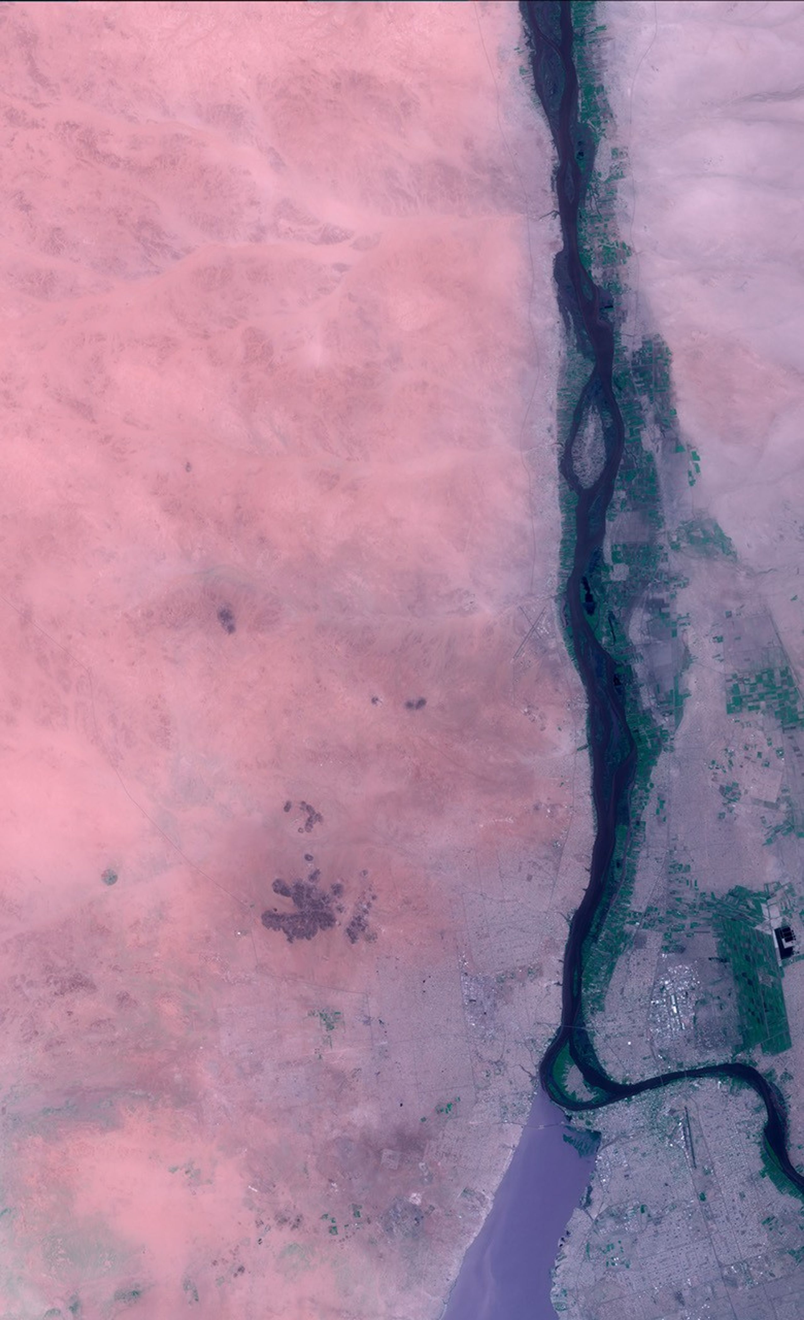
Although flooding along the Nile River in the Africancountry of Sudan is an annual event, this year’s riverlevels are the highest in more than 20 years. About 70,000 acres of farmland have been inundated by the rising river,displacing roughly 7,000 families from their homes. Downstream in Egypt,public works officials are confident that the the run-off canals behind the Aswan High Dam can carry enough water toavert flooding in their country. Several years of above-averagerainfall along the Nile River have already created severalnew lakes in Egypt.
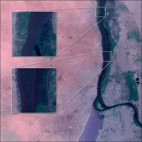
The Advanced Spaceborne Thermal Emission and Reflection Radiometer (ASTER), the zoom lens aboard NASA’s Terra satellite,acquired this high-resolution view of the Sudanese capital of Khartoum and floodedfarmland along the Nile on August 30, 2001. The “pseudo true-color” imageis a combination of near-infrared and visible light data which simulates a photographtaken from space. The city of Khartoum is at the lower right, at the confluenceof the White (left) and Blue (right) Nile Rivers. Flooded farmland along the banksof the Nile appears dark blue. The two inset images show the flooding at a spatial resolution of 15 meters per pixel--ASTER’s full resolution. The surrounding desert is colored pink.
Flooding is a particularly severe problem in this region because mosthuman settlements are along rivers. An earlier sequence of images from theMulti-angle Imaging Spectroradiometer (MISR), another instrument aboard Terra,shows seasonal fluctuation of the Nile.
References & Resources
Image courtesy NASA/GSFC/MITI/ERSDAC/JAROS, and U.S./Japan ASTER Science Team