


![Request for Information – Potential [Placeholder for Prize]](https://assets.science.nasa.gov/dynamicimage/assets/science/psd/solar/2023/09/s/solarsystem_0.jpg?w=1024)


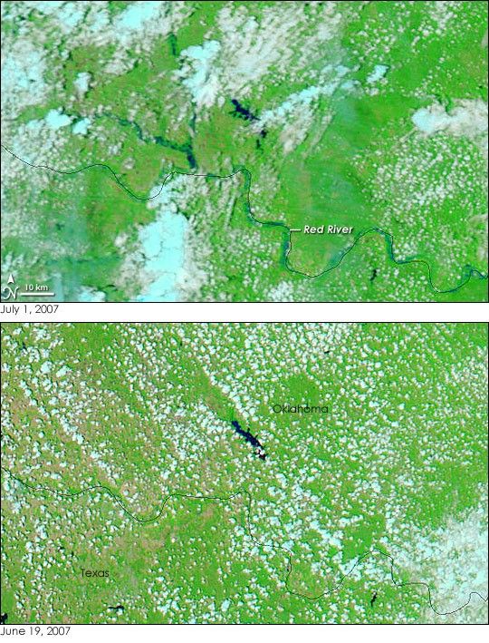
- July 1, 2007 (895 kB JPG)
- June 19, 2007 (1.4 MB JPG)
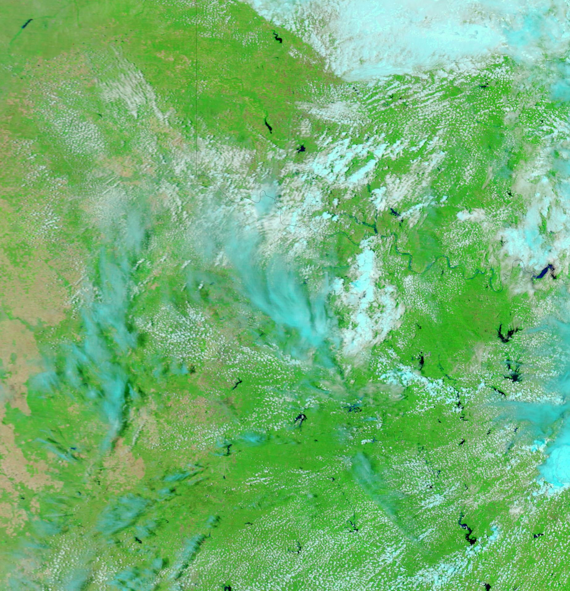
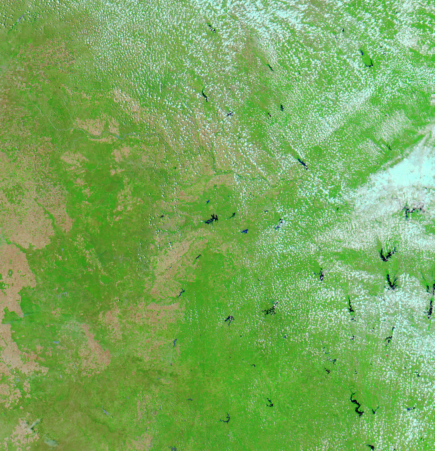
Though most of the rest of the Midwest was shrouded with clouds on July 1, 2007, when the Moderate Resolution Imaging Spectroradiometer (MODIS) on NASA’s Terra satellite collected the top image, small sections of the Red River were visible under partly cloudy skies. Compared to June 19, when Aqua MODIS took the lower image, the river was swollen on July 1, after heavy rain inundated Texas and Oklahoma. According to the National Weather Service, minor flooding was occurring along the Red River on July 1, and moderate to major flooding swamped its tributaries, Deep Red Creek and East Cache Creek, the two rivers flowing into the Red in this image.
The images were created with a combination of visible and infrared light to highlight the presence of water on the ground. In this type of image, water is black, though thick sediment colors the water blue. Clouds are pale blue and white. Plant-covered land is green, and bare earth is tan-pink. Daily images of Texas and Oklahoma are available from the MODIS Rapid Response System in both false color, such as these images, and photo-like true color.
References & Resources
NASA images courtesy the MODIS Rapid Response Team at NASA GSFC.


