


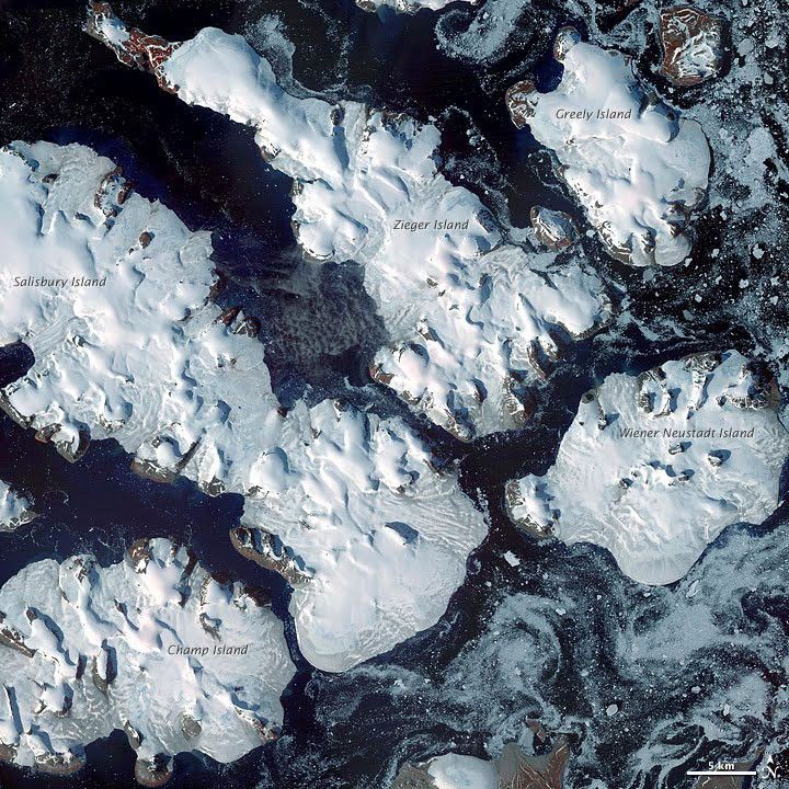
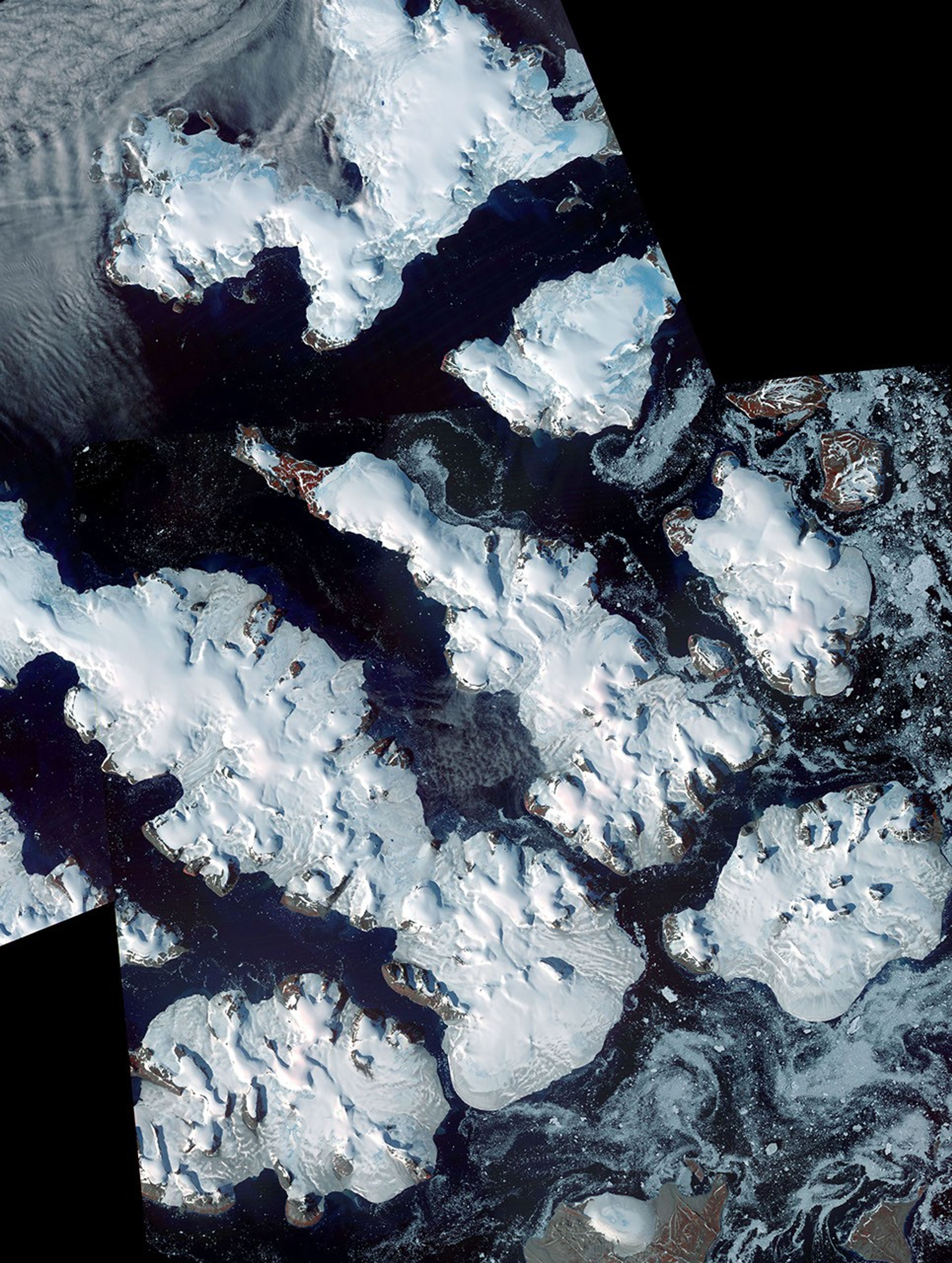
Located just 600 miles (970 kilometers) from the North Pole, Franz Josef Land is perpetually coated with ice. Glaciers cover roughly 85 percent of the archipelago’s land masses, and sea ice floats in the channels between islands even in the summertime.
The Advanced Spaceborne Thermal Emission and Reflection Radiometer (ASTER) on NASA’s Terra satellite observed the islands of central Franz Josef Land on August 16 and 19, 2011. (Another sensor on Terra captured a wider view on August 17, 2011.)
The image above was made from a combination of visible and near-infrared wavelengths, and ice appears in shades of white and pale blue. The amount of sea ice filling the channels between the islands of Franz Josef Land varies from summer to summer. Captured toward the end of the Northern Hemisphere melt season, this shot shows a modest amount of sea ice on the ocean surface. Some of the ice has accumulated in bays like the one near northeastern Zieger Island.
Most of the ice in this scene is anchored to land, as large glaciers blanket the islands. Yet today’s glaciers are tiny compared to the ice sheet that dominated the region about 20,000 years ago. Studies of Franz Josef Land have actually contributed to a larger understanding of when that massive ice sheet began its slow retreat. Raised beaches, which preserve evidence of land rising as the crushing weight of overlying glaciers eases (known as isostatic rebound), were first recognized on the islands in the late nineteenth century. Researchers estimate that the giant ice sheet had retreated by about 10,000 years ago.
References & Resources
- Formana, S.L., Lubinski, D.J., Ingólfsson, Ó., Zeeberg, J.J., Snyder, J.A., Siegert, M.J., Matishov, G.G. (2004). A review of postglacial emergence on Svalbard, Franz Josef Land and Novaya Zemlya, northern Eurasia. Quaternary Science Reviews, 23, 1391–1434.
NASA image created by Jesse Allen, using data provided courtesy of NASA/GSFC/METI/ERSDAC/JAROS, and U.S./Japan ASTER Science Team. Caption by Michon Scott with information from Walt Meier and Ted Scambos, National Snow and Ice Data Center.


