![Request for Information – Potential [Placeholder for Prize]](https://assets.science.nasa.gov/dynamicimage/assets/science/missions/a-step/FFR_Earth_Background_20251120%20.png?w=1024)


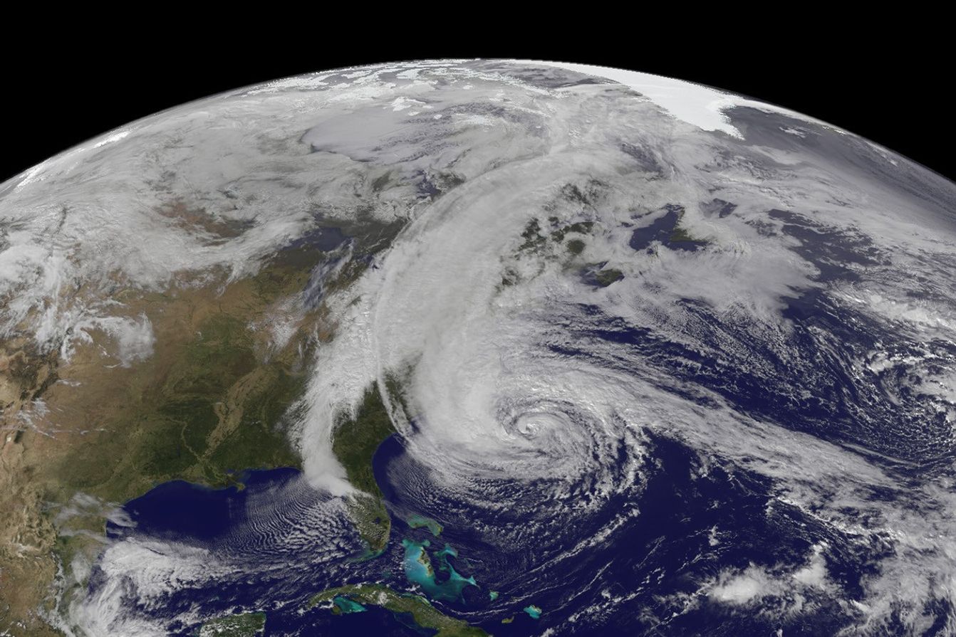
The Geostationary Operational Environmental Satellite 13 (GOES-13) captured this natural-color image of Hurricane Sandy at 1:45 p.m. Eastern Daylight Time (17:45 Universal Time) on October 28, 2012. Note how a line of clouds from a continental weather system runs south to north along the Appalachian Mountains, approaching from the west to meet the offshore storm.
Cameras on another geostationary satellite (GOES-14) collected “super rapid scan” images—one every minute from 7:15 a.m. until 6:26 p.m. EDT—which were compiled into a time-lapse video available on YouTube. In the animation, light from the changing angles of the Sun reveal the structure of the clouds and the details of the storm’s motion from dawn to dusk.
At 2 p.m. EDT, shortly after the still image above was acquired, the U.S. National Hurricane Center reported that Sandy was located at 32.8° North and 71.9° West, about 575 miles (930 kilometers) south of New York City. Maximum sustained winds were observed at 75 miles (120 kilometers) per hour, and the barometric pressure at the center of the storm was 951 millibars (28.08 inches).
For more views of the storm, visit our Hurricane Sandy event page. The National Hurricane Center provides the official U.S. storm forecasts and regular updates on conditions on its home page.
References & Resources
NASA Earth Observatory image by Robert Simmon with data courtesy of the NASA/NOAA GOES Project Science team. Caption by Mike Carlowicz.