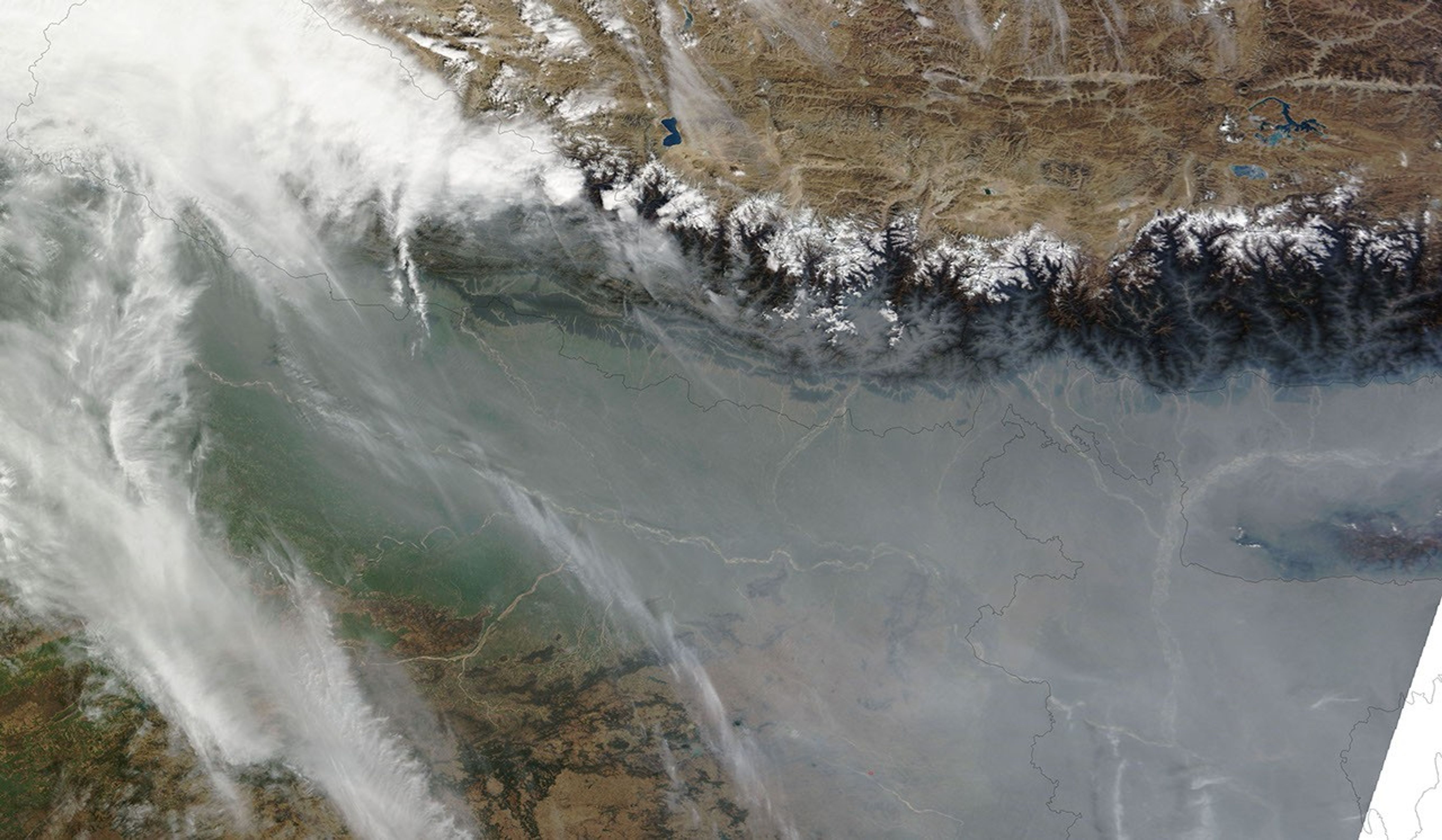
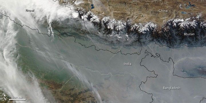
Cold, heavy air may have played a role in trapping haze near the base of the Himalaya in early February 2010. Thick haze hovered over northern India and Bangladesh, and even filled valleys in Bhutan and Nepal. The Moderate Resolution Imaging Spectroradiometer (MODIS) on NASA’s Terra satellite captured this image on February 8, 2010. Thick haze blankets the region in the east, but it thins somewhat in the west, where clouds hover over Nepal. Pale gray haze forms dendritic patterns reaching into the valleys of Bhutan and Nepal.
Winter conditions can trap cold air near the ground while warmer air hovers overhead, preventing the upward movement of the cold air and the pollutants it holds. The haze’s appearance may be somewhat exaggerated in this image, however, because it has been acquired near the edge of the satellite swath, where the sensor has to look through a thicker layer of atmosphere (a longer line of sight) than it does when it looks straight down.
References & Resources
NASA image courtesy the MODIS Rapid Response Team at NASA GSFC. Caption by Michon Scott.