

























Suggested Searches

1 min read

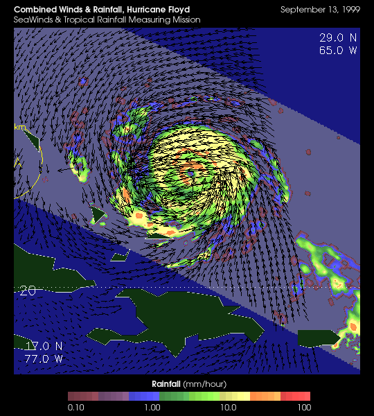
Hurricane Floyd from TRMM and QuikSCAT

Topics:
Hurricane Floyd from TRMM and QuikSCAT

This image of Hurricane Floyd combines rainfall data from the Tropical Rainfall Measuring Mission (TRMM) with wind data from QuikSCAT on SeaWinds. This combined data allows scientists to study the interplay between precipitation air currents.

for more information:
TRMM Fact Sheet
QuikSCAT Fact Sheet
Seaflux

References & Resources

Image courtesy of TRMM and QuikSCAT projects

None


You may also be interested in:

Stay up-to-date with the latest content from NASA as we explore the universe and discover more about our home planet.

Tropical Storm Arthur
2 min read

The first named storm of the 2026 Atlantic hurricane season brought intense rainfall and the threat of flash flooding to…

Article
Cyclone Rains Spur Papua New Guinea Landslides
3 min read

Heavy rains from Tropical Cyclone Maila triggered a deadly landslide in the mountains of East New Britain.

Article
Australia’s “Red Centre” Turns Green
3 min read

Abundant rainfall in February and March 2026 transformed the desert landscape of Central Australia.

Article




