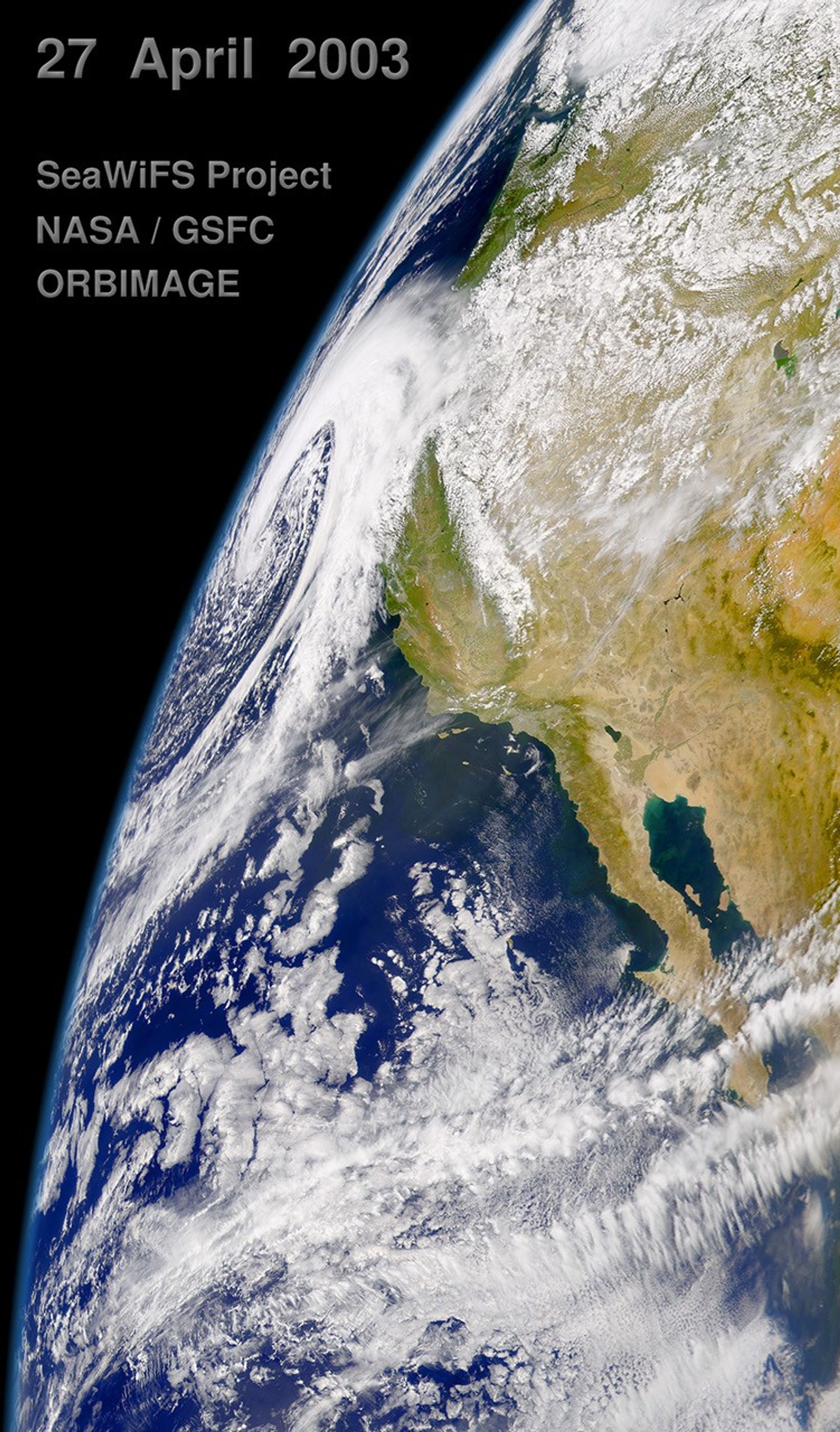
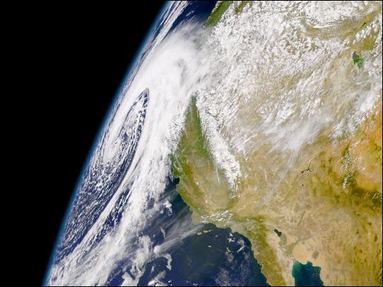
The Sea-viewing Wide Field-of-View Sensor (SeaWiFS), flying aboard theOrbview-2 satellite, captured this view of a massive low pressure systemapproaching the northern California coast. High winds, heavy rain, andsignificant snows (elevations above 7,000 feet) are expected today asthis strong storm spins onshore.
Monterey Bay, Point Conception, and Los Angeles are visible along theCalifornia coast below the storm. Inland, the thick white verticalstripe is the Sierra Nevada Mountains, still covered in snow.To the right of Los Angeles is a dark irregular feature—the Salton Sea.Below the Salton is a region of irrigated cropland that producesfruits and vegetables throughout the winter.
There appears to be a significant amount of biological activity in the Pacific Coastal waters around the Channel Islands, off California’s southern coast as well as in the Gulf of California. Note the dark green and turquoise patterns in the water, indicating the presence of phytoplankton blooms.
References & Resources
Image courtesy the SeaWiFS Project, NASA/Goddard Space Flight Center, and ORBIMAGE