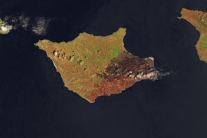


















Late in the evening on December 15, 2013, a wildfire was reported in California’s Los Padres National Forest. By the next day, the Pheiffer fire had destroyed 15 homes and charred more than 500 acres (200 hectares). The home of Big Sur’s fire chief was among those destroyed.
This natural-color satellite image shows smoke from the fire blanketing the area. It was acquired by the Moderate Resolution Imaging Spectroradiometer (MODIS) aboard the Aqua satellite on December 16, 2013. Red outlines indicate hot spots where MODIS detected unusually warm surface temperatures associated with the fire. The wind-blown blaze raged through chaparral, redwoods, oaks, and sycamores in a rugged coastal area.
Although the 2013 U.S. fire season produced many destructive fires, the overall number of acres burned was low in comparison to other recent years, according to statistics compiled by the National Interagency Fire Center.
Further Reading
- NASA Earth Observatory (2013, November 8) Building in Colorado’s Fire Zone, Part 1.
References & Resources
- InciWeb (2013, December 17) Pheiffer Fire. Accessed December 17, 2013.
- Monterey County Weekly (2013, December 16) Big Sur Fire: Reports of home destruction on Pfeiffer Ridge. Accessed December 17, 2013.
- Los Angeles Times (2013, December 16) Big Sur wildfire grows to 500 acres; fire chief’s home destroyed. Accessed December 17, 2013.
- Los Angeles Times (2013, December 9) Fire season tamer than expected; U.S. burn acreage far below average. Accessed December 17, 2013.
- National Interagency Fire Center (2013, December 17) Year-to-Date Statistics. Accessed December 17, 2013.
- National Interagency Fire Center (2013, December 17) Total Wildland Fires and Acres (1960-2011). Accessed December 17, 2013.
NASA image courtesy LANCE MODIS Rapid Response. Caption by Adam Voiland.