
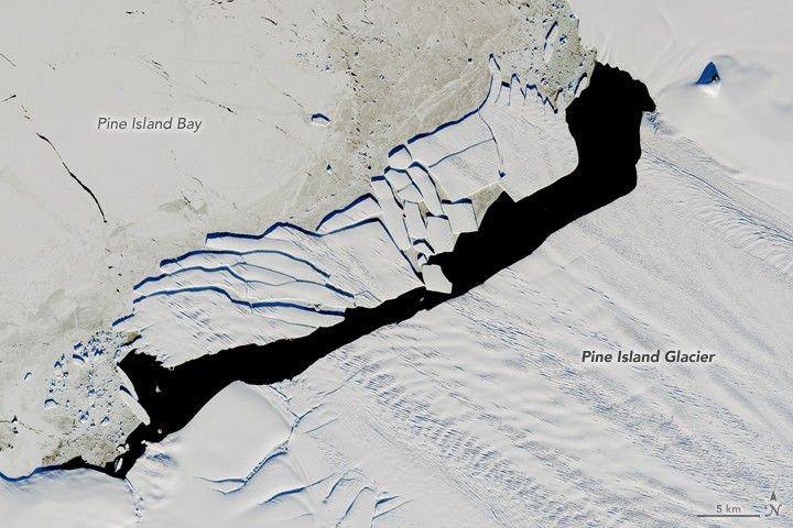
In September 2017, a new iceberg calved from Pine Island Glacier—one of the main outlets where the West Antarctic Ice Sheet flows into the ocean. Just weeks later, the berg named B-44 shattered into more than 20 fragments.
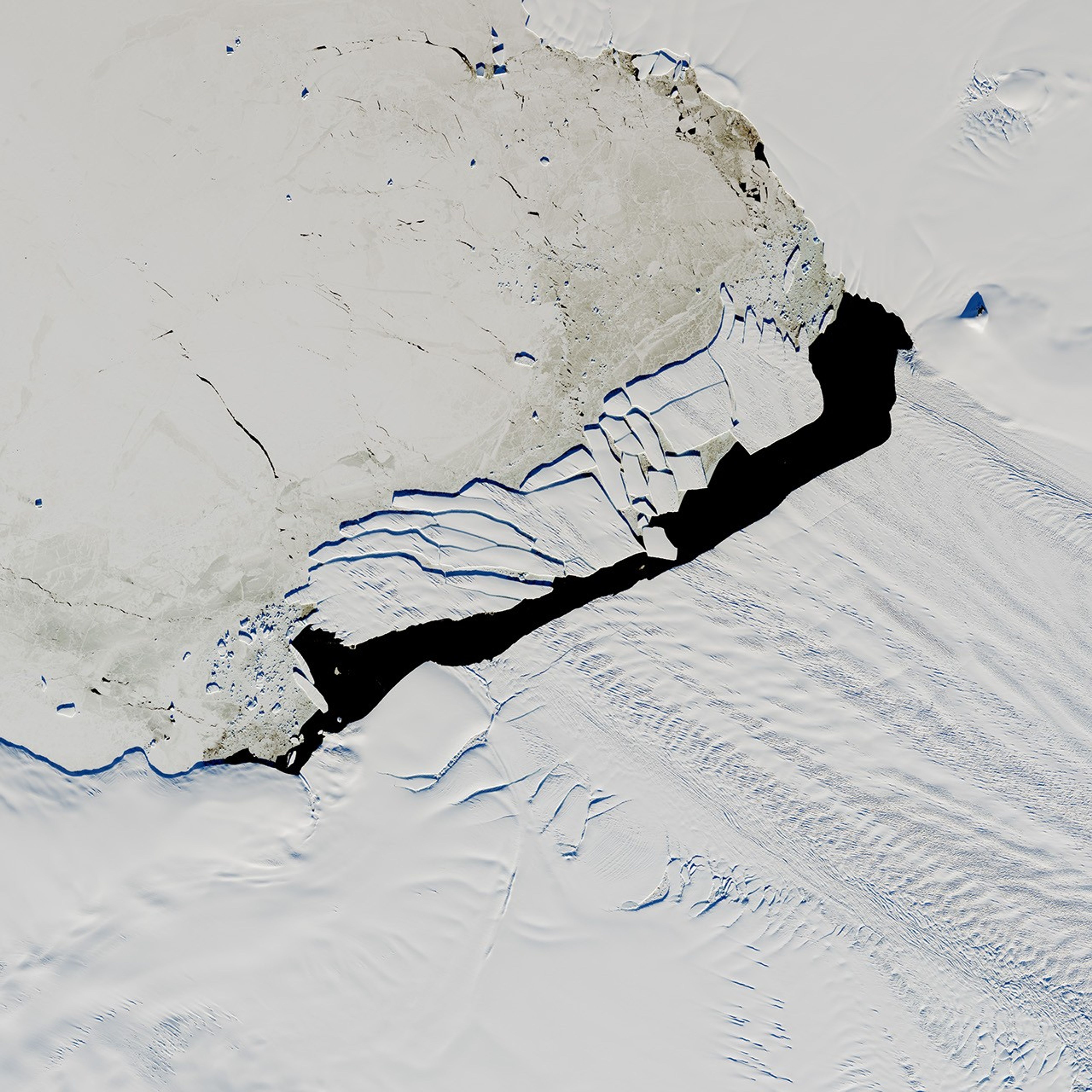
On December 15, 2017, the Operational Land Imager (OLI) on Landsat 8 acquired a natural-color image (above) of the broken berg. An area of relatively warm water, known as a polyna, has kept the water ice free between the iceberg chunks and the glacier front. NASA/UMBC glaciologist Chris Shuman thinks the polynya’s warm water could have caused the rapid breakup of B-44.
The image above was acquired near midnight local time. Based on parameters including the azimuth of the Sun and its elevation above the horizon, as well as the length of the shadows, Shuman has estimated that the iceberg rises about 49 meters above the water line. That would put the total thickness of the berg—above and below the water surface—at about 315 meters.
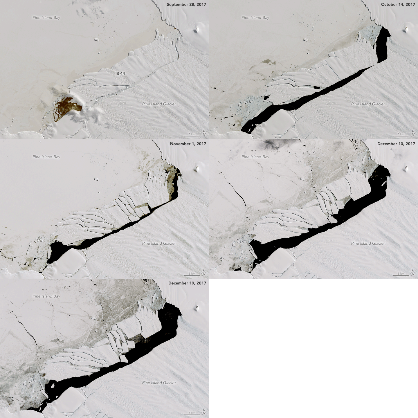
This animation combines five Landsat 8 views of B-44 acquired over the past four months.
References & Resources
NASA Earth Observatory image by Jesse Allen, using Landsat data from the U.S. Geological Survey. Caption by Kathryn Hansen.