February 3, 1997-February 19, 2020
With more than 80 percent of its 1,190 coral islands standing less than 1 meter above sea level, the Maldives has the lowest terrain of any country in the world. This makes the archipelago in the Indian Ocean particularly vulnerable to sea level rise.
With global sea level rising 3 to 4 millimeters per year, and that rate expected to rise in coming decades, some analysts anticipate a grim future for the Maldives and other low-lying islands. One study concluded that low-lying islands could become uninhabitable by 2050 as wave-driven flooding becomes more common and freshwater becomes limited. The Intergovernmental Panel on Climate Changes anticipates sea level could rise by about half a meter by 2100 even if greenhouse gas emissions are sharply reduced or rise up to 1 meter if greenhouse gas emissions continue to increase strongly.
While the Maldives government has explored plans to purchase land on higher ground in other countries as an insurance policy against sea level rise, planners are also working to enhance the resilience of the country’s current islands. One example is Hulhumalé, a newly constructed artificial island northeast of the capital, Malé.
The pair of Landsat satellite images above show just how much the area has changed between 1997 and 2020. Construction of the island, designed to relieve crowding in Malé, began in 1997 in a lagoon near the airport. Since then, the island has grown to cover 4 square kilometers, making it the fourth largest island in the Maldives. Hulhumalé’s population has swollen to more than 50,000 people, with 200,000 more expected to eventually move there.
The new island, built by pumping sand from the seafloor onto a submerged coral platform, rises about 2 meters above sea level, about twice as high as Malé. The extra height could make the island a refuge for Maldivians who are eventually driven off lower-lying islands due to rising seas. It could also prove to be an option for evacuations during future typhoons and storm surges.
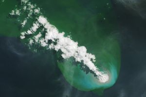
Hulhumalé is not the only island in the Maldives that has seen major changes since the 1990s. Reclamation projects have enlarged several other atolls in similar ways in recent decades. Among them is Thilafushi, a lagoon to the west that has became a fast-growing landfill and a common location for trash fires (note the smoke plume blowing to the southwest in the 2020 image). Gulhifalhuea is the site of another land reclamation project that is opening up new manufacturing and industrial space.
NASA Earth Observatory images by Lauren Dauphin, using Landsat data from the U.S. Geological Survey. Story by Adam Voiland.