
Days of intense rainfall in August 2016 led to widespread flooding in southern Louisiana. Rivers swelled high above their banks, and many crested at record-high levels.
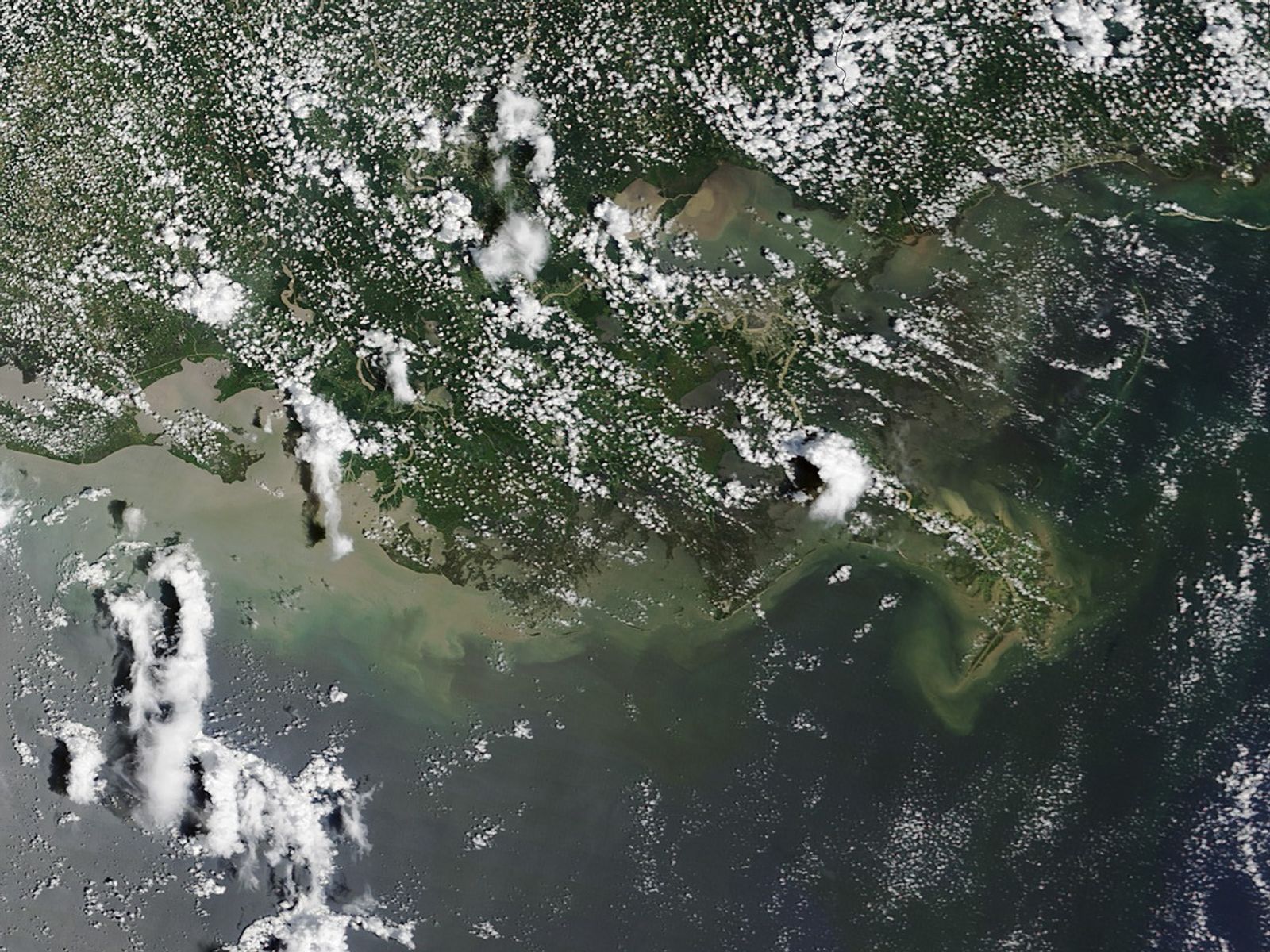
When the Moderate Resolution Imaging Spectroradiometer (MODIS) on NASA’s Terra satellite captured this image on August 17, 2016, brown sediment (bits of mud, rock, and minerals) was pouring from Lake Maurepas into Lake Pontchartrain through Pass Manchac.
Floods transport huge amounts of sediment as fast-moving rivers and streams can pick up and move larger particles more easily than slow-moving waters. They also collect runoff from lands that are usually above the water line.
The multi-day rainfall accumulations that hit southern Louisiana (more than 20 inches in some places) stemmed from an unusual storm pattern similar to a tropical depression, except that surface winds were light. The system was extremely slow moving, dropping 600 percent of normal rain over a seven-day period, according to the Lower Mississippi River Forecast Center of the U.S National Weather Service.
References & Resources
- CIMSS Satellite Blog (2016, August 12) Flooding in Louisiana. Accessed August 18, 2016.
- National Weather Service River Forecast Center (2016, August 15) Lower Mississippi RFC. Accessed August 18, 2016.
- National Oceanic and Atmospheric Administration (2016, August) Louisiana Flood Imagery. Accessed August 18, 2016.
- State of Louisiana, Office of the Governor (2016, August 14) Major Disaster Declared for the State of Louisiana. Accessed August 18, 2016.
- U.S Geological Survey (2016, May 2) Sediment and Suspended Sediment. Accessed August 18, 2016.
- Weather Underground WunderBlog (2016, August 15) Billion-Dollar Flood Has Louisiana Reeling; 98L May Become a Tropical Depression. Accessed August 15, 2016.
- Weather Underground WunderBlog (2016, August 14) Historic Flood Event in Louisiana From 20-30 Inches of Rain. August 18, 2016.
NASA image by Jeff Schmaltz, LANCE/EOSDIS Rapid Response. Caption and image cropping by Adam Voiland.