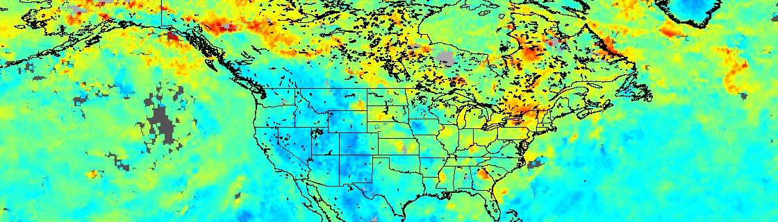
Airborne levels of smoke and pollution are high over eastern Alaska and northwestern Canada because of intense wildfires that have been burning for much of the past two months. While the Alaska fires, which started in mid-June 2004, are waning, the fires in Canada are increasing in magnitude. The smoke and pollution coming out of these fires have been spread all across North America and are being carried eastwards over the Atlantic. This is clearly evident in the above image, which shows the total column amount of carbon monoxide as measured by the Measurements of Pollution in the Troposphere (MOPITT) remote sensing instrument on board NASAâs Terra satellite. The data represent a composite of 14 days from July12 to July 26, 2004. High levels of pollution are indicated by yellow and red colors, and blue indicates low pollution. Images from the MODIS instruments aboard the Terra and Aqua satellites show the locations of the numerous fires across the region during this same time period as well as the thick, widespread pall of smoke they produced.
References & Resources
NASA image created by Jesse Allen using data courtesy the NCAR/UCAR MOPITT Instrument Team