


full-size images:
April 18, 2001 Near Infrared (1.6 MB)
April 18, 2001 True Color (1.1 MB)
April 25, 2000 Near Infrared (1.8 MB)
April 25, 2000 True Color (1.3 MB)
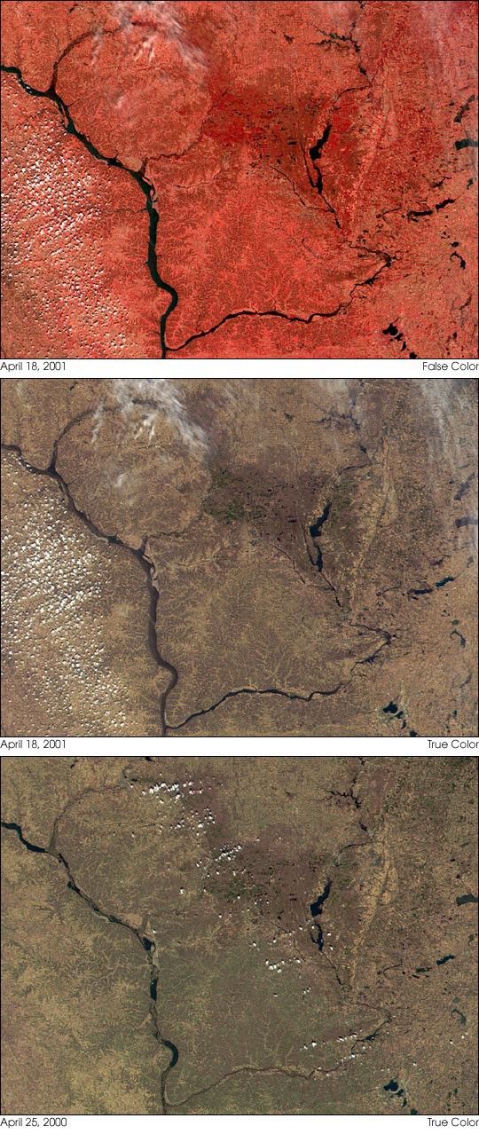
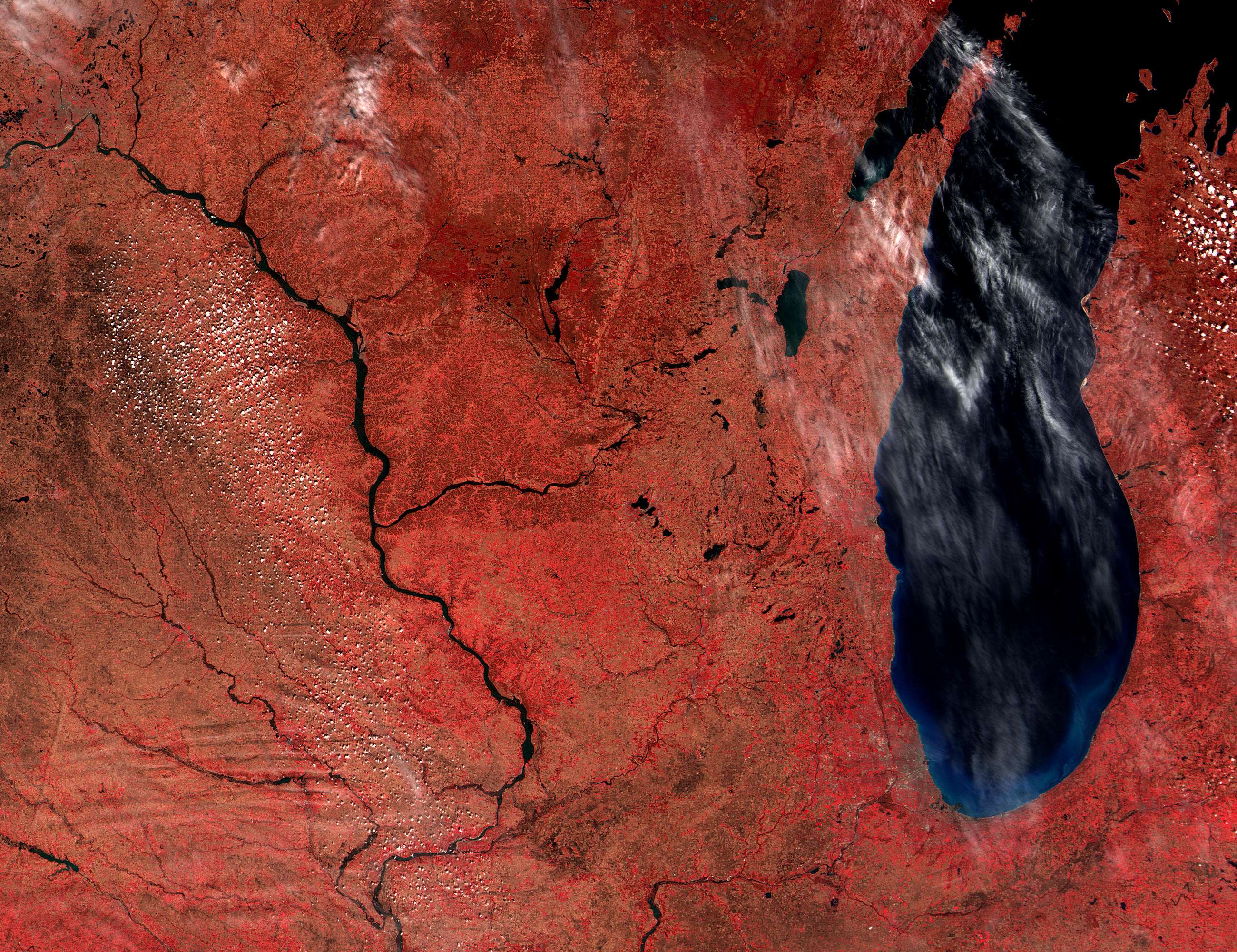
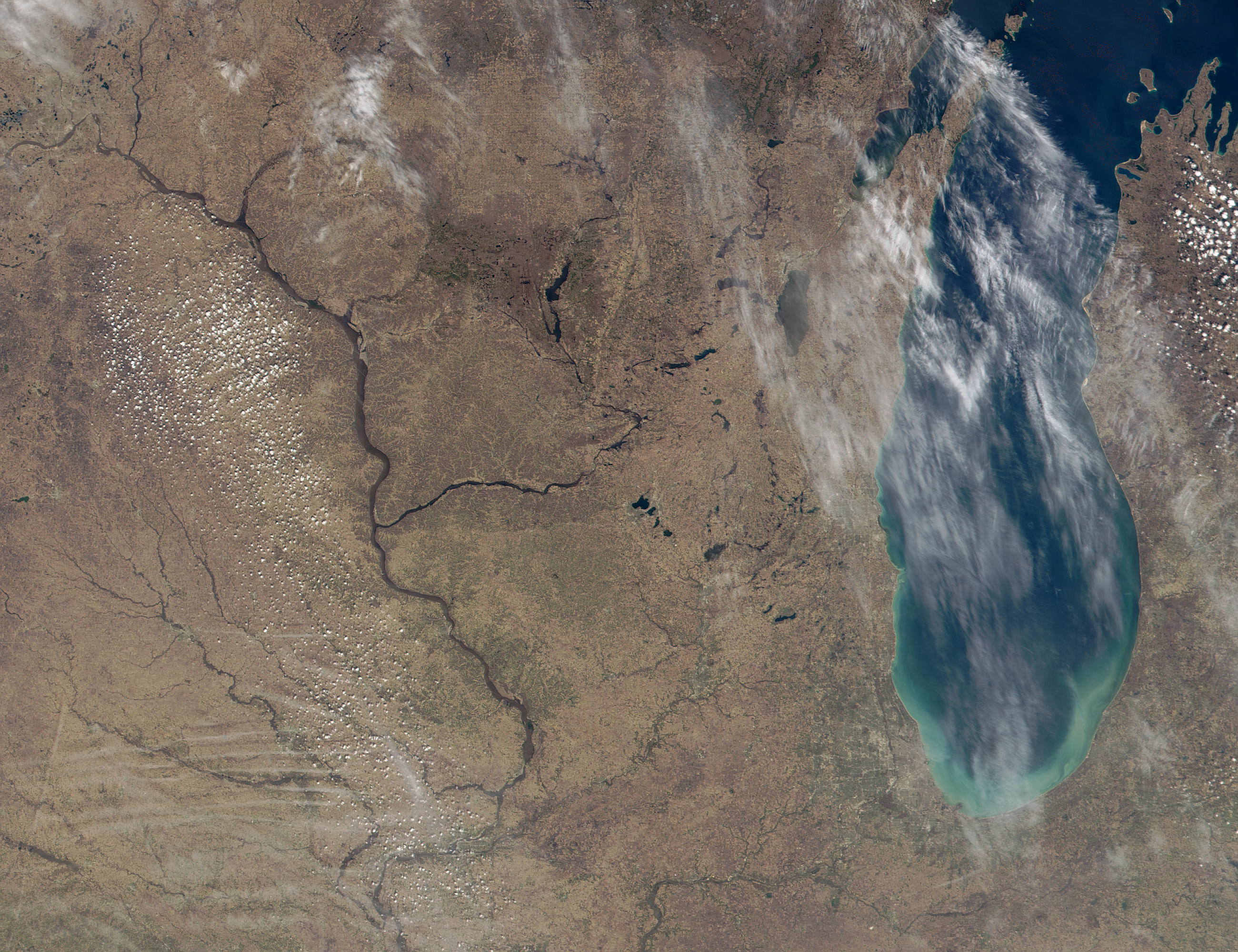
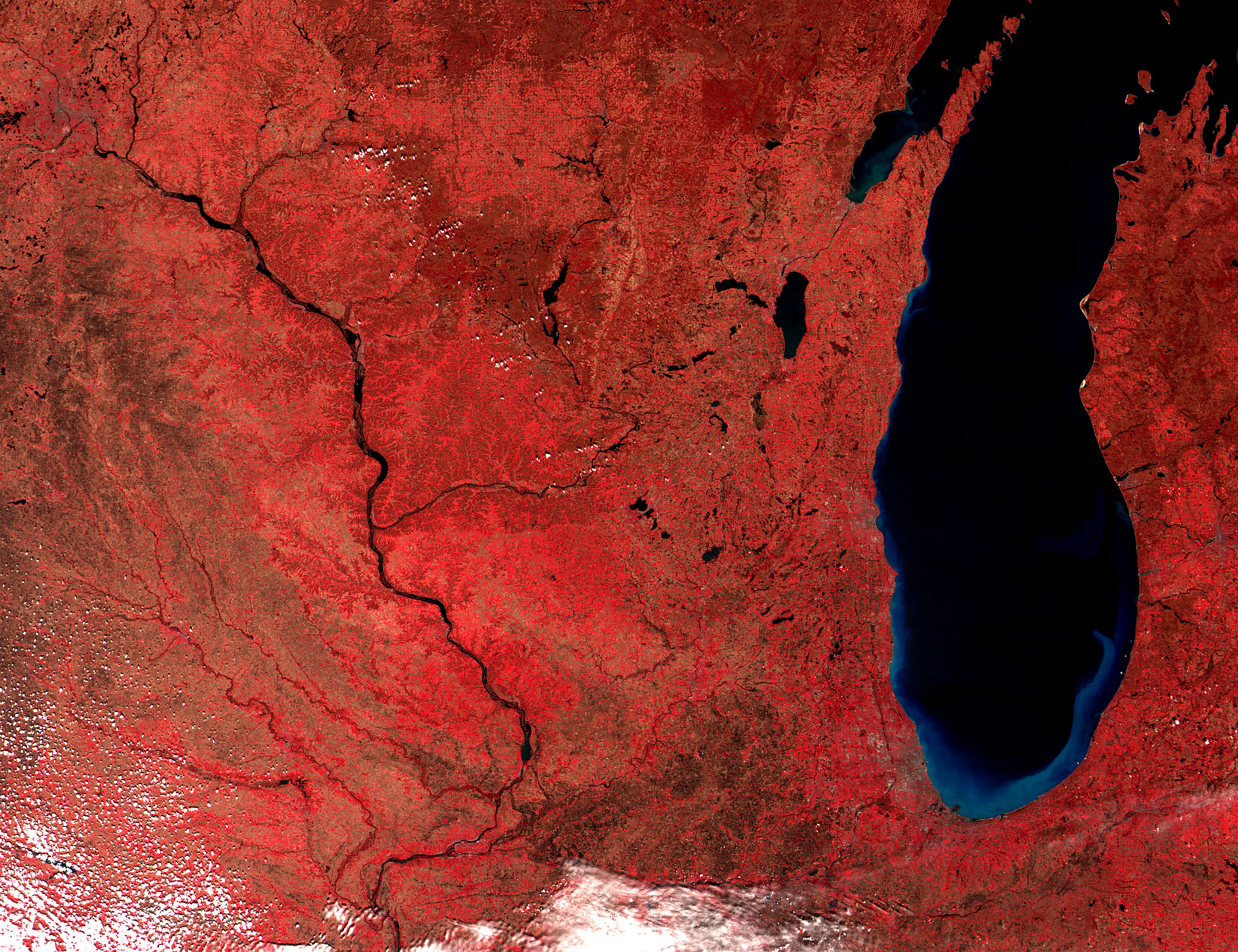
The combination of high rains and melting snow caused the MississippiRiver to surge to near-record high levels yesterday (April 18) in partsof Wisconsin and Iowa. Along populated stretches of the river,residents constructed sandbag barricades to contain the rising waters.Still, the Mississippi overran its banks in many places, forcinghundreds of shoreline residents to abandon their homes and bringingbarge and rail traffic to a halt along a 400-mile stretch of the river.
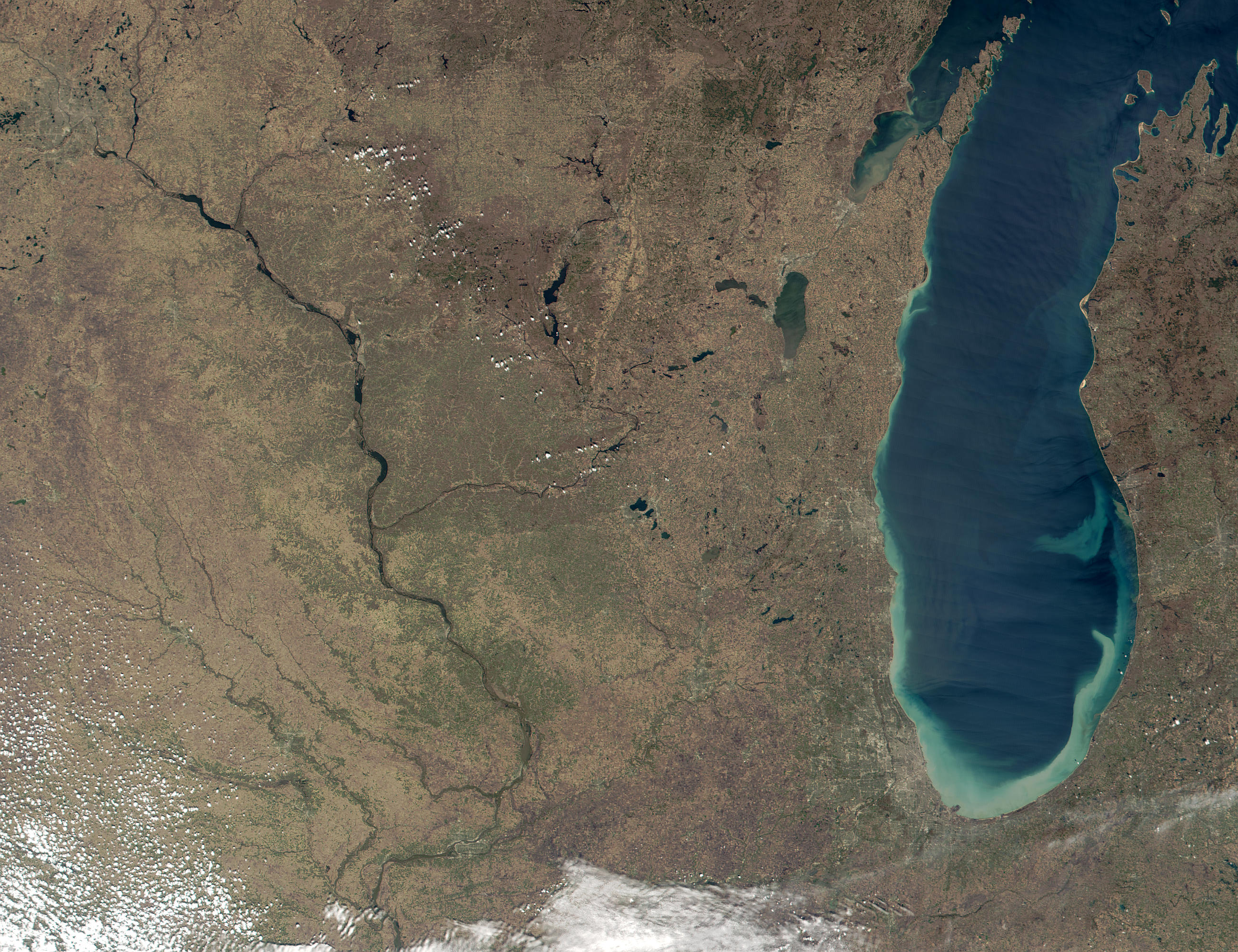
The Mississippi's muddy waters crested at 16.41 feet around 12 noon nearLa Crosse, WI, which is more than 4 feet above flood stage but is stilla foot and a half below the record high set by the flood in April 1965.The true-color image in the center (above) was acquired by theModerate-resolution Imaging Spectroradiometer (MODIS) at 12:15 p.m.local time yesterday as the waters were cresting. Notice that thebrownish color of the heavily sediment-laden water closely matches thecolor of the surrounding landscape. But the contrast between water andland is much more apparent in the false-color image (top), made usinga combination of MODIS' infrared and visible channels. The bottom imageis another MODIS true-color image acquired on April 25, 2000,when the river was closer to its normal level. The full-size scenes wereproduced at a spatial resolution of 250 meters per pixel.
In these images, the town of La Crosse is situated on the river'seastern shore, roughly 15 miles south of the Black River and 60 milesnorth of the Wisconsin River, both tributaries of the Mississippi. Tothe south, in parts of Iowa and Illinois, the river is predicted tocontinue rising through the weekend and to crest sometime early nextweek. Unfortunately, there are scattered showers forecast for theregion later this week, which could extend the time the waters remain atflood stage.
These images were produced from data collected and processed by theUniversity of Wisconsin-Madison's MODIS direct broadcast receivingstation. The MODIS sensor flies aboard NASA's Terra spacecraft,launched in December 1999.
References & Resources
Images courtesy Liam Gumley, MODIS Atmosphere Team, University of Wisconsin-Madison Cooperative Institute for Meteorological Satellite Studies, and Jacques Descloitres, MODIS Land Team, NASA's Goddard Space Flight Center
None


