
A series of heavy rainstorms has brought unseasonal flooding to parts of the U.S. Midwest. According to the National Weather Service, many areas in northern Iowa, southern Minnesota, and western Wisconsin received anywhere from 4 to 8 inches (10 to 20 centimeters) of rain.
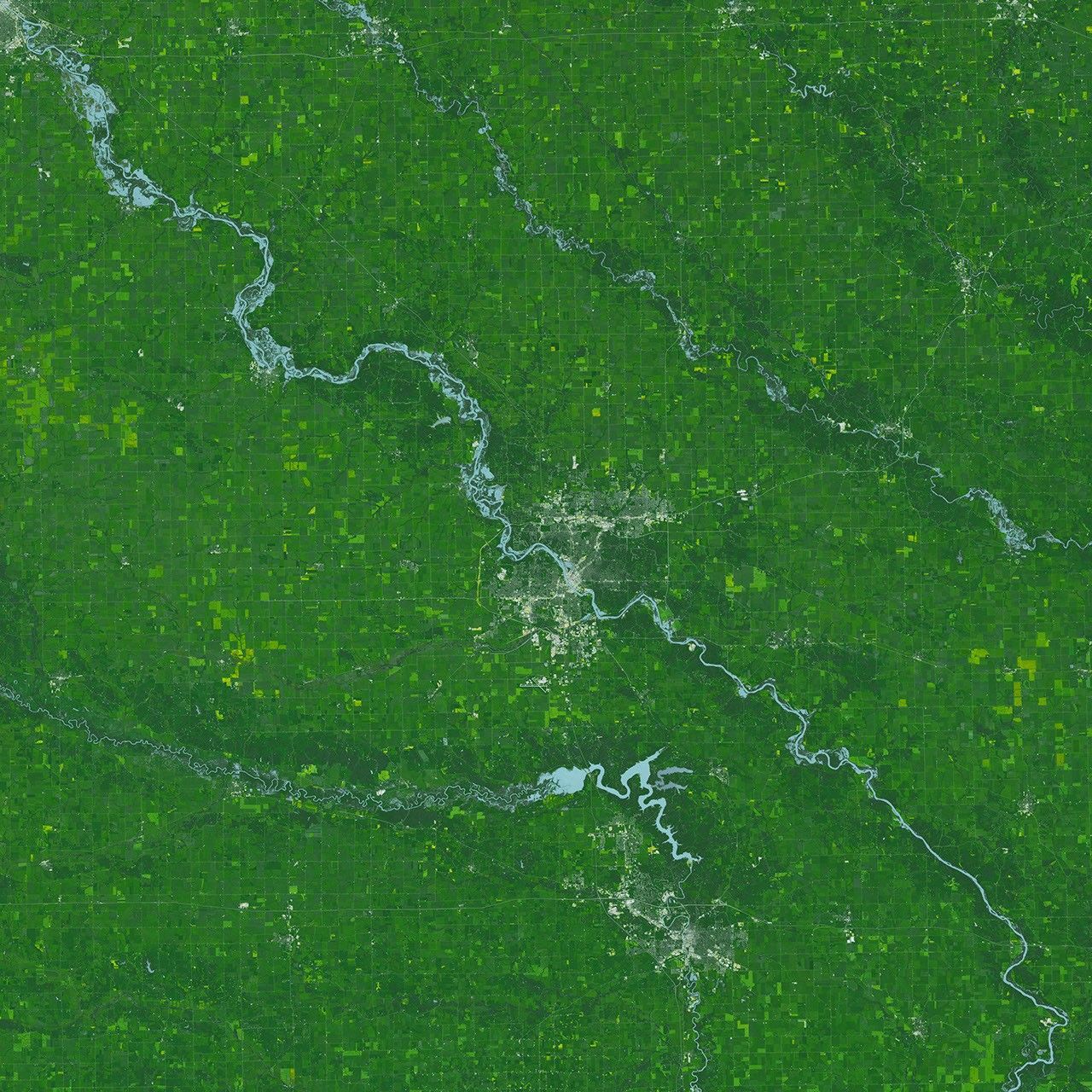
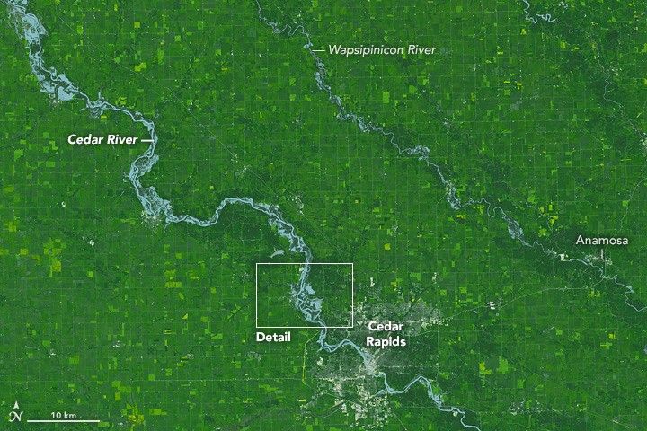
At 11:47 a.m. U.S. Central Daylight Time (16:47 Universal Time) on September 26, 2016, the Operational Land Imager (OLI) on Landsat 8 satellite acquired these images of Iowa’s swollen Cedar and Wapsipinicon rivers. These false-color images use shortwave infrared light to highlight the flooding. The artificially light blue water makes it easier to see; during floods, disturbed sediment often colors rivers brown, which can make flood waters difficult to distinguish from land. Vegetation and farmland appear various shades of green.
The top image shows a wide view, when the water level of the Cedar River measured just over 20 feet (6 meters)—8 feet above flood stage—near Cedar Rapids. The water level continued to rise and crested on September 27 at nearly 22 feet (10 feet above flood stage). That’s the second-highest crest on record, exceeded only in June 2008, when the river crested at 31 feet. Thousands of people were encouraged to evacuate from Cedar Rapids, the second-most-populous city in Iowa.
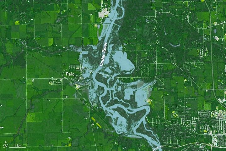
The second image shows a detailed view of flooding in the vicinity of Palo. When this image was acquired, the water level at this part of the Cedar River was 16.5 feet. It crested on September 27 at 18 feet.
According to a graph from the U.S. Geological Survey, flooding near Cedar Rapids is uncommon in September. Flooding here more commonly occurs after heavy rains in spring and summer. According to news reports, the September 2016 flooding could affect the harvest and processing of corn and soybean crops.
References & Resources
- Fortune (2016, September 25) Harvest Halts, Processors Close as Rains Swamp Upper Midwest. Accessed September 27, 2016.
- National Weather Service (2016, September 27) Observed and Forecast Stages for (CIDI4). Accessed September 27, 2016.
- National Weather Service (2016, September 27) Cedar River at Cedar Rapids. Accessed September 27, 2016.
- Palo, Iowa (2016, September 27) Welcome to the City of Palo website. Accessed September 27, 2016.
- Twitter (2016, September 27) NWS Quad Cities. Accessed September 27, 2016.
- Weather Underground (2016, September 26) Thousands Urged to Evacuate Iowa Floods; Megi’s Threat to Taiwan Escalates. Accessed September 27, 2016.
NASA Earth Observatory image by Jesse Allen, using Landsat data from the U.S. Geological Survey. Caption by Kathryn Hansen.