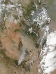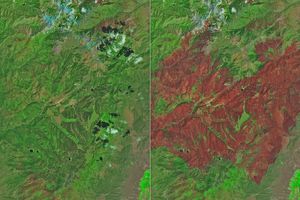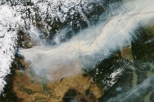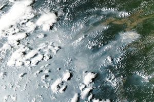

Burning in the mountains of eastern Arizona near the border with New Mexico, the Wallow Fire was well on its way toward becoming one of the largest fires in Arizona history when the Moderate Resolution Imaging Spectroradiometer (MODIS) on NASA’s Aqua satellite took this image on June 4, 2011. Winds and hot, dry conditions helped the fire grow quickly in the week after it ignited on May 29. People caused the fire in the Apache National Forest, though its exact cause is still under investigation, said the Arizona Division of Emergency Management.
Red outlines the fire in this image. Winds were blowing the fire northeast toward the communities of Alpine and Nutrioso, both of which were evacuated. The dense plume of smoke pouring north from the massive fire affected air quality as far north as Wyoming and as far east as Georgia.
The towering clouds that rise above the smoke between Alpine and Nutrioso resemble classic fire clouds—pyrocumulus or pyrocumulonimbus clouds. Such clouds form when intense heat from the fire pushes air high into the atmosphere. Fire clouds sometimes generate intense thunderstorms that can either dampen the flames with drenching rains, or propel the fire with strong winds. The Arizona Division of Emergency Management reported storm and wind activity in the area covered by the clouds, though the two are not necessarily related.
Throughout the fire area, winds and hot, dry weather conditions allowed the blaze to grow quickly on June 5. By early on June 6, the fire had burned 192,746 acres, making it the third largest fire in Arizona’s history behind the Rodeo-Chediski Fire and the Cave Creek Complex Fire. Incidentally, the state’s fifth largest fire, the Horseshoe 2 Fire is currently burning south of the Wallow Fire.
References & Resources
- ABC15.com. (2011, June 6). 2 of Arizona’s top 5 wildfires are burning right now. Accessed June 6, 2011.
- Arizona Division of Emergency Management. (2011, June 6, 6:01 a.m.). Crews focus on perimeter control on Wallow Fire. Accessed June 6, 2011.
NASA image courtesy Jeff Schmaltz, MODIS Rapid Response Team at NASA GSFC. Caption by Holli Riebeek.